
State Library Victoria members can access hundreds of online resources from home. That’s millions of articles, magazines, archives, ebooks, videos, songs, audiobooks and more, available through the catalogue anytime. We have also digitised hundreds of thousands of items in our collection, which can be freely accessed through our catalogue. These include photographs, artworks, maps and more. We’re taking a closer look at new and/or interesting databases as well as hidden gems from our digitised collections. Read on for top picks and tips from Librarians.
Not a member yet? Sign up online first and reward your curiosity.
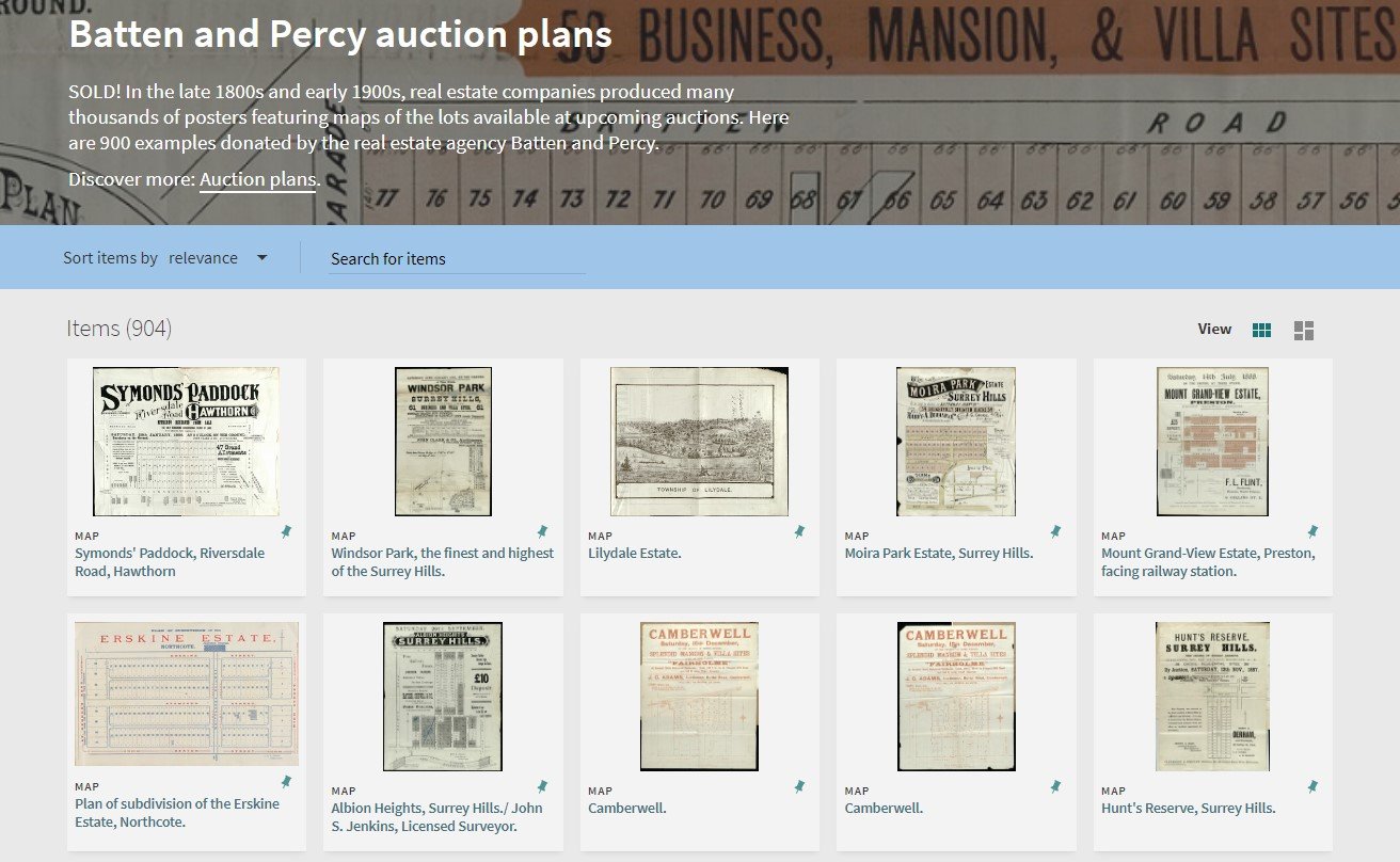
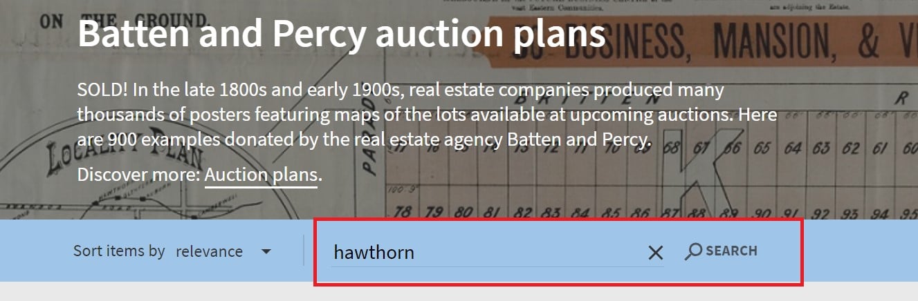
Today we’re looking at the Batten and Percy Auction Plans, a collection of maps and advertisements that the Library has digitised.
What makes this collection so great?
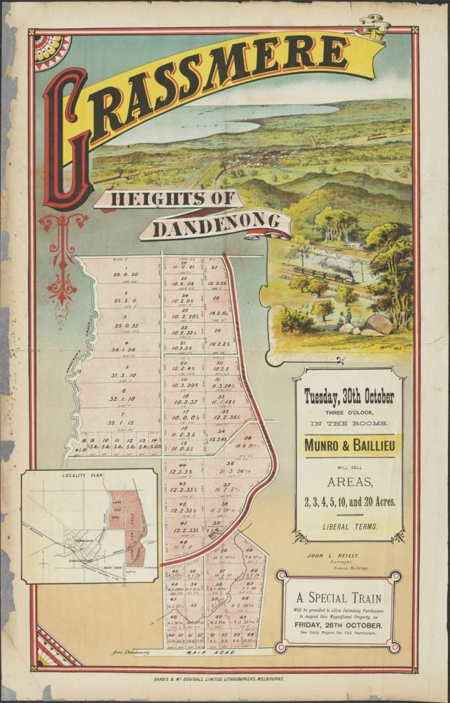
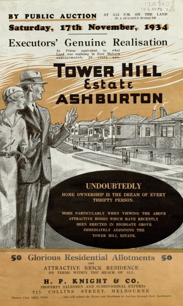
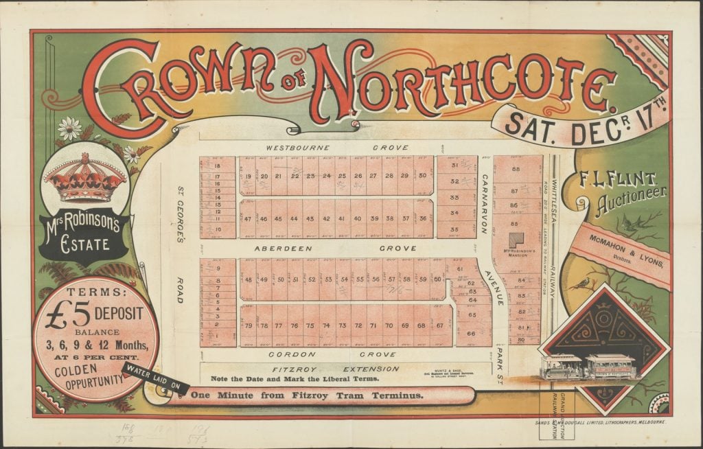
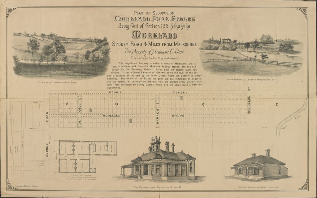
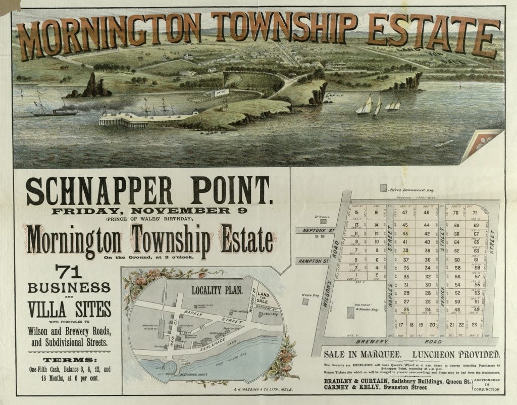
In the late nineteenth century, as Melbourne’s population was expanding, parts of the city began to be subdivided and developed. This subdivided land was sold off by real estate agents who produced posters and flyers to advertise the land sales. These posters and flyers are what we refer to as Auction Plans. Batten and Percy was one of these real estate agents and the Library holds over 900 plans collected by them, some their own, some produced by other real estate agents.
The auction plans vary in style greatly, from simple black and white leaflets depicting the size and location of allotments for sale, to lavish colour posters with illustrations of the area. The plans can reveal much about a location, and are a valuable tool for both local and family history research.
Some of the information you might find on these plans includes:
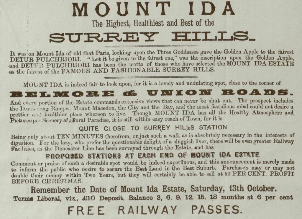
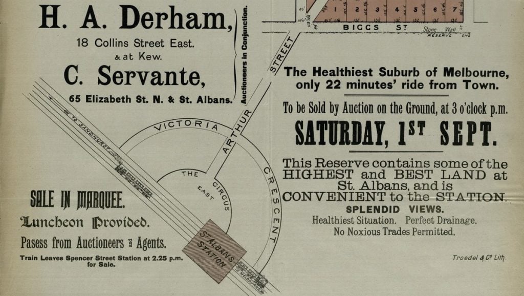
- How a suburb was described to appeal to buyers – what were perceived to be its attractive features
- Features and amenities of the area – some of these may have since moved, or were never even built (for example, train stations)
- The name given to an estate or a certain part of a suburb
- Photographs or drawings of the area before housing was developed
- The cost or deposit required to purchase the land
- How the land was subdivided – in some cases it may have been further subdivided since this sale
- Significant buildings or houses close to the land being sold
It is worth noting that auction sales didn’t always lead to houses being built immediately, and in the 1880s, sales and estate planning sometimes fell through. The Sands & McDougall directories, and historical newspapers on Trove, are both great sources for confirming the outcome of auctions, or when houses started to appear in a particular location.
How to find plans
The Batten and Percy Plans can be accessed via our Collection Discovery page, a tool which makes browsing digitised collections simple. Collection Discovery allows you to sort the plans by title or date. They can also be searched – by typing a suburb in the search box, you can quickly see relevant plans for that part of Melbourne.
Another way to access relevant auction plans is by searching the Library catalogue. Limit your search by selecting Maps from the dropdown menu. Search for the names of two cross streets plus the words auctions victoria.

Some highlights
Historical information
The below plan for the subdivision of an estate in Hawthorn provides a great illustration of the kind of information you can find in auction plans. We learn that the estate was a fruit orchard and that the whole estate was planted with fruit trees. Anyone purchasing a block of land would inherit these trees, which at the time of sale were ‘laden with fruit’. The plan also contains a common claim found on many auction plans, that the estate is ‘only 5 minutes walk from the Glenferrie Station’. Many of the auction plans would stretch the truth about how close to public transport the land was – in this case Google Maps suggests it’s closer to a 15 minute walk.
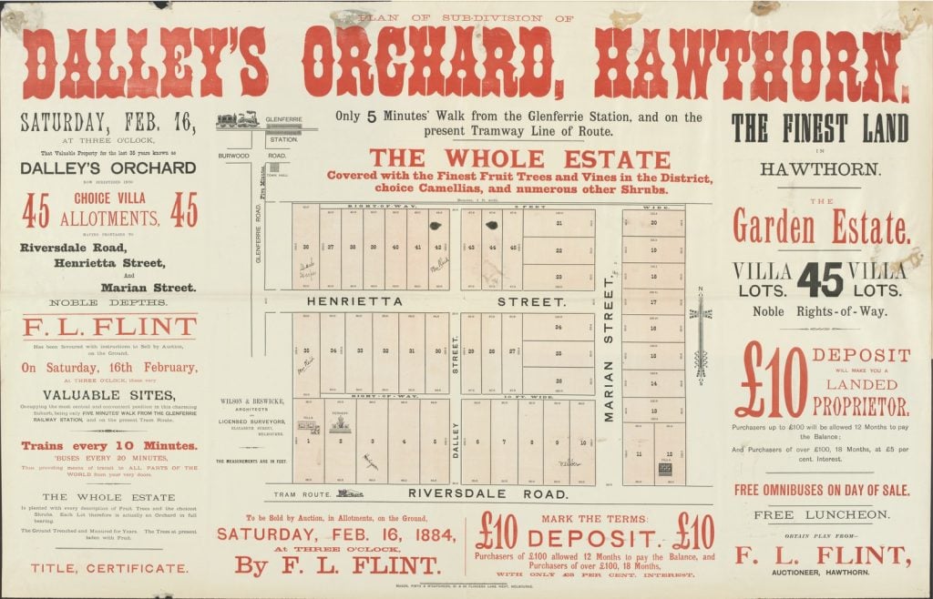
Most plans will depict the allotments for sale as well as the streets bordering and within the land being sold. While some claims made on the advertisements may be stretching the truth, the size and boundaries of the subdivision were usually quite accurate.1
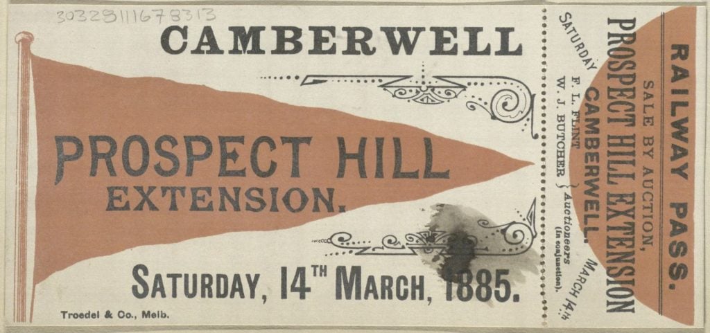
Train passes and free lunches
As well as advertisements for land sales, the collection also includes train passes. It was common for free rail passes to be given to interested parties so they could travel to the auction. Interested parties could usually pick these up from the auctioneers’ offices. A free lunch, often served in a marquee, was another enticement offered to encourage prospective buyers to travel to the auctions.
Beautiful designs
Many of the plans were produced in full colour, with elaborate design elements and illustrations. Some plans feature sketches of houses, if there were any already existing on the land being sold. These were sometimes exaggerated to create an impression of grandeur that would be appealing to prospective buyers. These house illustrations also served the purpose of making the land seem more ‘highly developed and desirable’.2
We hope you enjoy browsing the Batten and Percy Auction Plans. We always welcome your recommendations for database trials – let us know what you’d like to see. Have a research query or questions on how to use our online collections? Ask a Librarian.
More to explore
See also our Researching buildings & houses research guide