
Elizabeth Street. Glorious one day…
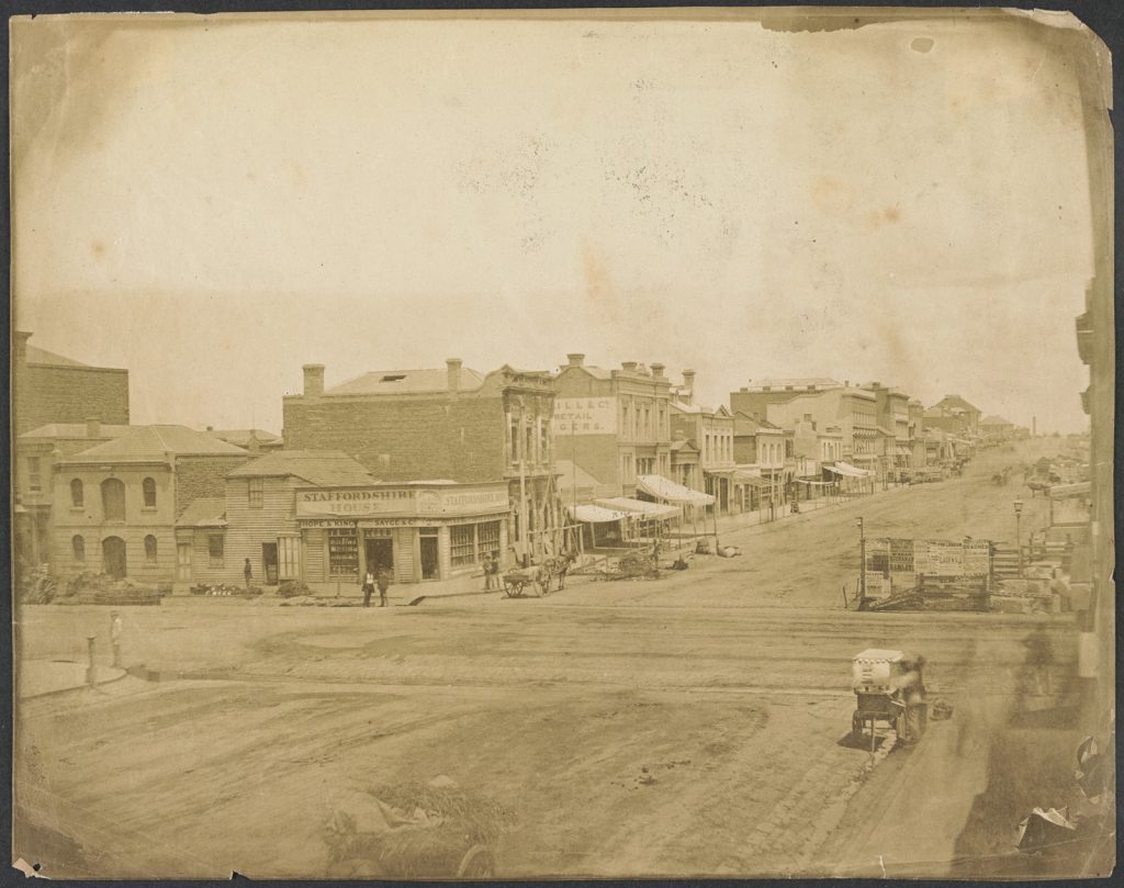
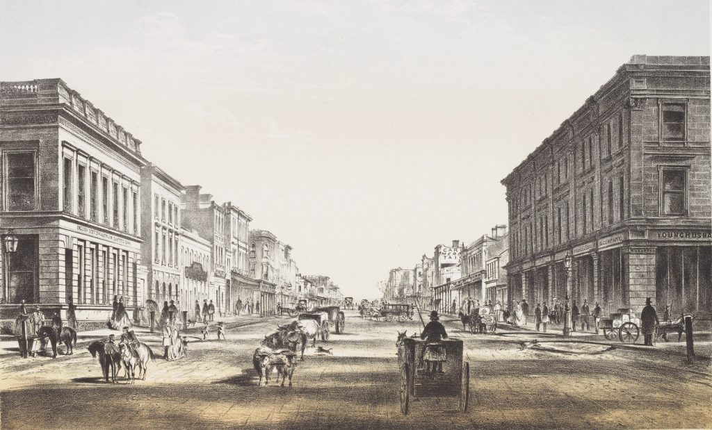 Elizabeth Street, 1864; 30328102131686/17
…flooded the next.
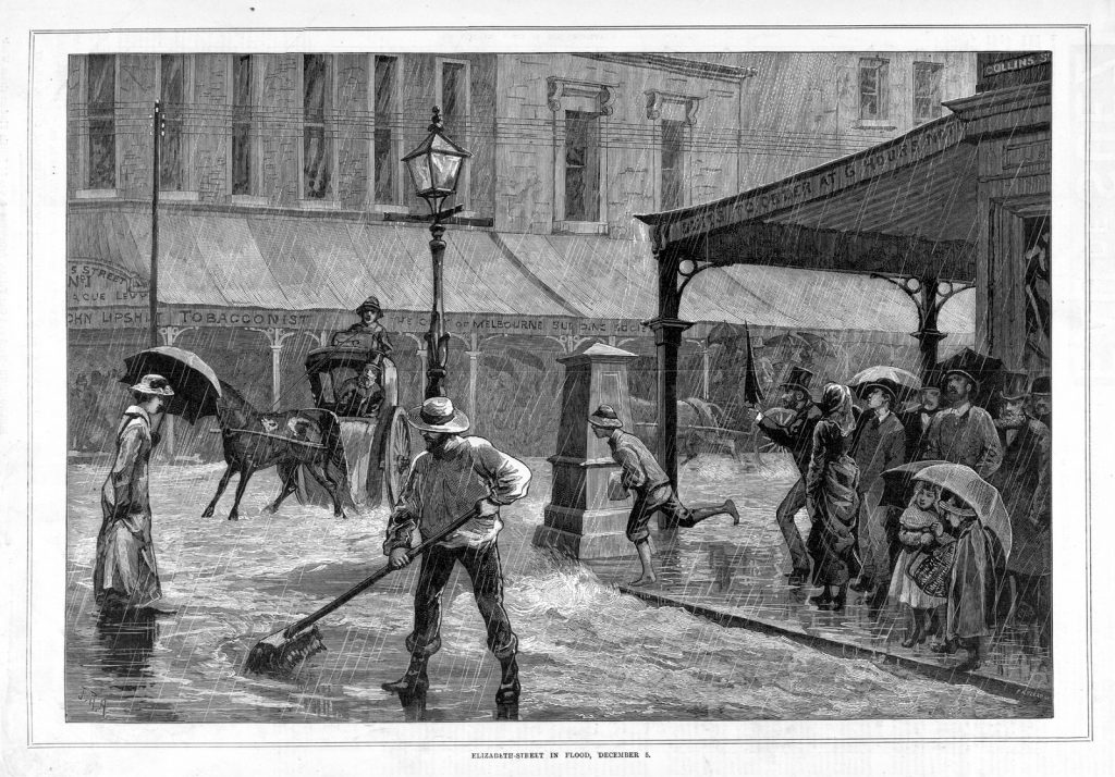 Elizabeth Street in flood, December 5. Published in The Australasian Sketcher on 18 December 1882; A/S16/12/82/349
It was a problem Melburnians were to become well-acquainted with; not just in Elizabeth Street, but most of the city.
In his Chronicles of Early Melbourne, journalist Edmund Finn, aka Garryowen, chronicles no less than six floods within the first ten years of settlement, as well as a snow storm.
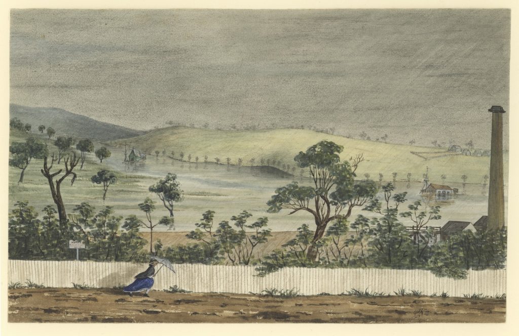
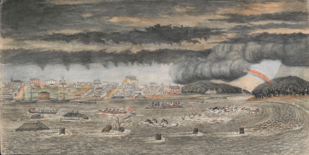 The flood of 1849. Watercolour by W.F.E.Liardet; H28250/36
Whilst some of this could be attributed to Melbourne’s fickle weather, the finger has also been pointed at the city’s early town planners. Because Melbourne was built upon an enormous water catchment. It was a decision that some would come to regret.
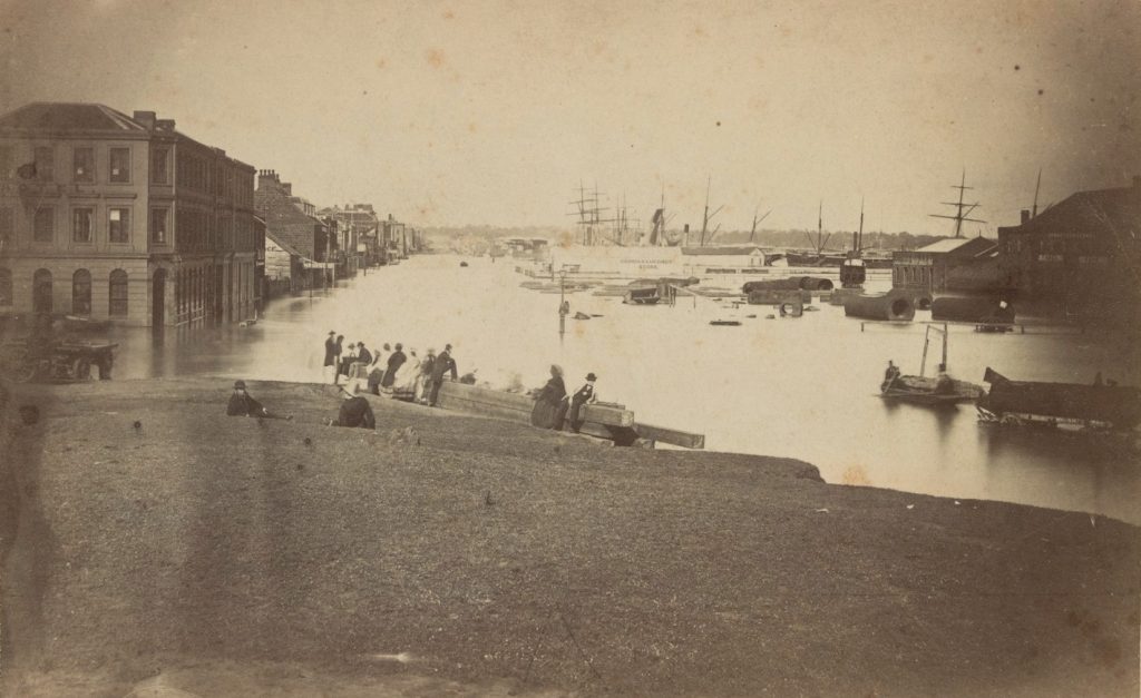 Corner of Flinders and Spencer streets under flood. Circa December 1863; H6251
As early as 1835, the First Peoples of the land tried to warn the settlers about the dangers of the floodplain. Nobody listened. [1]
In 1839, their predictions finally came to pass, with a weather pattern Melburnians will be familiar with:
During the first three weeks of December in 1839, the weather was scorching, and hot-windy. When a sudden change set in, and for three days and nights there was a continuous downpour of rain. [2]
 Yarra in flood, 1862. Watercolour by Charles Norton; H88.21/59
By Christmas Eve, the Yarra River had burst its banks, flooding the low-lying areas of the township. It was a harbinger of things to come, with another five floods recorded in the 1840s alone.
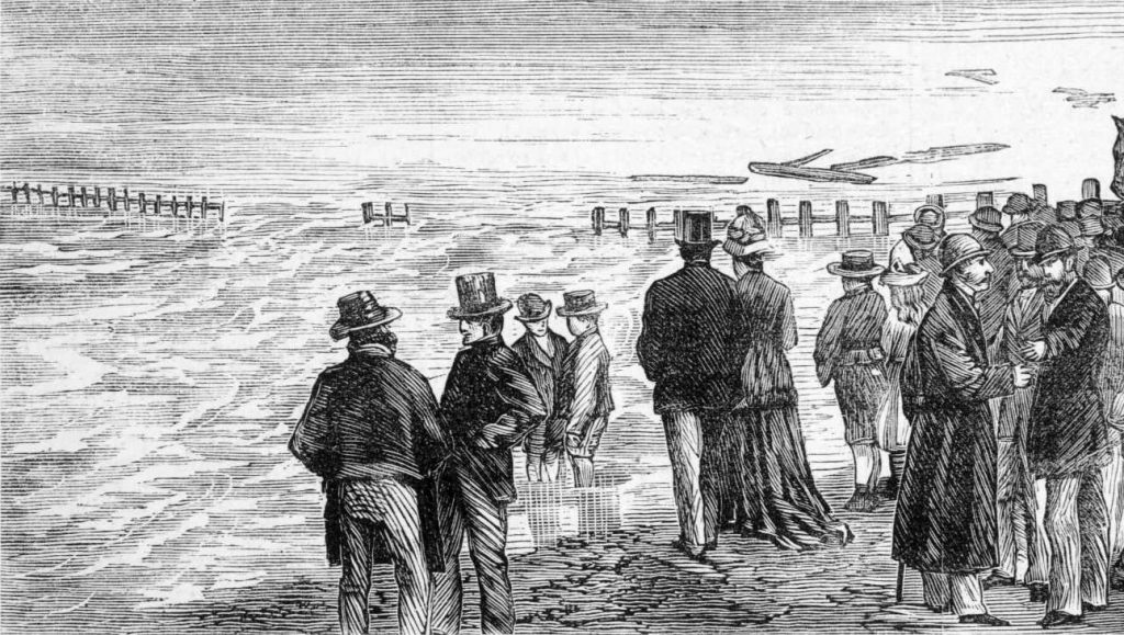 Incidents of the flood. From the Illustrated Australian News, 15 April 1878; IAN15/04/78/56a
Despite the spectre of these natural disasters, settlement went on, apace. Hills were flattened, vegetatation was removed and waterways were buried.
Elizabeth Street was no exception. A natural lowpoint between two hills, the site was a waterway prior to settlement, with little interest in being called a street. In winter time, it became a ‘jungly chasm — an irregular, broken-up ravine through which the winter floodwaters thundered over shattered tree trunks, dispersed rocks, roots and ruts.’ [3]
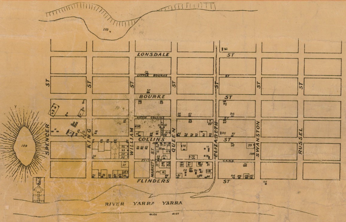 Detail from Plan of town of Melbourne 1837 A.D.
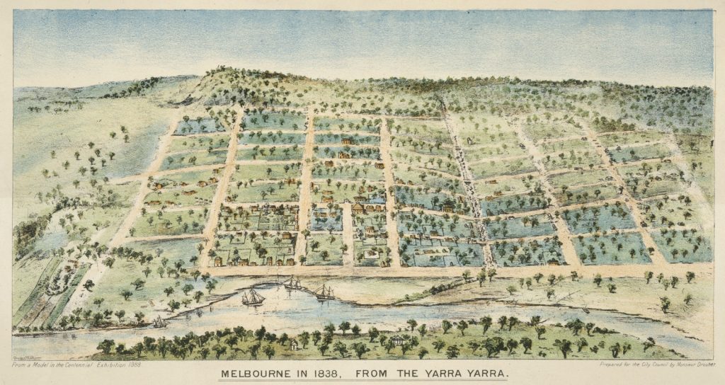 Melbourne in 1838, from the Yarra Yarra. Colour lithograph by Clarence Woodhouse. You can see Elizabeth Street in the dip on the right, with footbridges leading across it at intervals; H24502
The floodwaters would culminate in a deep gully at the intersection of Elizabeth and Collins streets. Locals called the waterway the River Townend, after the ‘fat, comfortable grocer’ who did business on the south-west corner. [4]
 Corner of Collins and Elizabeth Streets, Melbourne. Circa 1860-1863; H82.246/4
In later years, it was known as the River Williams, or Williams Creek, depending on the size of its waterflow.
‘Melbourne missed a great chance in filling up with a street this troublesome, and…unhealthy hollow,’ financier and historian William Westgarth wrote in 1842.
A reservation of the natural grass and gum-trees between Queen and Swanston streets would have redeemed Melbourne … and the riotous Williams might, with entire usefulness, have subsided into a succession of ornamental lakes and fish ponds. [5]
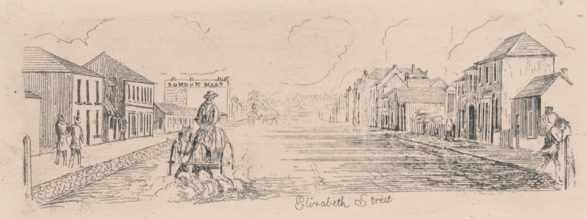 Elizabeth Street. Etching by Henry Gilbert Jones, circa 1841-1845; H15274/8
William Westgarth’s idea was revisited in 2015, when place-making practitioner Gilbert Rochecouste proposed that Elizabeth Street be dug up and reinstated as a canal. The proposal generated a fleeting discussion, but was dubbed ‘unfeasible’ by the Melbourne City Council. [6]
Over the years, there were many attempts made to tame ‘the Williams.’ In 1844, a floating drain was built in Flinders Street, with little effect. Pavements and harder road surfaces were introduced, but the flooding of the street’s lower end continued.
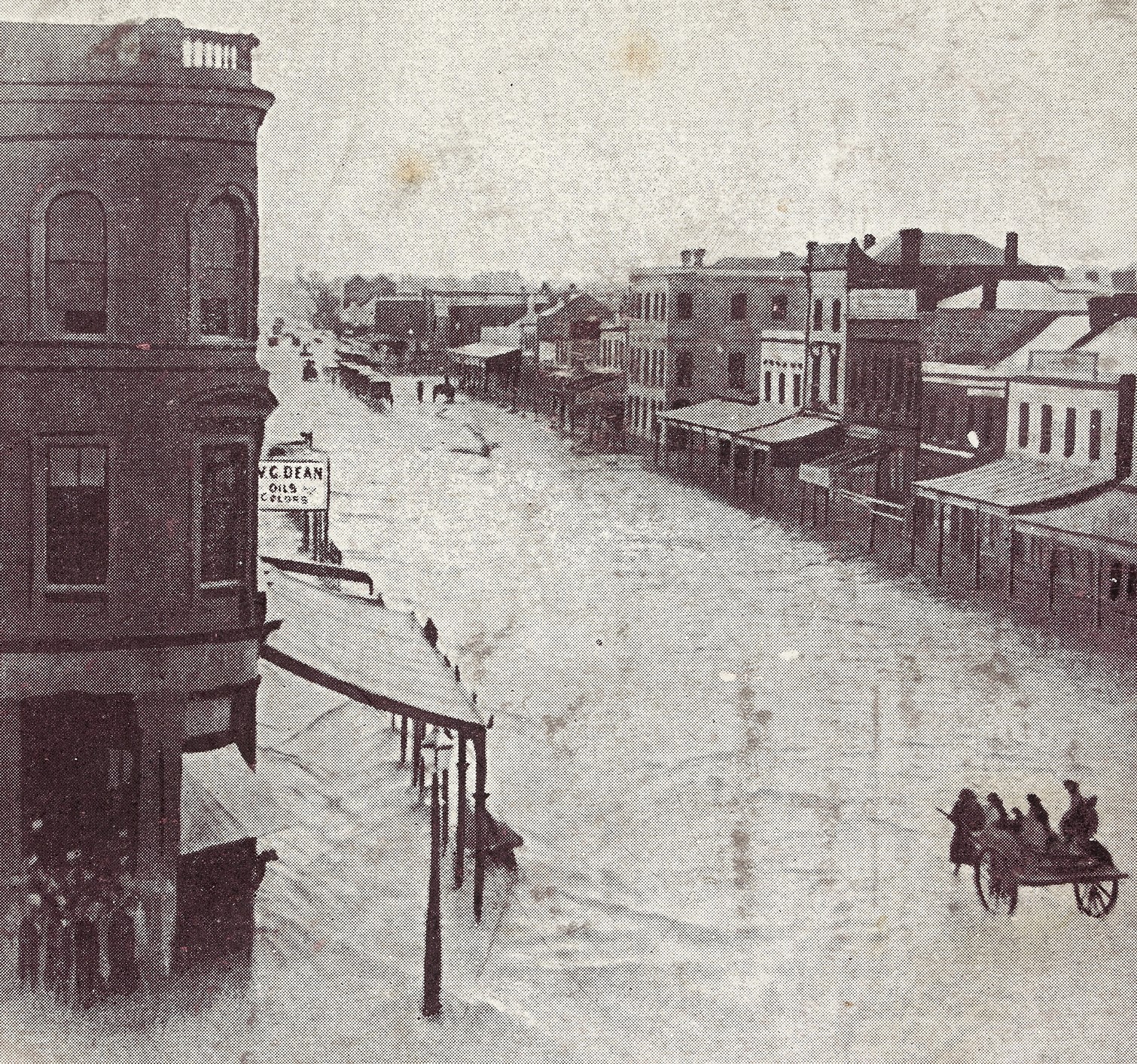 ‘The Flood’, Elizabeth Street, 6 pm. Dec. 8, 1862;
H13599
After yet another serious flood in 1882, it was agreed that something needed to be done.
In June 1884, work commenced on the construction of two giant storm water drains under Elizabeth Street, that would take the creek underground, with the outflow going into the Yarra.
Whilst the drain eased Elizabeth Street’s woes, it did not fix the problem entirely.
Perhaps the most famous example of the creek’s resurgence came in February, 1972, when 78.5 mm of rain fell on the Central Business District in one hour. The Age newspaper reported that Elizabeth Street became ‘a white-capped river running at about 12 knots.’ There were ‘waves spraying over the tops of parking meters,’ lifting ‘cars bodily, turning them about, and then sweeping them away.’ (The Age)
Walking down Elizabeth Street today, there is little sign of the former waterway. But Melbourne Water is under no illusions. The street is still deemed an ‘extreme flood risk’, and the riotous Williams may yet return.
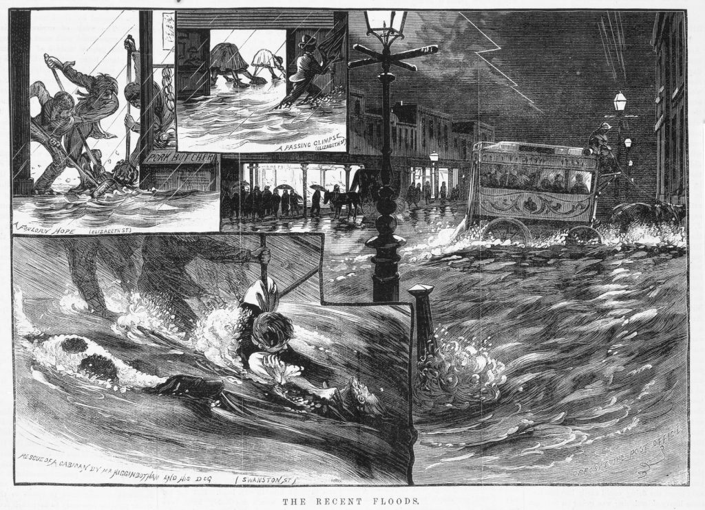 The recent floods. From The Illustrated Australian News, 30 November 1881; IAN30/11/81/217
References
[1] Finn, Edmund, The chronicles of early Melbourne, 1835 to 1852 : Historical, anecdotal and personal, vol. 1, p. 211
[2] As above
[3] As above, p. 4
[4] As above, p. 109
[5] Westgarth, William, 1888, Personal recollections of early Melbourne and Victoria, p. 30
[6] Dow, Aisha, ‘Soft approach to hard issue of Elizabeth street flood risk,’ The Age, 11 March 2015, p. 11
Further reading
Otto, Kristin, Yarra. A diverting history of Melbourne’s murky river
Presland, Gary, The place for a village: how nature has shaped the city of Melbourne
You may also like
Olde Melbourne guidebooks
Very interesting history. I understand a few years ago when Lincoln Square in Carlton was renovated that underground water retaining tanks were installed to hold back some water from the Elizabeth Street storm water drains should there be flooding rains.
I find the development of Melbourne town very interesting. My ancestor, Alan Bell from Strone in Scotland, ( Clyde River ), arrived in Melbourne in 1840. He married an Irish girl, Francis ( Fanny ) Sullivan some 10 years later. Alan Bell was buried in Numurkah whilst Francis ( Fanny ) was buried in Footscray. Between them they produced 11 children.