
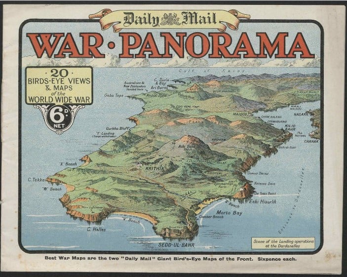
Daily Mail War Panorama, n.d. ; The Robert Opie Collection, First World War AM database
We have all seen films, heard stories or read books that somehow have a reference to ‘treasure maps’, especially books such as Treasure Island by Robert Louis Stevenson. Exploring the collection of databases held at State Library Victoria might also lead to rich rewards that are largely unexpected as we follow clues to find resources such as ‘maps’, that are not obvious in the titles of our databases — in this sense, the maps are the treasure!
These digital map resources and databases are listed both alphabetically and by subject area. So if we wanted to look for map databases, we could search the database subject list in the State Library catalogue and open the Maps subject link, where we can find 16 databases and websites focused on maps.
Screenshot of Maps section in the State Library database subjects list
This, however, is not the end of the story, and if we look a little further we can discover maps buried in all sorts of databases that have rich map resources but are not specifically focused on maps. Here, we will highlight three databases that are listed in our catalogue as examples of the diverse locations for large map collections.
London Low Life
The catalogue summary description of the London Low Life database has the briefest mention that it includes maps.
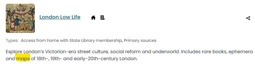
London Low Life description in the State Library catalogue
When we go into the database, we find that there are 27 interactive maps of London covering the period 1780 to 1920. These 18th-, 19th- and 20th-century maps are overlaid on a modern London searchable base map that allows us to see how the city developed over time. The changes show the impact of new railways from the 1840s and the redevelopment of London suburban areas through the 19th century.
A good example that illustrates this development is the area near the Thames River where Charing Cross Road now exists close to Waterloo Bridge. Opening Map 22 (c. 1862) in the London Low Life database, shows Charing Cross and Charing Cross Road, however, the rail station is labelled ‘South Eastern Railway Station’ and was only called Charing Cross Station later, as seen on Map 9 (1874). Map 15 (1859) indicates that Charing Cross Road did not exist at that time (see below).
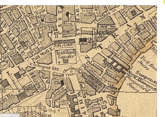
Cross’s New plan of London, 1859. Published by J Cross.
The different tabs on London Low Life’s Interactive Map page reveal that a lot more is on offer beyond just the basic maps. If we click on the tab Tallis Street Views, we get access to detailed engravings from the 1840s that have been processed to simulate a 3D environment of the buildings along both sides of certain streets.
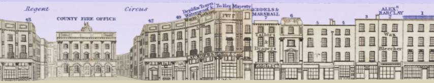
Tallis Street Views, Piccadilly, 1838-40.
The other two tabs on the Interactive Map page provide access to 19th-century images of locations in London and a range of thematic data. This provides a wealth of information and research material for writers, researchers, family historians and armchair travellers.
British History Online (BHO)
The British History Online (BHO) database (University of London) is a UK-based research site specialising in British historical materials with more than 1000 volumes that also include large numbers of historical maps. This is the perfect database to follow our snapshot of London Low Life, as it has a large collection of earlier maps of historical London, as well as more than 100 volumes of 19th-century Ordnance Maps of Britain.
The variety of digital resources available on BHO is very broad and rich, and includes a fascinating Dictionary of London. The State Library has the 1918 print edition and a copy on microfilm with the book’s subtitle stating ‘…being notes topographical and historical relating to the streets and principal buildings in the city of London’. The broader scope of the database can be described as containing an extensive range of sources for urban history from the early medieval period to the 20th century, as noted in the BHO subject guide by Matthew Davies, Professor of Urban History.
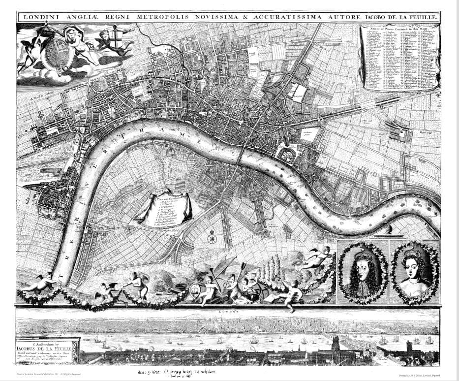
James De La Feuille’s Map of London c. 1690
The Ordnance Maps are very useful and contain a large amount of information but do require a small knowledge of British geography to comfortably explore, although they can be searched ‘by using the first part of a post code, e.g. NR17’, as described in Using British History Online: Searching and Browsing.
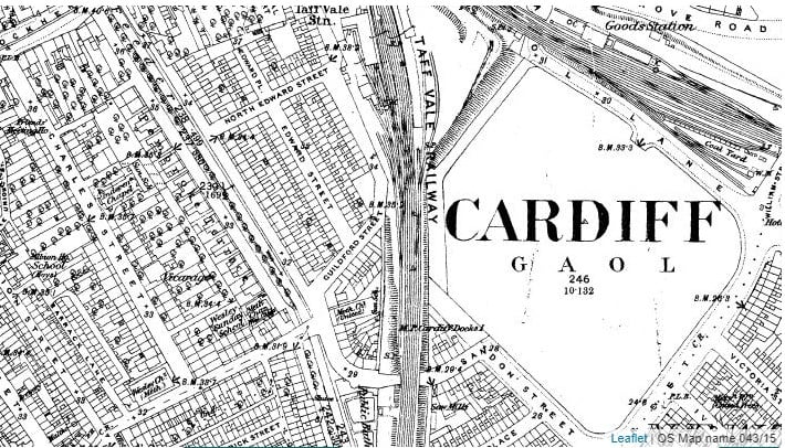
Map of Cardiff and its Environs (Southampton, 1875-1882)
British History Online is an excellent resource for research into historic Britain, with the available materials offering hours of exploration in historic maps and all the other rich collection materials.
First World War
The First World War database is made up of four modules of primary sources covering a huge range of topics in this global conflict. The database was constructed and released during the centenary anniversary years of WWI beginning in 2014 and ending in 2019, 100 years after the soldiers were demobilised and returned to their home countries.
Opening the database reveals a series of tabs including one titled Maps, which leads to a page offering access to Interactive Maps and a Maps Gallery.
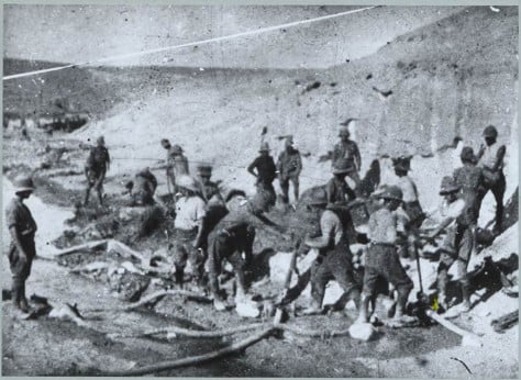
The Maps Gallery contains approximately 1200 trench maps, while the Interactive Maps section offers maps covering every major war front and timeline during the war, giving an interactive visual development of the battles. This is a major research resource in the study of the war and benefits students, researchers and historians. The database includes a range of Australian material and references to the Australian divisions covering all the major battles, including ANZAC forces at Gallipoli.
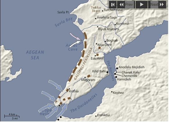
Left: April 25 1915, Allied troops land at Cape Helles and Australians and New Zealanders at Anzac Cove;
Right: Australian Forces at Gallipoli 1915-1916, Album 1, no. 25.
Summary
Our little survey of three databases has revealed the existence of more than 2000 maps, where some maps are enriched with layers of interactive ability or additional historical information. We can even see ‘street view’ maps of streets in mid-19th-century London that prefigure modern Google street views. This depth of hidden information hopefully alerts us to the range of material buried in the large number of databases that State Library Victoria makes accessible from home to all Library members. Look, and you may well find…
Happy treasure seeking!