
This blog was originally published on 29 October 2020.
It’s 20 years since Melbourne’s Federation Square opened in 2002, so we’ve taken a look at the history of the site and its surrounds.
Port Phillip at the time of first contact
Aboriginal Clans of the Kulin Nation occupied the rich and varied landscapes around Port Phillip Bay for tens of thousands of years.
Charles Grimes’ survey party visited Port Phillip in the summer of 1802-3 on a voyage from Sydney to King Island. In February they journeyed along the river and hinterland. James Flemming recorded:
The ground is a swamp on one side and high on the other …
Saw many swans, pelicans, and ducks. The timber in general is gum, oak, and Banksia; the two latter are small; the gums from ten to thirty feet high. The most eligible place for a settlement that I have seen is on the Freshwater River…The country in general is excellent pasture and thin of timber…There is great plenty of fish in Port King. The country in general is newly burnt…1.
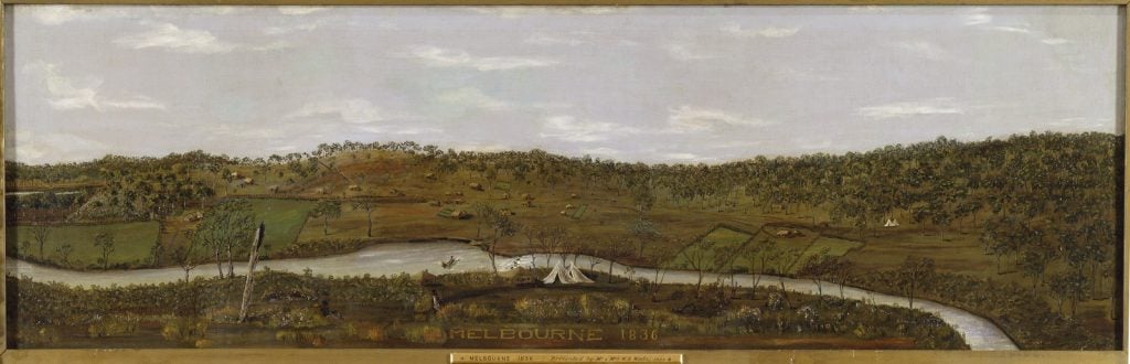
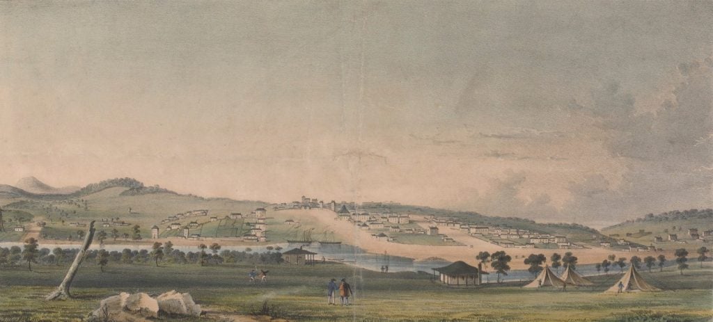
Over 30 years later, Europeans returned to Port Phillip in search of pasture. The northern side of the river, first surveyed by Robert Russell in 1837 and upstream from a rocky river crossing — The Falls — did indeed become the site for a new settlement.
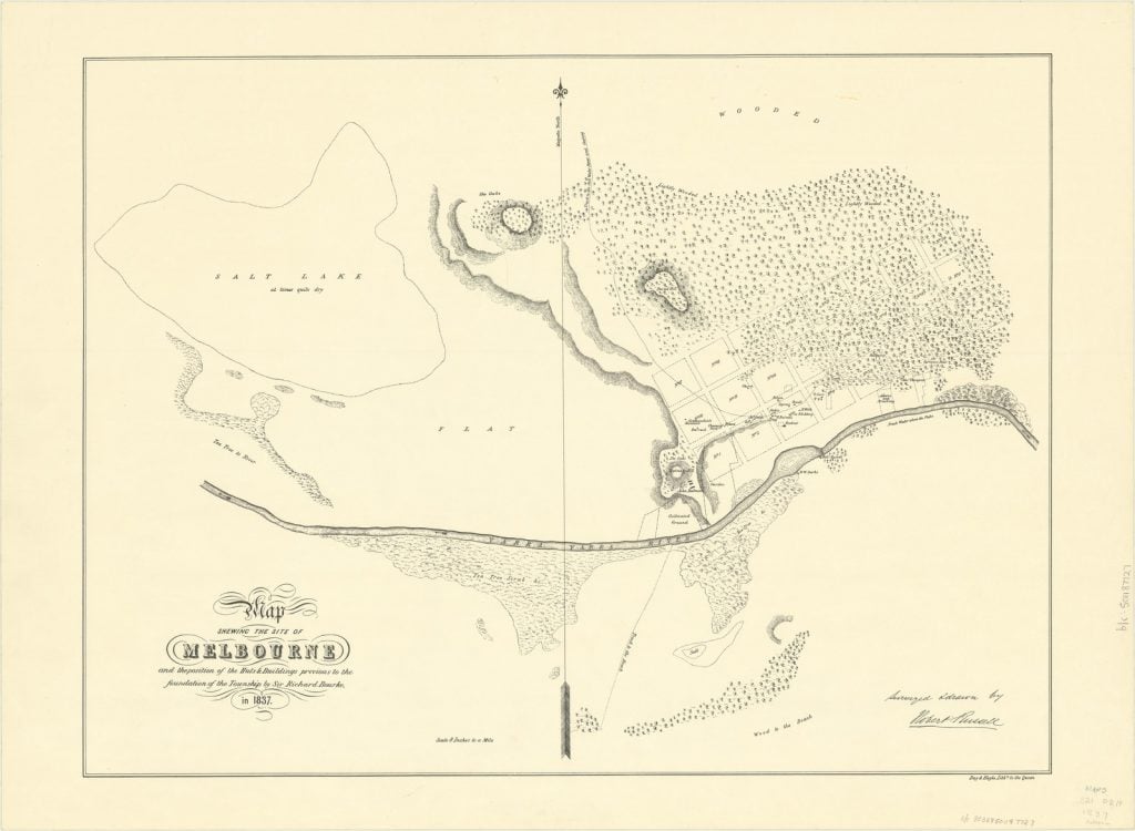
surveyed & drawn in 1837 by Robert Russell
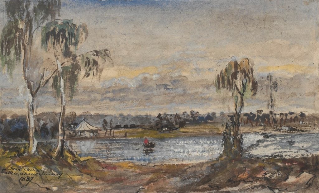
Watercolour by Robert Russell, 1893; H568
On the eastern end of the growing town, the swampy sliver of land was to undergo several identities before becoming the site of Federation Square.
Registrar’s office and morgue
By the 1850s the rapidly growing city realised it needed somewhere central to keep its unknown dead, and in response to complaints about the existing practice of post-mortems and inquests being conducted in public houses, a site on the embankment of Princes Bridge was proposed to replace an earlier morgue in Melbourne’s wharf area. 2
With bodies frequently retrieved in and around the Yarra River, and a need for people to view and identify the unclaimed dead, a central location was favoured. Unsurprisingly this grisly proposal was met with vigorous public debate and opposition.
As our rich cits [citizens] drive across the bridge then, exhausted by the labors of the day; and, with empty stomachs…they must not feel surprised if they find themselves suddenly assailed with a whiff of something not particularly appetising. They must console themselves with the reflection, that it is nothing worse than the smell from the decaying bodies of a few of their fellow creatures. 3
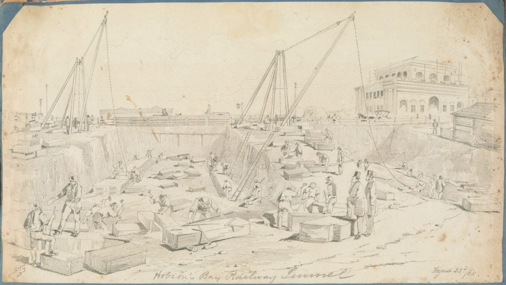
Construction began in 1854, with the completed stone building occupied by the City Coroner and Registrar’s office. The morgue — to ‘be situated in the bank of the bridge approach, and thus form a kind of catacomb…masked with shrubs’ — did not open until 1871. 4 It included a deadhouse without windows, a court building for inquests, and a laboratory. Twelve years later the site was required by the Railway Department and incorporated into the public transport network. A temporary site at Cole’s Wharf, between William and Queen Streets, was soon identified as not fit for purpose, and deliberations began for a new location.
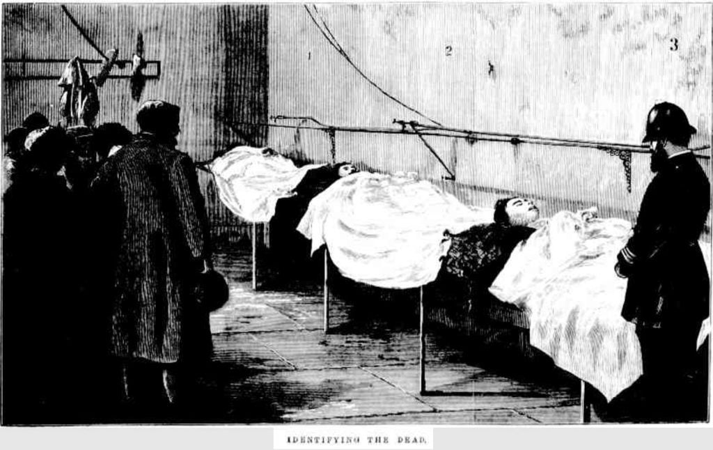
The morgue returned to the eastern end of the city, at the opening of a new building in 1888 on the then Batman Avenue where it functioned until 1951. Improvements to all amenities would allow people ‘to be able to look at [the bodies] without experiencing any unpleasant sensations so far as physical well-being is concerned.’5
Fish market
The introduction of a rail system brought new opportunities for business in the city. One such beneficiary was Melbourne’s fish market.
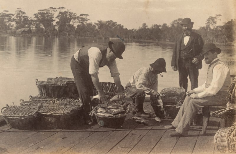
Whilst locally caught fish had long been traded on the banks of the Yarra, the advent of the railways allowed fish to come from further afield. Fish from Queenscliff and Western Port would be sent to Melbourne on the early train. They were taken to a temporary stand known as ‘Fish Green’, on the corner of Flinders and Swanston Streets. There, they were unloaded from their baskets, and auctioned off to the highest bidders.
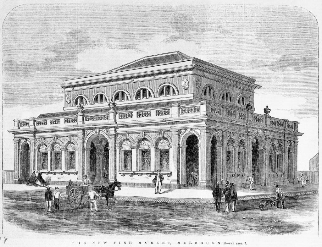
Melbourne needed a more permanent fish market, so in 1865, the Council began construction of a building to house the market on the south-west corner of Flinders and Swanston Streets. The market opened the following year.
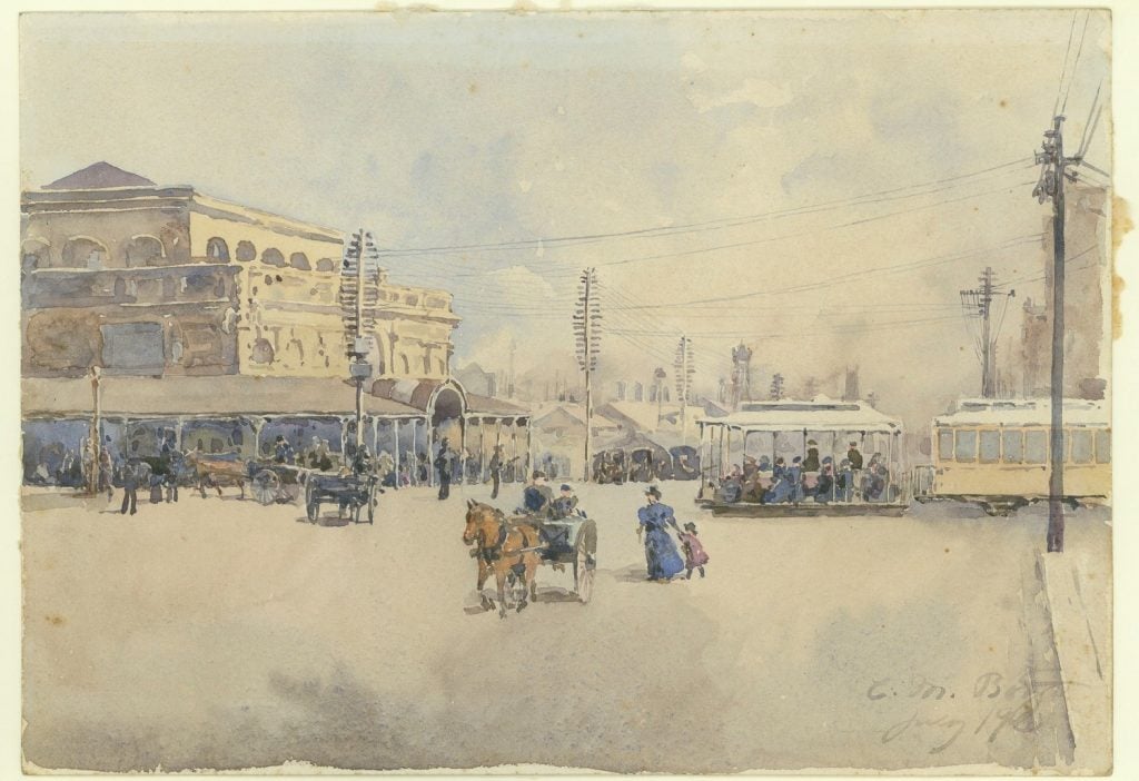
Watercolour by EM Boyd, 1905; H15521
It remained there for more than 25 years, until the railways required the site for a growing railway network. The fish market’s new home, on the corner of Flinders and Spencer Streets, opened in 1892. Handy to the rail lines, fish, game and other produce was delivered to these impressive, refrigerated quarters.6
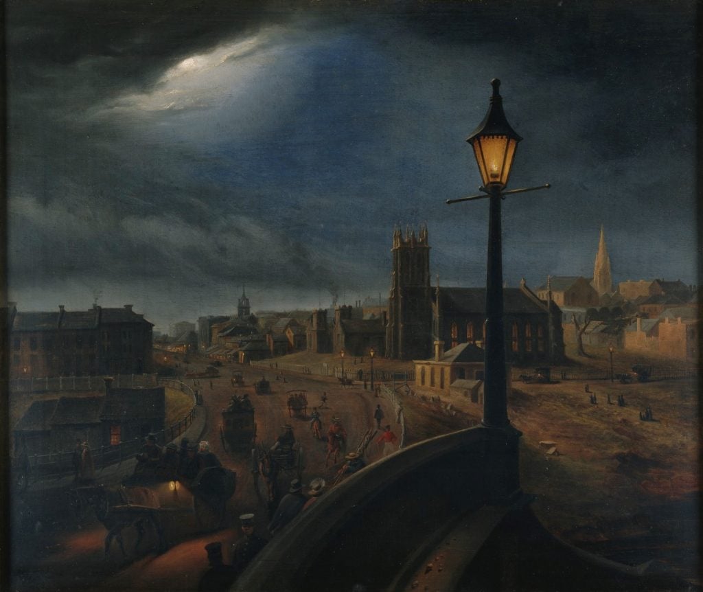
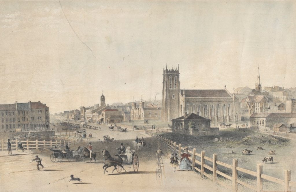
Princes Bridge
The Yarra River defined European settlement and still marks the extent of Melbourne’s Central Business District. Initially the river was crossed by a punt – an expensive option for farmers and traders.
Should you wish a drive in a gig across to enjoy the benefit of sea air, the charge is one shilling on week days, and two shillings on Sundays. Now, Sir, I do not object to pay for pleasure, but the great cause of complaint is the monstrous charge of three shillings per thousand for the conveyance of bricks across the punt. 7
A wooden bridge was constructed but again charged tolls. At this time Victoria was known as the Port Phillip District, and was part of the Colony of New South Wales. As far back as 1840 there were representations to the decision makers in Sydney for a toll-free bridge.
Finally, in 1845, a Select Committee of the NSW Legislature agreed to provide funding for a grand new stone bridge, not subject to tolls. There was discussion as to the best location with many favouring a crossing at the end of Elizabeth Street. However a Swanston Street crossing was finally agreed to. With much pomp, a foundation stone was laid on 20 March 1846. Lt Governor La Trobe remarked:
A single arch thrown across our largest river, it will be the means of uniting two of the most fertile portions of a country justly designated Australia Felix, and be of incalculable convenience to the community, and advantage to the commercial interests of Melbourne. 8
The bridge took 4 years to complete, causing grumblings from Melbourne at the ‘parsimonious policy of the Sydney Government … [and the] …neglect with which an absentee Government treats a distant dependency.’ 9
The bridge was opened on 15 November 1850 with much fanfare, coinciding as it did with extensive celebrations for news of the Royal Assent given to the Australian Colonies Act (paving the way for the Port Phillip District to become the Colony of Victoria the following year.)
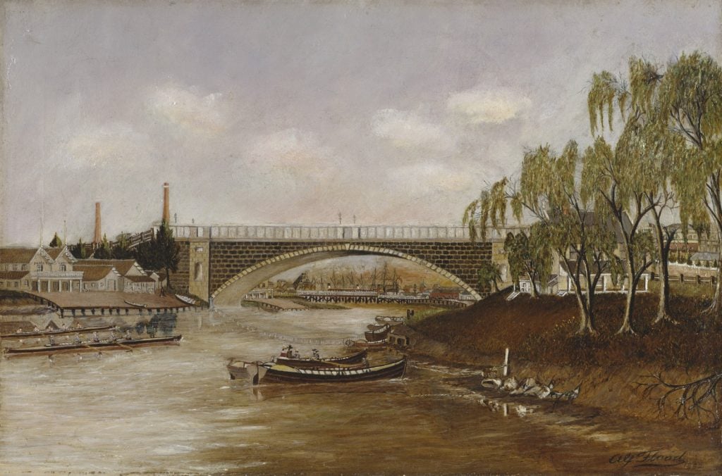
This first Prince’s Bridge was an impressive edifice stretching across the river with a single 47 metre arch, and 96 metres in length. However, no-one could have accounted for the massive growth of Victoria over the next 30 years, and increasingly the bridge was unable to cope with the vast demands of the rapidly expanding colony.
Also, the single arch, such a proud feature of the design, was found to impede the flow of the Yarra after heavy rain. In 1884 the bridge was carefully dismantled with a view to re-erecting it elsewhere — this didn’t happen. A temporary bridge served the community for 4 years, and in 1888 the current Princes Bridge was opened.
Celebrations on Princes Bridge
Princes Bridge has always been Melbourne’s gateway.
In 1867, Prince Alfred, the Duke of Edinburgh visited Melbourne. The bridge was decorated with a welcoming arch to mark this first royal visitor.
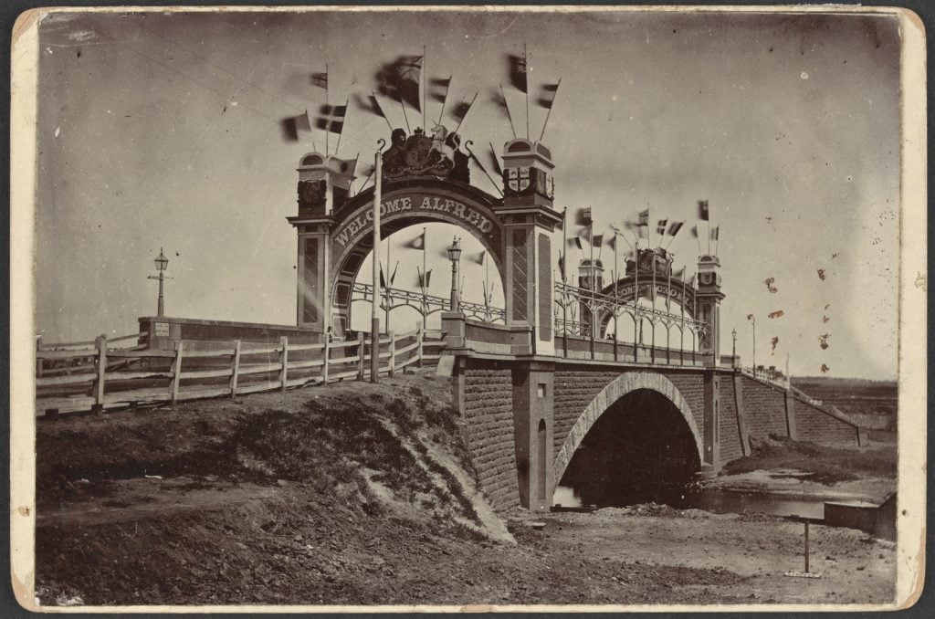
Photograph by Bagg, [1867]; H12465
In 1901, the Princes Bridge municipal arch greeted the Duke of York as he entered the city to open the first Australian parliament. Temporary arches also marked Victoria’s sesqui-centenary in 1984/5 and the centenary of Federation in 2001.
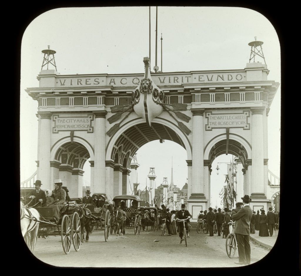
Photograph by SJ Jones, [1901]; H82.43/111
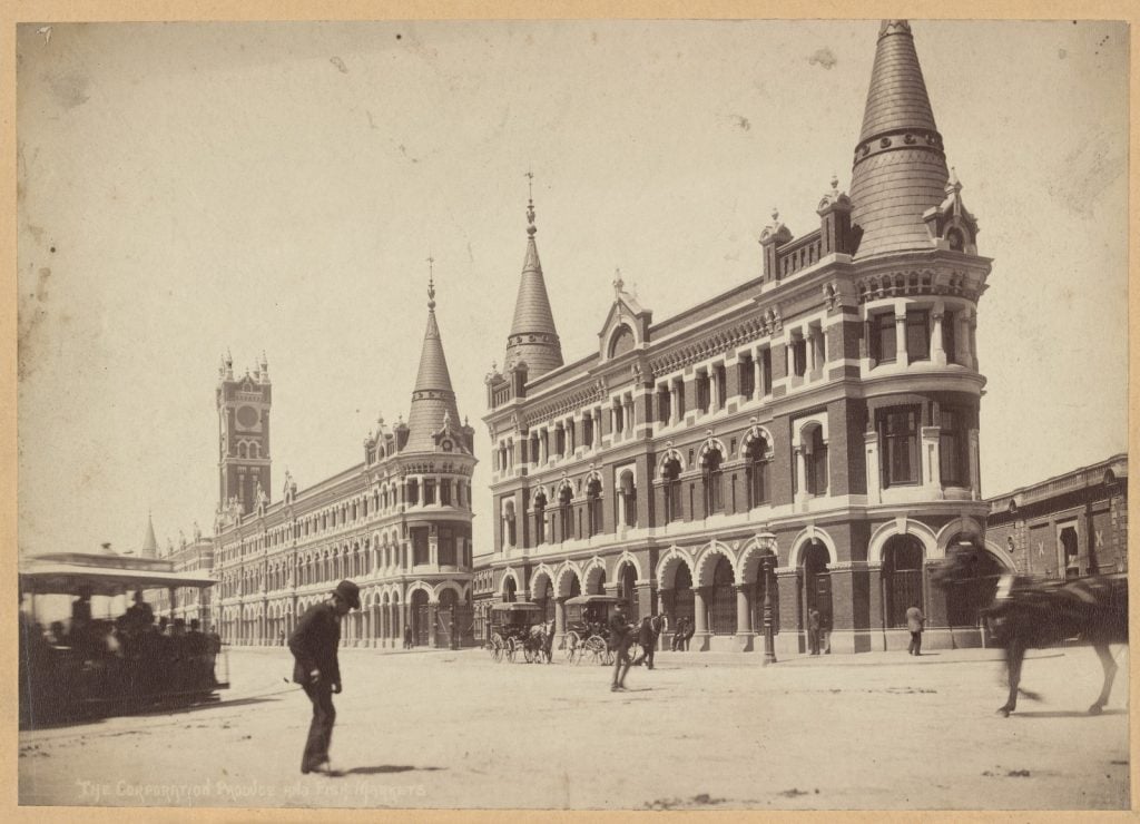
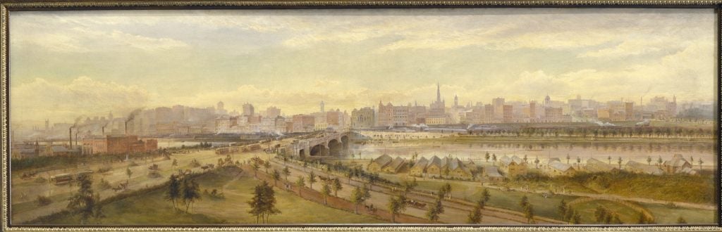
Railways
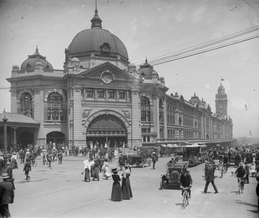
In 1854, Melbourne’s first railway line opened, running between Flinders Street and Port Melbourne, with the platform running alongside the fish market. Ultimately the growing rail system took over that site as the city’s burgeoning population needed a new central railway station, with Flinders Street being the obvious choice for a location. The Flinders Street station building we know today was opened in 1910.
In 1859 Princes Bridge station opened, serving the line to Richmond. It closed in 1865 with the completion of the tunnel beneath Swanston Street joining the Flinders Street and Princes Bridge lines.
In the second half of the 19th century the railways snaked ever further across the colony and in 1879 Princes Bridge railway station reopened as the terminus for the new Gippsland railway.
The Princes Bridge railway station kept operating as an increasingly lonely addendum to the great Flinders Street railway hub.
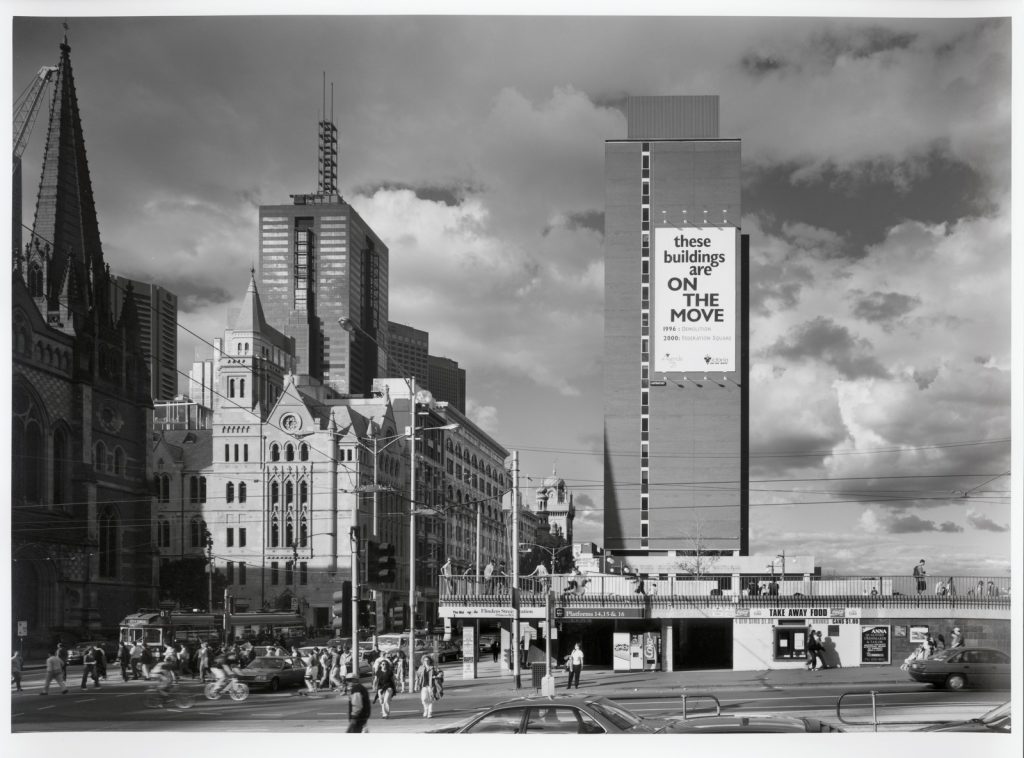
Remodelled as part of the Princes Gate Towers — the station, after over a century of service, closed permanently in 1997 to make way for the Federation Square development.
Princes Gate Towers
In 1963, Victorian Premier Henry Bolte sought to address the railway yards’ isolation with the announcement of a five million dollar redevelopment project. Its centrepiece was the proposed construction of two 15-storey towers that would straddle the divide between the area east of Flinders Street and the Yarra.
The Princes Gate Towers (later known as the Gas & Fuel buildings), were completed in 1967.
Much maligned by the Victorian public, they dwarfed nearby St Paul’s Cathedral and effectively barricaded the city off from the river.
Ironically, Bolte’s bigger plans for Princes Gate were never realised. In 1997, the towers and the station were demolished, and Melburnians breathed a sigh of relief.
Planning for a city square in Melbourne
There had long been a desire for a public square in Melbourne.
Robert Hoddle’s grid layout of city streets precluded the relaxed and open air life that art critic Lionel Lindsay wrote of in the Herald in 1935:
The truth is that we have no civic life; and that it is not possible if the people cannot use their city for relaxation and amusement! Public squares, with their surrounding cafes and orchestras, the pleasure of
the promenade free to the poorest; refreshment, cheap and good at any hour — when those are denied there is little for the people to do but make a dash for the pub, frequent the cinema, or go back to their hutches like good little rabbits! 10
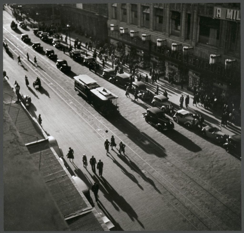
Photograph by Wolfgang Sievers, 1939;
H2000.195/20.
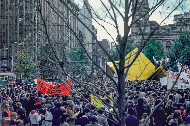
The city did get its desired square on the corner of Collins and Swanston Streets, officially opening in 1981, designed by architectural firm Denton, Corker & Marshall.
This work is in copyright.
The square did ultimately take on a civic role, but failed to ignite the public’s imagination. Reduced and redesigned in 2000 as a more intimate public space, the square closed in 2017 for the Metro Rail Project.
Sparking that public imagination was central to the new Federation Square project.
This image is in copyright.
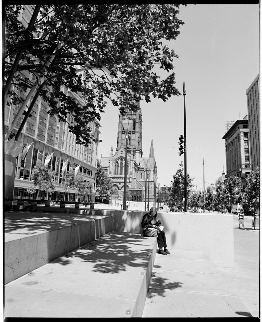
Federation Square
While this location has undergone many incarnations over time, the site we know as ‘Federation Square’ has a short history. Following the demolition of the Princes Gate Towers, an international design competition asked for designs that would highlight the site’s aim to be the public square that Melbourne had always wanted — a civic and public meeting ground where people could gather to celebrate, mourn, reflect, protest and engage with community.
The design of ‘Federation Square’ would honour the centenary of Federation, and though it was hoped the project would be completed in time for centennial celebrations on January 1 2001, the construction was not completed until October the following year.
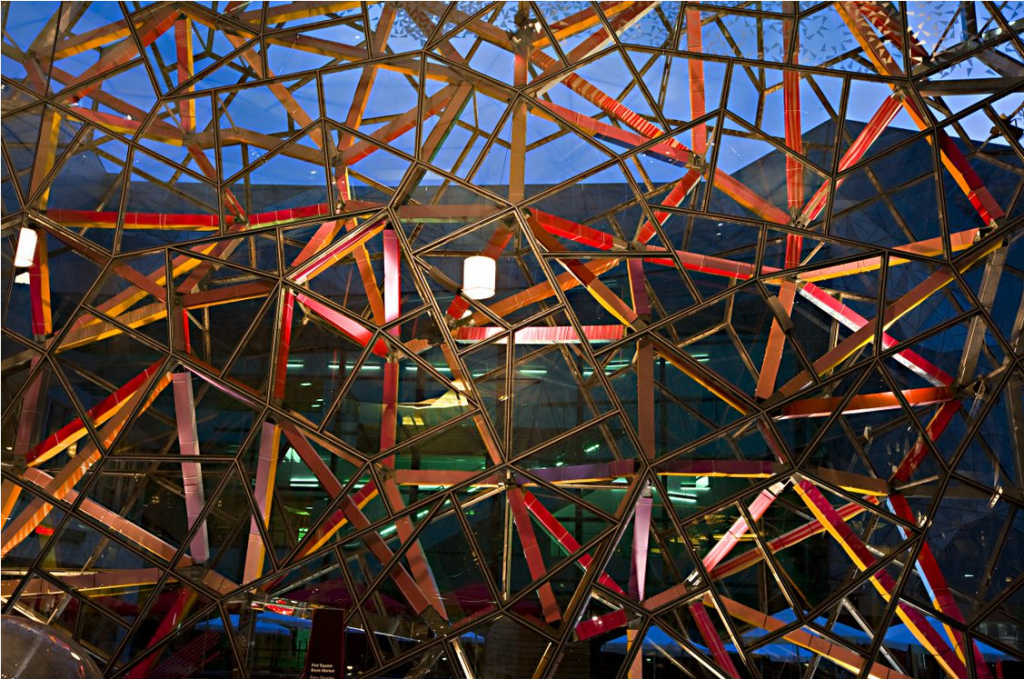
The award-winning result – designed by LAB Architecture and Bates Smart — was an interlocking complex of buildings and laneways designed around a large open space area, on a deck above rail lines and platforms.
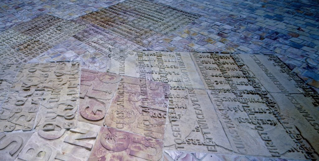
Implicit in the architects’ design was the idea of federation, and the coming together of independent identities to form a coherent whole, with the fractured geometry of glass, steel and stone offering unexpected connections and vistas.

Images courtesy Federation Square. These images are in copyright
The bold multi-dimensional design was widely supported by the design community, but was initially less popular with the public.
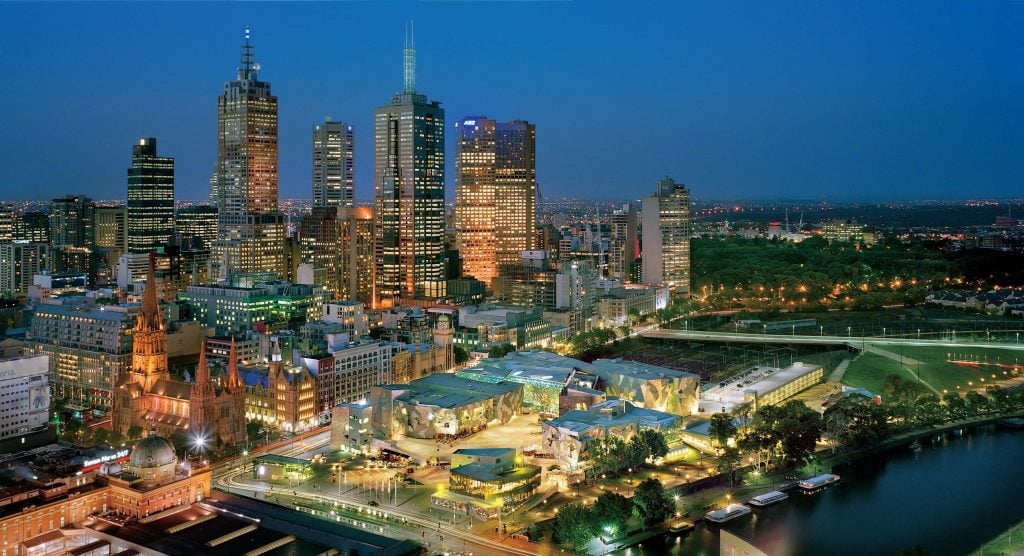
Image courtesy Federation Square. This image is in copyright
Since then, Melburnians have embraced their Fed Square and — in recognition of its historical, cultural, aesthetic, technological and social significance to Victoria — the site was formally listed on the Victorian Heritage register in 2019, making it the youngest heritage listed site in the world. 11
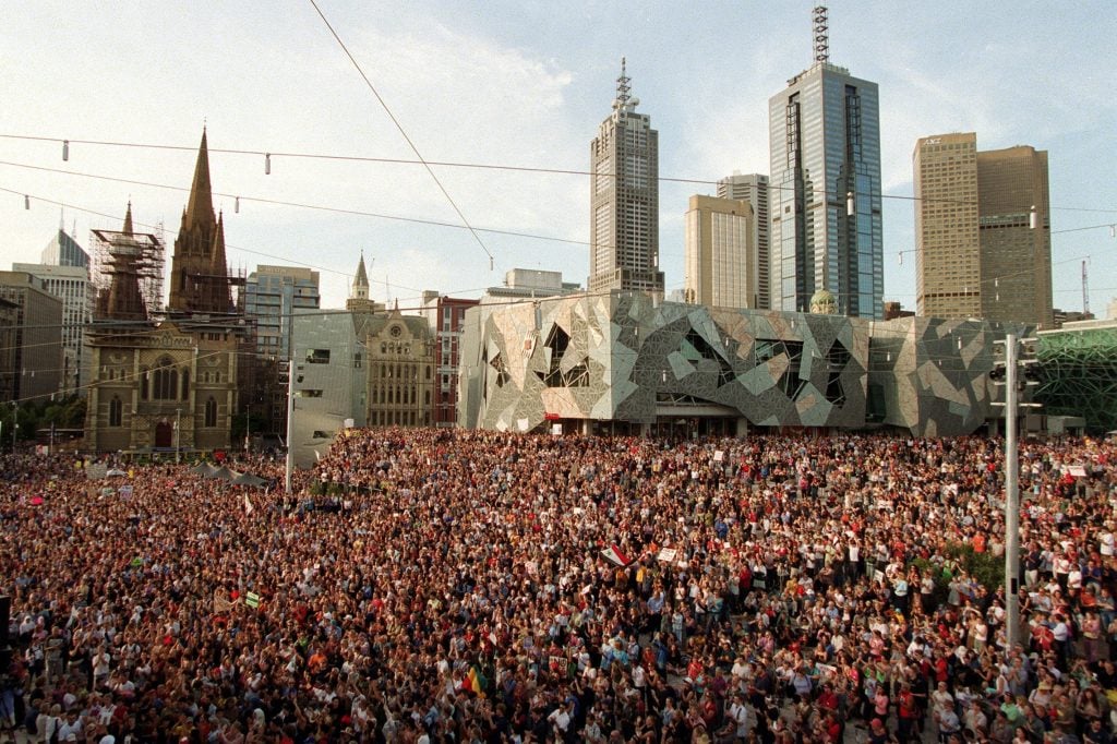
Image courtesy Federation square.
This image is in copyright
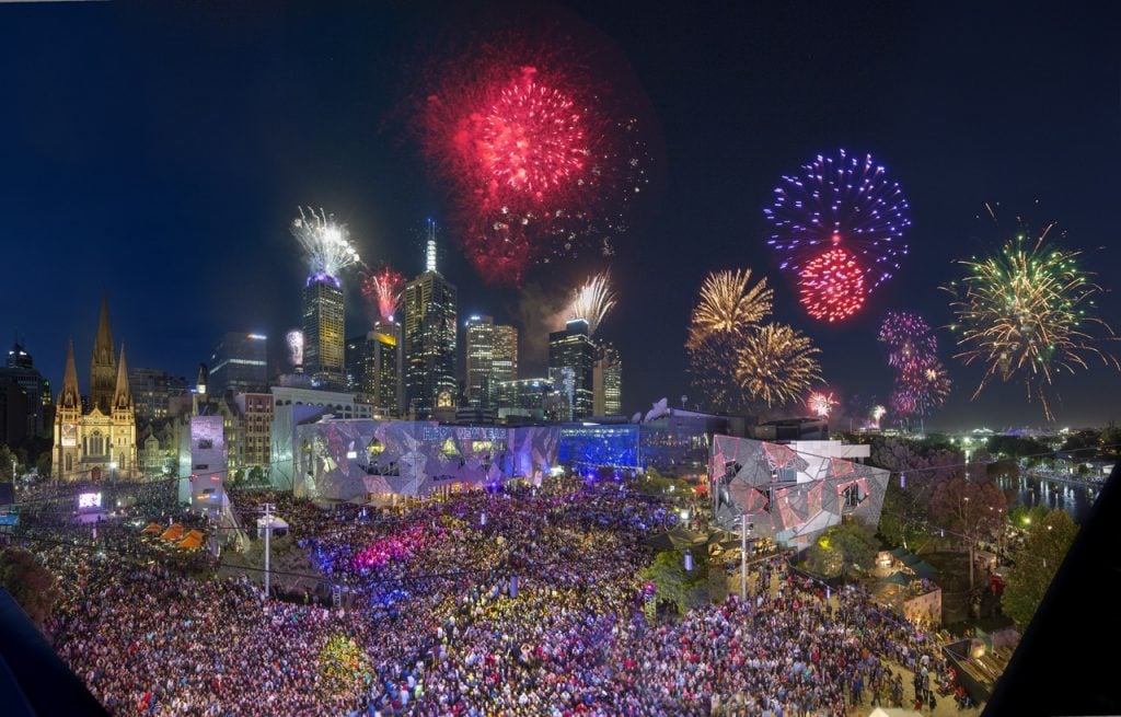
Image courtesy Federation Square. This image is in copyright
More to explore
Books and journal articles in our collection on Federation Square – online material is available from offsite with State Library Victoria membership.
Fed Square
These significant cultural institutions call Fed Square home:
Koorie Heritage Trust – learn the history of Aboriginal Victoria and South Eastern Australia.
The Ian Potter Centre: NGV Victoria – explore the Australian art Collection.
ACMI – Australian Centre for the Moving Image – discover the universe of screen culture.
Fed Square video – image listing
References
Note: Princes Bridge has been variously referred to as Prince’s and Princes Bridge over the years. We have taken our reference from the relevant work, or the catalogue record.
- A journal of the explorations of Charles Grimes, Acting Surveyor-General of New South Wales. Kept by James Flemming. 2, 8 February 1803, pp. 14, 15
- Andrew Brown-May and Simon Cooke, Death, Decency and the Dead-House: The City Morgue in Colonial Melbourne, Provenance: The Journal of Public Record Office Victoria, issue no. 3, 2004
- The new dead house, The Argus, 10 June 1854, p.5
- Andrew Brown-May and Simon Cooke, Death, Decency and the Dead-House: The City Morgue in Colonial Melbourne, Provenance: The Journal of Public Record Office Victoria, issue no. 3, 2004
- The new morgue, Herald, 9 April 1888, p.3
- New fish and meat market, The Argus, 26 April 1892, p.6
- Letter, Melbourne times 24 December 1842, p.2
- Laying the foundation stones of the new bridge and hospital at Melbourne, Sydney Morning Herald, 1 April 1846, p.3
- The bridge over the Yarra, Port Phillip Gazette and Settler’s Journal, 16 August 1847, p.2
- Watching life from a city pavement, The Herald, 11 May 1935, p.31
- Determination of the Heritage council, Federation Square, 15-17 April 2019, Heritage Council Victoria
Hi Jane. I wonder if you have come across any photographs of the ‘new morgue built in 1888 on Batman Avenue? Also do you have an exact location? The Herald article you cite says it was on the ‘Northen Bank of the Upper Yarra and midway between Princes Bridge and the friendly Societys Gardens. I am writing a novel based on the disappearance of my great grandmother and am trying to get an understanding of the appearance of the morge and location. Many thanks
Hello Meg – thanks for your question – I have passed you query on to our Ask A Librarian service.