
The Library’s Historical Maps and Plans Collection contains around 8000 maps on microfiche, covering the first sixty years of European settlement in Victoria. This was once one of our most heavily requested maps collections, but these days, you can find it online, thanks to a digitisation project by the Public Records Office of Victoria (PROV).
You might be wondering why these maps are so popular. The answer lies in the remarkable details that lie within them, from descriptions of what the landscape was like when Europeans arrived, to the locations of early buildings and houses, tracks used by diggers travelling to the goldfields, pastoral runs, and even shipwrecks.
There are 48 sub-collections within this collection on a wide variety of subject matter. To follow are some of the popular ones.
Feature plans
Feature plans are a miscellaneous group of maps depicting land that was in many cases, on the threshold of settlement. They offer us unique insights into what an area was like, such as where natural water features like springs, ponds, swamps and lakes were located, what the quality of the soil was like, and the type of vegetation that was growing in an area.
In this feature plan of Portland Bay (below), you can see that the land has been subdivided, ready for development. The location of several natural ponds have been marked on the map, as has the presence of a burial ground, although it does not say whose burial ground it is.
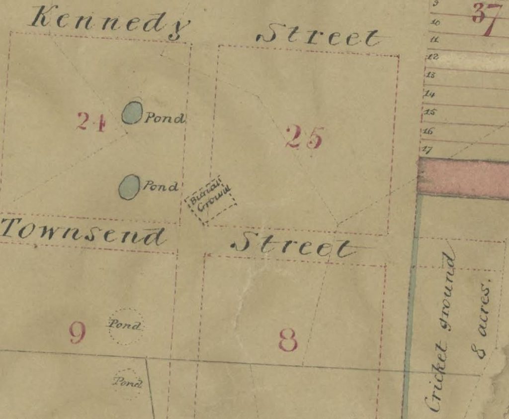
Feature plans may also show the names of the people who first took possession of an allotment from the Crown. You can see names on allotments in this feature plan of Queenscliffe, below:

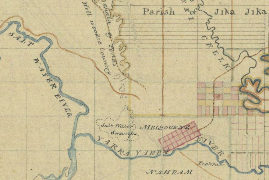
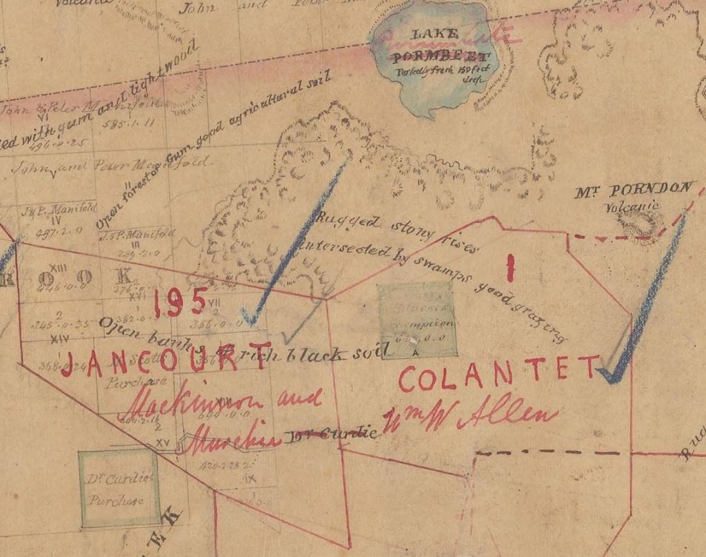
Pastoral runs
Pastoral runs show the large areas of Crown Land that were licensed by squatters for grazing between the years of 1847 and 1882. They are particularly popular with family historians trying to trace the history of their ancestors.
All of these plans show the boundaries of runs and sometimes, they also give descriptions of vegetation and plot the location of tracks, fences, and huts.
In this map of pastoral runs from Heytesbury County (below), the names of pastoral runs have been marked in red with the squatters’ names marked underneath. The map also contains descriptions of vegetation and soil.
Roll plans
These maps were named Roll plans because the originals were very large in size and traditionally rolled up.
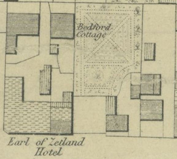
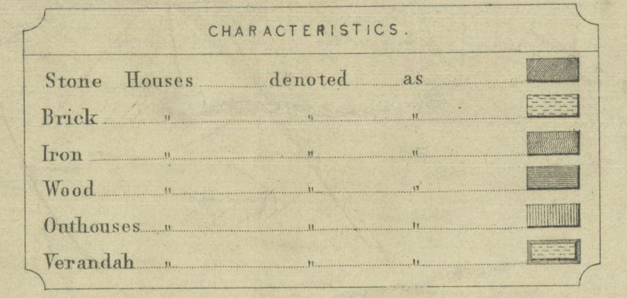
This excerpt from a roll plan (below) shows us the localities, names and even building materials used for some of the earliest buildings in East Collingwood. At the top you can see a wooden house called Bedford Cottage. There is a large garden on the block next door. The pub, ‘Earl of Zetland’, shown at the bottom left, was located on Stanley Street. According to the map key, it was made largely of brick, although there was one section made of wood. You can also see the outlines of several outhouses, denoted on the map by vertical parallel lines.
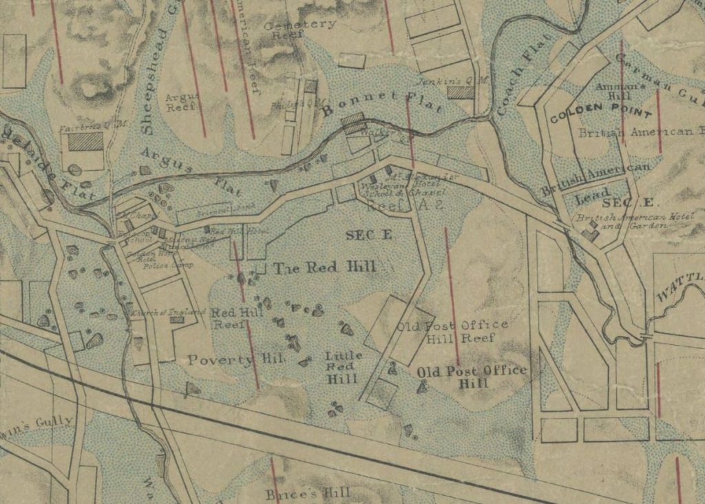
Goldfields
This sub-collection is great for discovering details about the goldfields. You can find information such as where leads and gullies were, the locations of townships, buildings and shops, and also routes diggers took to the goldfields.
This map (below) shows the route diggers took to get to the Jordan goldfields. It shows where they could find provision tents along their journey, as well as where they could find water and feed for their horses.

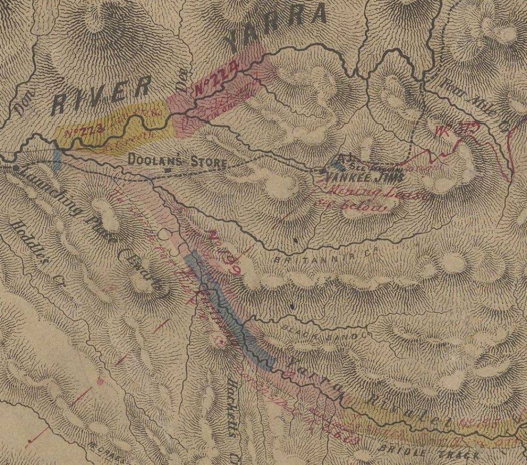
Explorers’ routes
These historical plans show the routes that explorers took in Victoria.
This map (below) shows the location of Yankee Jim’s (later known as Warburton), which at the time this map was published in 1865, had a population of around fifty people. 1 Sources of supply are marked on the map, including a place known as “Doolan’s Store” (which has all but vanished from the history books).
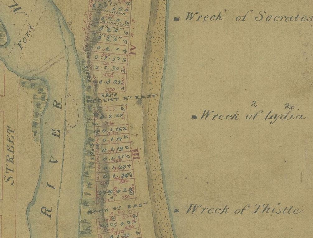
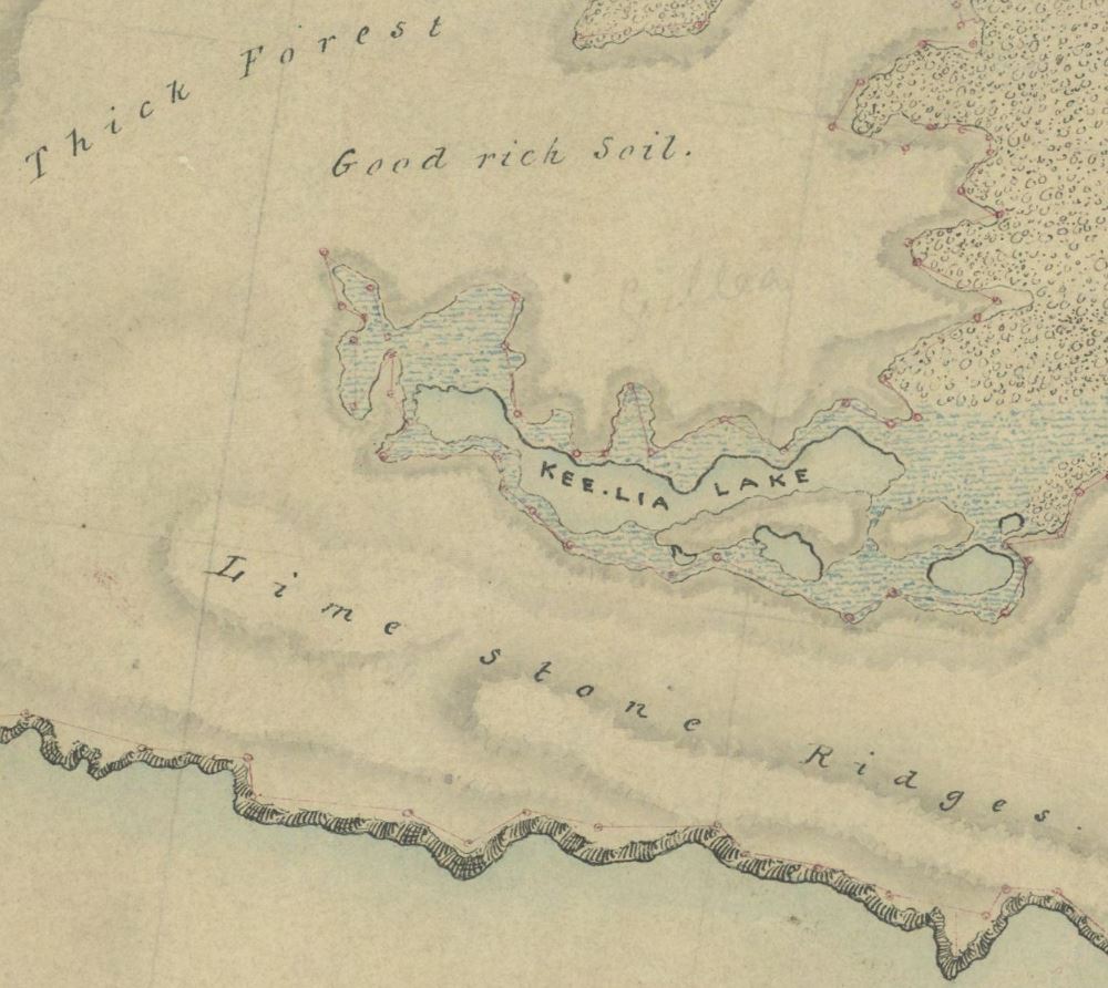
Coastal surveys
This sub-collection consist of surveys of the Victorian coastline conducted between 1840 and 1870. These surveys were intended to define the configuration of the coastline, describe the structure of coastal vegetation and identify any land occupations.
In this map (below), you can see that the quality of the soil has been noted (“good rich soil”), as has the location of a lake, thick forest, and lime stone ridges.
You can find a complete list of these sub-collections, along with their classification codes (which usually consist of a prefix eg FEATR and then a number), on the PROV website.
In addition to the subcollections above, there are maps on subjects as varied as cemeteries, old and new roads, police reserves, electric telegraphs, water supply routes, railway lines, and many more.
You can read more about the Historical Maps and Plans Collection, including tips on how to find and download maps, in our research guide: Maps for local and family history. There is also a wealth of information about historical plans on the PROV website.
With special thanks to Blair Gatehouse.
You may also like …
References
- Whitworth, R P, 1865, Bailliere’s Victorian gazetteer and road guide: containing the most recent and accurate information as to every place in the colony with map, F.F. Bailliere, Melbourne, p 410
A most interesting email
Thank you
I am interested in the work being done. I am seeking a 19th century map of Keilor including Arundal covering the area of the Keilor Man excavation.
Hi Kerry, Thanks for your interest. I will log your enquiry with our Ask a Librarian service, and one of our librarians will get back to you. Sarah
This is just terrific that all of these early maps have been made available.
As a committee member of the Edward Hunter Heritage Bush Reserve Moe 3825 I am very keen to find out the history of the Reserve area before it became Crown Land in approx 1879 as a railway reservoir for steam trains. I will try and arrange a search in approx June.
Thankyou so much for bringing this resource to my attention.
Regards,
Bruce King
Hi Bruce, thanks for your comment. I’m glad you found the information useful. Sarah
Amazing work Team,
What facinating history contained in these maps.
So much potential creative & historical use.
Many thanks, Sarah
Thanks Sarah! I’m glad you enjoyed it.
Fascinating…any maps from this period, of the Elsternwick area please?
Hi Barb, Thanks for your interest. I will log your question with our Ask a Librarian service and one of our librarians will get back to you. Sarah
Interested in pre 1900s maps of Koroit to Warnambool. How do I go about those?
Hi Shane, Thanks for your question. I will log your question and we will get back to you via email with an answer. Sarah
Would youhaveamap ofElizabeth street and Flinders lane corner
North /east cnr from 1838 onwards
Showing a building also.Thku
Hi Beryl, Thanks for your interest. I will log your question with our Ask a Librarian service and one of our librarians will be in touch. Sarah
What an astonishing and useful resource. Thanks to everyone involved in making this generally available.
Currently researching the history of John Richardson, MLA Member for East Geelong 1861-1876. We have located rate records showing that he occupied a property in the Strawberry Hills Division. Can you inform as to the location and perhaps a map ? We assume that it is in the Geelong area.
Hello Phillip, Thanks for your question. We will be in touch in the coming days with an answer for you. Sarah
What a wonderful service. Thank-you!
This sounds good. I am interested in two original houses in Green Street Ivanhoe, No. 7 and No. 10. Who built them, who owned them and/or resided in them and the dates. I haven’t had success in finding this information to now. Maybe your maps may help.
Hi Alan, Thanks for your interest. I will log your question with our Ask a Librarian service and we will be in touch. In the mean time, you might find our research guide: Researching buildings and houses helpful. Sarah
Hi Sarah,
My grandfather, George Henry Bausch was in the First World War & he was granted a Soldier Settlement parcel of land from the Government up in the Maloga area near Lockington.
I was interested to know if you had any maps of that area & the Soldier Settlements there.
I don’t what the year was that he settled there.
Regards
Lynette Knight
Hello Lynette, Thanks for your interest. I will log your question and we will send you a response via email in the coming days. Sarah
The Public Record Office Victoria also holds a lot of info on WW1 soldier settlements. Please see: https://prov.vic.gov.au/explore-collection/explore-topic/researching-land-and-property/world-war-i-soldier-settlement
Looking for anything from koroit Belfast tower hill 1840,s to 1860s
Hi Chris, Thanks for your question. One of the librarians from our Ask a Librarian service will be in touch about your enquiry. Sarah
Hi Chris,
I’m looking for early Fitzroy maps. Also seeking maps with topographic elevation and terrain.
Thanks for your help
Hi Lou, thanks for your enquiry. I will pass your question on to our Ask a Librarian service, and one of our librarians will get back to you. Sarah
Fantastic collection of maps. Love the early explorer map of Warburton especially.
Does anyone know anything about Peter McAllister who lived in Wangoom around the 1860s?
Hi Ula, Thanks for your interest. I will log your question with our Ask a Librarian service and one of our librarians will get back to you. Sarah