
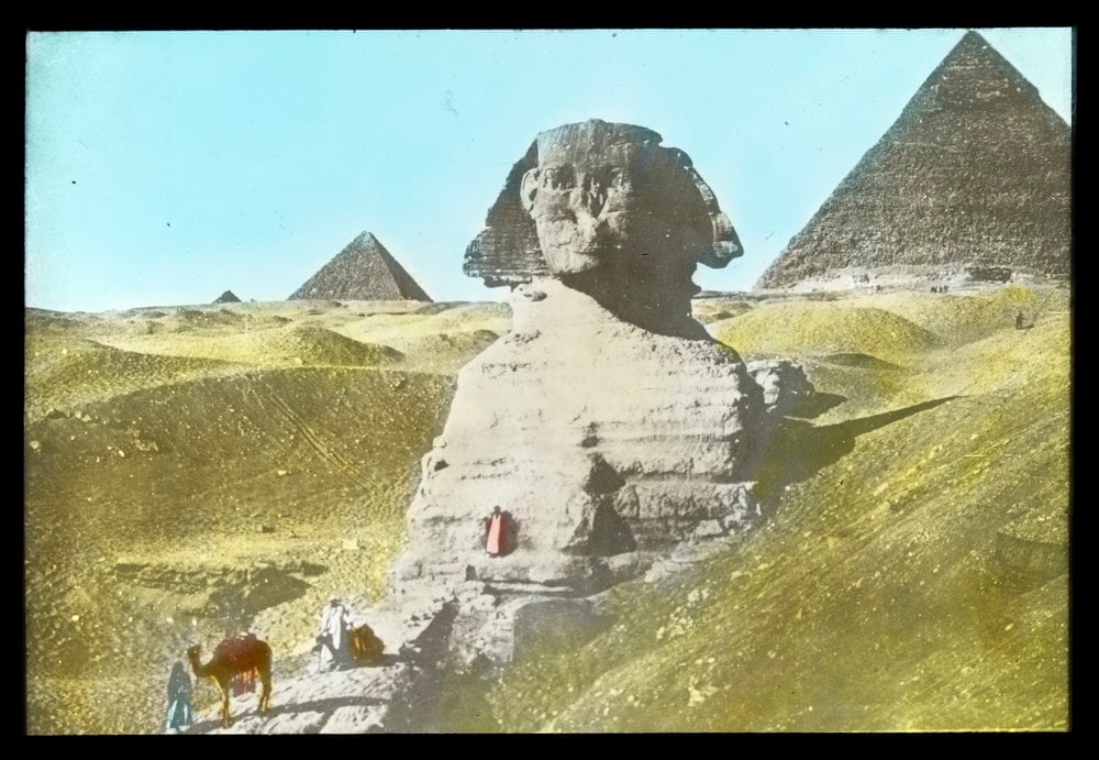
Pyramids and Sphinx, Egypt, H2002.80/6
When I think of travel guides, the image of fictional Belgian detective, Hercule Poirot, armed with a little red book, pontificating near the Pyramids always seems to come to mind. The Poirot movies are set in the 1920s and 1930s so he was most likely clutching a Murray or Baedeker travel guide – both were known for their iconic red bindings and gilt lettering.
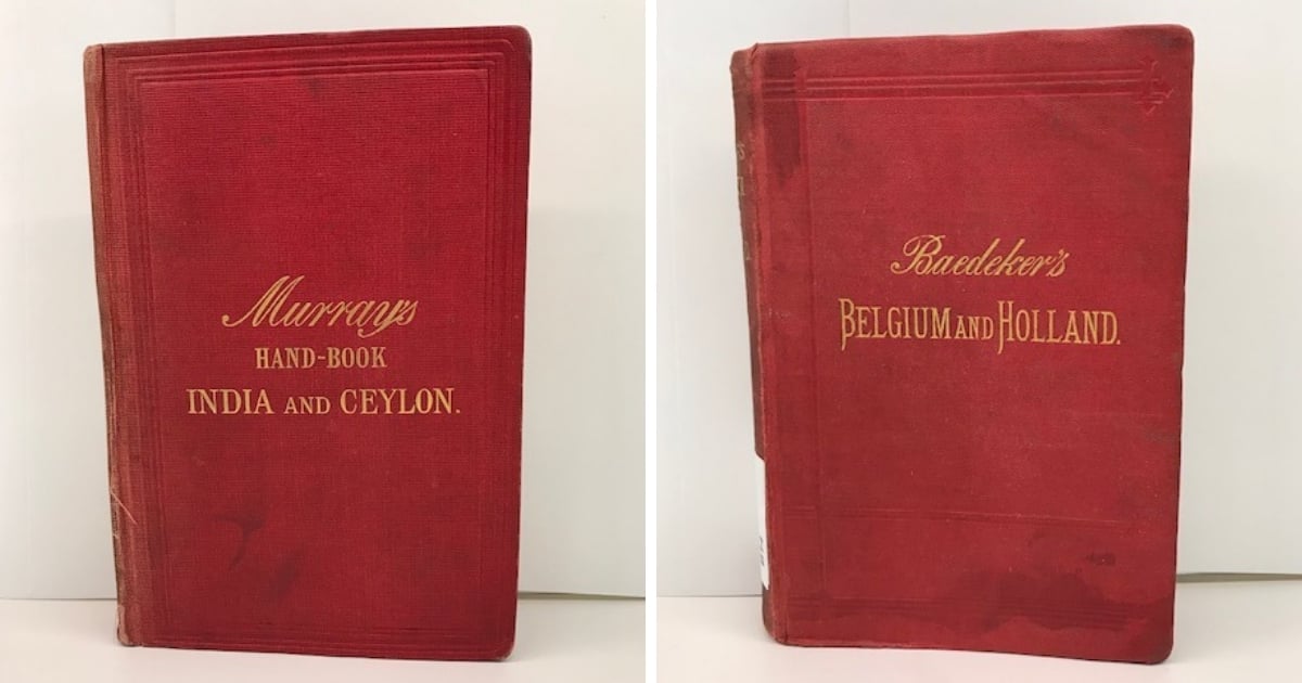
The iconic covers of Murray and Baedeker travel guides
The English publisher, John Murray III, continuing the publishing business begun by his forbears John Murray I and II, started publishing his Handbooks for Travellers in 1836. These became the standard in travel literature of that time. Murray’s guides offered the discerning traveller itineraries in terms of numbered routes, descriptive notes and practical information. See which Murray’s guides the Library holds.
On another part of the continent, Karl Baedeker, a German national, born in 1801 into a family of printers, publishers and booksellers, took travel publishing to new and more descriptive heights. His aim was to assist the independent traveller to see and experience the sights without the aid of guides, innkeepers, hired servants and coachmen. We have a large number of Baedeker guides.
In 1828 Murray published Mariana Starke’s Information and Directions for Travellers on the Continent. Starke’s book set out the template for the later Murray guides. He replaced her method of using exclamation marks to denote worthwhile sites with a star rating system. This method of ranking sites was also used by Baedeker.
Baedeker and Murray collaborated through the early years but by the 1850s tensions rose over the slowness of updates from Murray. There was a demand for Baedeker’s guides to be translated into English but due to an agreement between him and Murray, Baedeker held back. After his death, however, his sons Ernst, Karl and Fritz pursued their travel publishing business with renewed vigour, eventually overtaking the Murray travel guides.
Travel guides have been around a long time, but not in the form they take today. In the ancient world there were guides written as reconnaissance documents to aid conquest of foreign territory; there were also guides for pilgrims to holy places (e.g. Petrarch’s guide to the Holy Land: Itinerary to the sepulcher of Our Lord Jesus Christ) and guides written for those on the quest for cultural, artistic and linguistic refinement on the Grand Tours of the 18th century (an example, Rev John Chetwode Eustace’s A classical tour through Italy an MDCCCII, is available online to Library members).
Another interesting find in our collection is the Tabula itineraria Peutingeriana, which is a road map of the early Roman empire. View it in Trove.
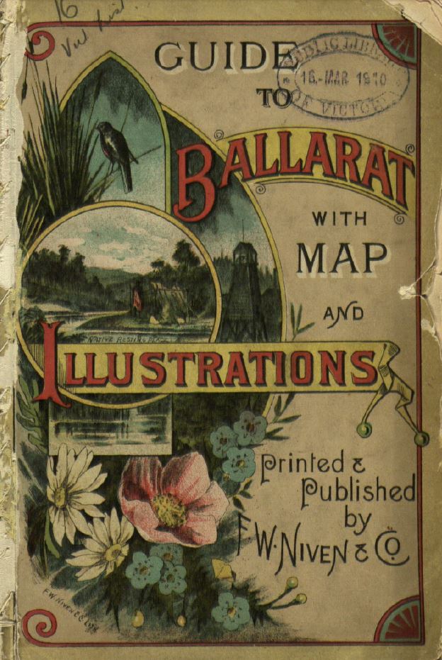
FW Niven & Co’s Guide to Ballarat
Closer to home, the concept of tourism as leisure emerged in the late nineteenth century, as Victoria grew in wealth from the gold rush. Early tourist guides to the provincial towns and holiday resorts of Victoria were produced as little booklets with advertisements and illustrations. The Library holds an Illustrated handbook of the Bay for those seeking recreation during the summer months (1874-1877), Daylesford and its surroundings by ‘A Wanderer’ (1885) and guides published by FW Niven in the 1890s including Ballarat and Warrnambool.
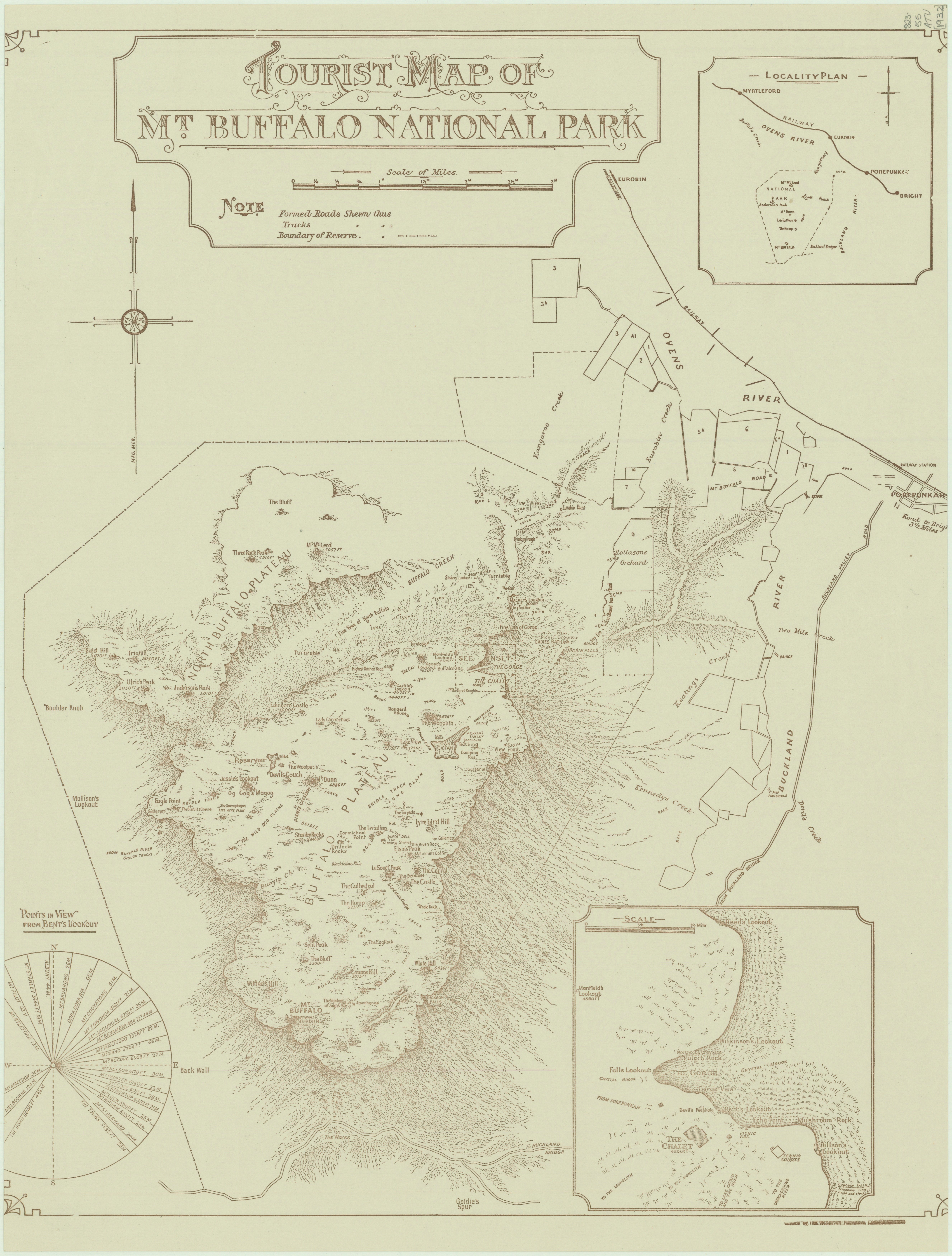
Named by explorers Hume and Hovell in 1824, Mount Buffalo boomed as a tourist destination from the end of the nineteenth century into the early twentieth century. Improvements to the roads and extensions to the railway lines saw city dwellers escape to the clear air of Victoria’s Alpine region. The formation of the Bright Alpine Club in 1888 contributed to the development of this region, with published guides of information and itineraries for city escapes.
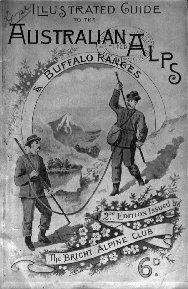
From 1898, an initial site of 2880-acres was reserved for a national park, which extended throughout the early twentieth century. The Manfield family, a famous pioneer family on the mountain, ran a guest house and guided tours up Mount Buffalo. Find out more about mountain guide, Alice Manfield, and the Mount Buffalo region in the Changing face of Victoria exhibition.
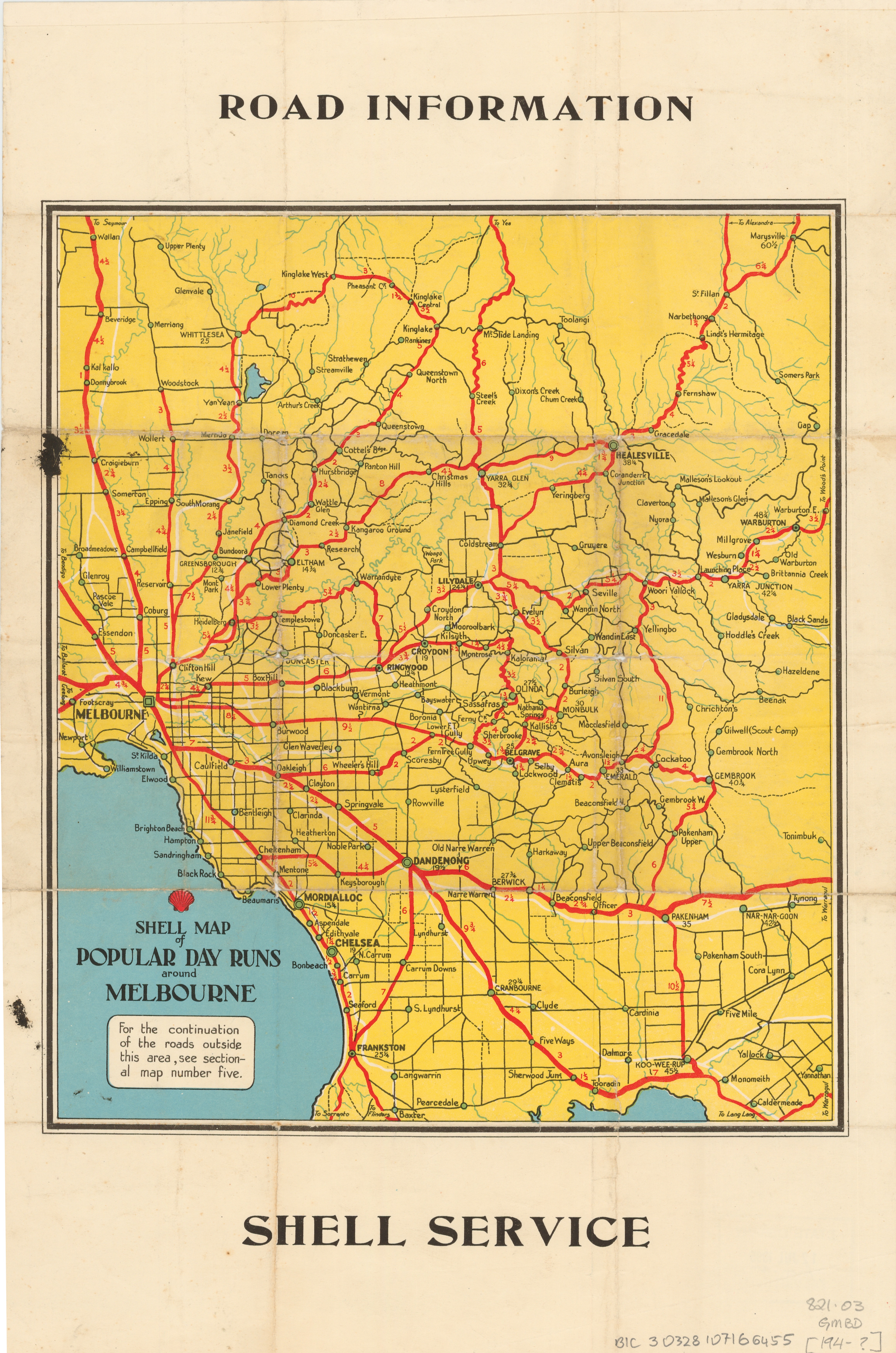
As road, railway and national park infrastructure improved, Victorians took up the opportunity to hit the road. The Library holds many Australian travel guides in map format, including 1920–50s Victorian tourist maps by Victorian Railways and the Department of Crown Lands and Survey and the Shell Company road and touring guides.
Travel guides abound today, especially the ubiquitous Lonely Planet guides, Fodor’s, DK travel guides, Rough guides, and Frommer’s guides, all of which are represented in our collection. Explore these today on our catalogue or browse the shelves in the La Trobe Reading Room (for Australia) and the Redmond Barry Reading Room (for the rest of the world) to get started on your own journey.
As a lover of maps, this was really interesting and there is a lot to follow up, I still have some Shell and Mobil road maps but I am forgetting how to travel by using maps. Thanks Mew Leng.
I still have my tattered copy of Murray’s Handbook to India, Pakistan, Burma and Ceylon (1968 edition) which was my guide when I first went to India in 1969. From the section on Motoring: “A second car for the servants and baggage is a wise precaution in case of a break-down”. And from the Camping section: “Servants required in camp are a bearer and a cook; a water-carrier and a sweeper may be got locally”. I’m sorry to report my own travels did not live up to Murray’s lordly expectations!
Nice reading and pictures Mew Leng. Thanks for sharing this 🙂