
by Dr David Sornig
The Yarra delta was once a fertile landscape dominated by a large blue saltwater lagoon. In his account from 1835, John Batman described a cloud of a thousand quail flying over the miles of wetlands, while the lagoon was ‘upwards of a mile across, and full of swans, ducks, geese, etc.’
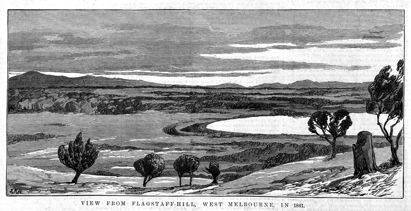
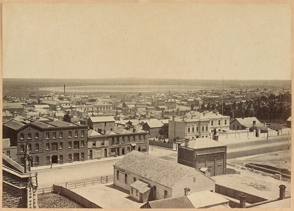
The Australasian sketcher, 1881
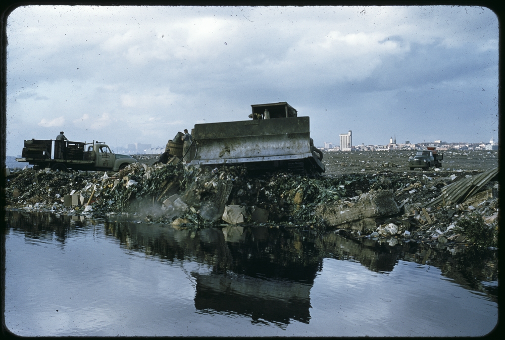
As I wrote in my earlier blog about West Melbourne’s lost wetlands, the vibrant blue lagoon, wetlands and hard-to-navigate stretch of the Yarra River known as Humbug Reach have all long since disappeared. So too have almost all remnants of the area’s rubbish tips, slaughterhouses, boiling-down works and other noisome industries. The hermit dwellings and Depression-era Dudley Flats shanty town that dominated the area in the 1930s and ’40s have also vanished.
The once-industrious docks have been redeveloped into a leisure and residential zone, and the remaining flatlands stretching all the way to the Maribyrnong River in the west are now crammed with container ports, roads and railways.
My Creative Fellowship
In 2015, I was fortunate enough to have been the recipient of a State Library Victoria Creative Fellowship. During the fellowship, I researched and documented the transformation of the West Melbourne wetlands over the 180 years since European settlement.
Along the way, I assembled biographies of three of the district’s more extraordinary residents between the 1920s and 1950s: Elsie Williams, a Bendigo-born singer of Afro-Caribbean origin; Jack Peacock, the king of Dudley Flats’ tip-scavenging economy; and Lauder Rogge, a German hermit-sailor who lived for decades with 60 dogs on a stranded boat.
The outcome of my fellowship was a book, Blue lake: Finding Dudley Flats and the West Melbourne swamp (Scribe, 2018), in which I shared the story of my journey of discovery and documented the lives of these three local characters.
Wetland walks
While I completed most of my research for Blue lake at the State Library, it was very important for me to connect that research to the physical place I was writing about. And the best way to make that connection was to spend a lot of time in the area simply walking, exploring and imagining the area as it once had been. I find that the meditative spaces of walking and imagination are very closely linked.
During my walks, I became very aware just how few people today venture into the area on foot, let alone spend time imagining.
So, following the publication of my book, I was keen to return to West Melbourne – not alone this time but with a group of people who could contribute to the collective imagining of the area’s history, and the connection between past and present.
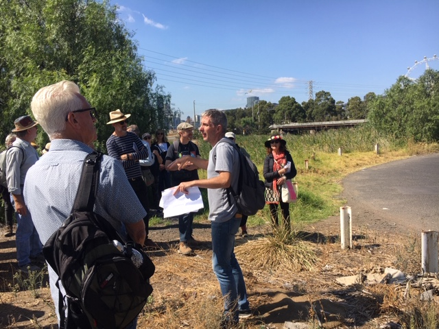
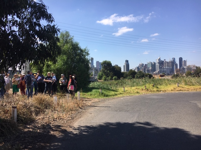
The result was a series of walks called ‘Walking the blue lake’, organised by the State Library on 14 and 17 March 2019.
More than 50 people joined me on the three walks. We traced the circumference of the former blue lake, both in part and in its entirety, and reflected on the area’s lost history and the largely forgotten lives that were lived there.
I hope you enjoy the following impressions from that collective journey around the lake.
1. Alice Glover
My overriding impressions were the disrupted topography of the original wetlands; the inescapability of overpowering urban construction; the thought of the dispossessed original inhabitants and how unimpaired, restful, productive and probably beautiful the place must have been in their time; and the contrasting human stories of the Dudley Flats dwellers.

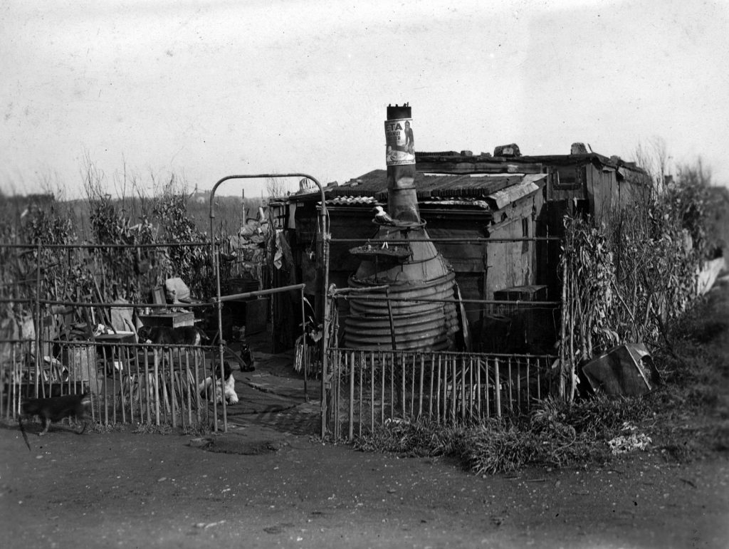
Housing Investigation and Slum Abolition Board, c 1935
The site of the Dudley Flats ‘Bachelors Quarters’ on the side of the Railway Coal Canal,
close to Victoria Dock. Only single men lived here.
2. Andrew Gregg
[The walk] brought a long-overlooked, drive-through, no man’s land to life. Learning about how a once fruitful paradisiacal landscape in pre-colonial times was turned into a dead, drained and poisoned dumpscape was sad as well as inevitable. We live overlooking this whole area (at the North Melbourne station) and will now look at it with a deepened imagination.
The site close to the entrance to the West Melbourne Tip,
where Jack Peacock was the ‘King of Dudley Flats’ from the 1930s to the 1950s,
and where Elsie Williams spent her last days in 1942.
3. Teresa Savage
I learned a lot about the area I’ve often driven above! It made me think about how life must have been and yet how things haven’t always changed as much as we think. We still have homeless people – some of whom would not want to swap with a home owner.
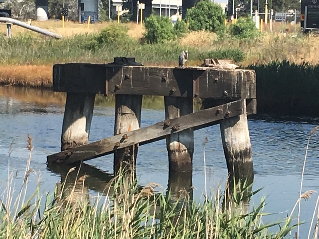
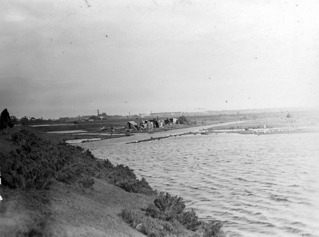
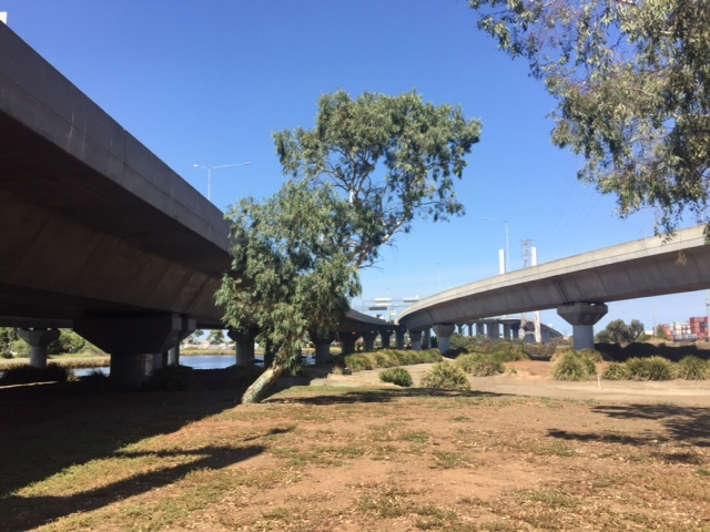
The Railway Coal Canal, or Moonee Ponds Creek, marks the eastern shore of the former lagoon. The image shows the remains of a railway bridge that was used to dump locomotive coal ash on the Railway Tip, which was on the western bank of the canal.
Moonee Ponds Creek is named for the Moonee Moonee chain of ponds – the last and largest of the ponds was the tidal lagoon (the ‘blue lake’) that you can see in this photo.

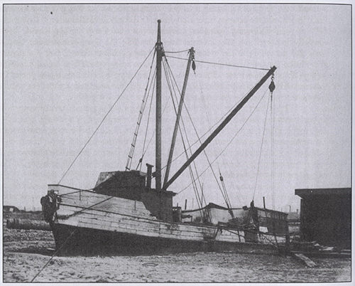
The Maribyrnong River from the site where it once intersected with the Yarra, which was diverted into the Coode Canal in the 1880s. When the Yarra’s original course was eventually filled in during the 1920s, Lauder Rogge’s schooner was stranded there
4. Carol Pelham Thorman
The tour sparked the memory of my own wild west adventure…
In the 1970s, when my contemporaries were documenting their full-grain lentil lives in Carlton share houses, I branched out, towards the wild and uncharted west of the city. There a house could be bought for only two times my humble yearly income; however, lentils were unattainable. Imagine! South Kensington.
With only a bike for travel, I discovered a labyrinth of private roads, footbridges, hidden paths, over- and underpasses. They opened up the unfamiliar territory that would become my neighbourhood; the busy heavy industrial sites next to forgotten wastelands and encroaching residential pockets, the truck-laden roads and impenetrable railways.
Access was never a straight path. It is only now, when I can google map the area, that the proximity of sites and their patchwork of hurdles and obstacles is truly apparent.
Today, I wonder how many of those living remotely high above the ground in Docklands explore beyond the gentrified precincts of Harbour Town?
5. Margaret McVey
Dudley Flats comes alive when one hears the story of the characters who once lived and worked on the banks of the Yarra.
The site of the Dudley Flats shanty town from the early 1930s to the early 1940s
Podcast
To go on a virtual walking tour of West Melbourne’s lost wetlands, hear David Sornig’s Blue lake podcast on Radio National’s History listen program.
More to explore
- Apply for a Creative Fellowship
- Watch creative duo The Orbweavers perform songs inspired by their fellowship research into waterways in the west of Melbourne
- Discover how to use maps in our collection for Victorian local history research
For an interview with David Sornig check out Episode 6 of the “My Marvellous Melbourne” podcast: http://mymarvellousmelbourne.net.au/
Nobody wants to remember the Aborigines who were in West Melbourne until the homeless Irish Catholics pushed them out in the 1930’s.
Some of the Aborigines ended up on the south side of the Yarra River. In the 1940’s the building of the Fishermeans Bend Airport by the USA army displaced some of them.
A small number of Aborigines lived in the “sting weed” jungle till the 1960’s. They were the last of the full blood Aborigines in Victoria. They lived by clothing themselves from what they could find in the tips at night when the white rubbish gatherers were not around; and, ate the many birds, rabbits and weeds the swamps gave them.
They lived the nightmare of the invaders in their land as we did before we ended up in Australia, to invade another peoples land.
Great piece. Small point: the John Noone image is 1869, not 1863.
Thanks for letting us know Anthony.
Now amended.
Paul
As kids in the 50s we would ride our bikes along Dynon Road from Hopeton Bidge to North Melbourne and the north side of the tip here some of the mansions were. Or down along the river to Footscray Road along Footscray load to Moonee Ponds Creek back along the old course f the river about half way back you could get onto the island over a narrow bridge there was the old airport with its sign ” Daily Flights 30 Shillings. There were lots of old boilers and bits from ships and the gun emplacements from ww2 were still there. Back to the Swing Bridge it was still there then onto Footscray Wharf where they wrecked ships and I well rem playing on an old Antartic ship I think the Tharla Dan . The Akuna
Then down Whitehall Street and in and out of the side streets past the sugar works and Cumming Smith’s and the ferry at Francis street that took you to Fisherman’s Bend out and down Hyde Street across Stoner Creek past the back of the pumping station – still operating then. Past the oil terminals you could get in to some of the wharfs left at the power station down to the ferry then back and down the Strand along Hobsons Bay to Nelson Place in and out of the wharfs
The Castlemaine was no there at that stage. The old morgue the Habour Trust to Breakwater pier passing the Dock Yard and the old Dry Dock the wheat storage a d the time Ball to the Falling and Light before the Government vandals destroyed it to Shelly Beach where the
Karcaricky?? Spelling was wrecked on the rocks and follow the waterpast the footy ground and right along the Esplanade ad back up to Champion Road and back to Newport and Williamstown Road and home to Footscray. Whay great adventures mabe there was some risk but was what we dd it for.. it all lives in my memory
We had other adventures further north along Ballarat Road to Bourke Street and down to Solomon’s Ford on the River.
for more adventures If we could only turn the clock back what wonderful dsys they were.