These photographs are part of the State Aerial Survey that was produced by the Department of Crown Lands & Survey between 1945-1965. They cover mostly regional Victoria from Albury to Willaura. The majority are scaled at 1:15,840. They are mosaics, which means multiple photographs were joined together to form one large overall image.
[Photo-map of Victoria]. 782 B3 Albury
To locate them using the online catalogue, choose Maps from the drop-down menu to the right of the search box and search for the locality name and the phrase “820 BR [1945-1962]”. For example, Murchison AND “820 BR [1945-1962]” gives this result. To identify a precise area and its name, consult the online VicMap index.
[Photo-map of Victoria]. 912D3 Willaura
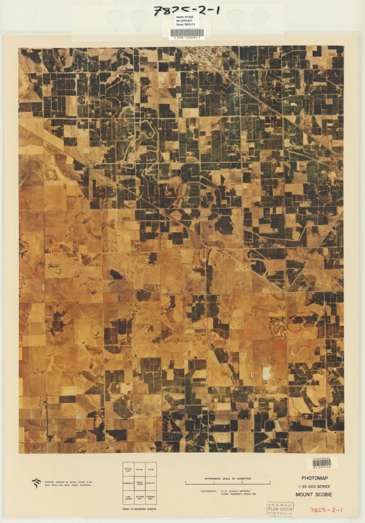
The Library has digitised another series of aerial photographs published by the Department of Crown Lands and Survey and other government agencies from the late 1960s through to the early 1980s. They cover most of metropolitan Melbourne and regional Victoria. Most are scaled at 1:25,000. To locate these, search for the locality name and the phrase “Victoria photomap”. For example, the search “Swan Hill” AND “Victoria photomap” gives this result. There are around 80 photographs from the series that are in colour.

![[Photo-map of Victoria]. 782 B3 Albury Black and white aerial photograph of Albury featuring the Murray River, North Hume, Eastern Highway and Fell Timber Creek.](https://blogs.slv.vic.gov.au/wp-content/uploads/2016/05/download2-1024x736.jpeg)
![[Photo-map of Victoria]. 912D3 Willaura Black and white aerial photograph featuring Lake Bolac and the Glenelg Highway.](https://blogs.slv.vic.gov.au/wp-content/uploads/2016/05/download3-1024x715.jpeg)


Where these from the newly aquited monash geography donation?
Hi Kara
No these are aerial photographs that have been in our collection for a long time. The Monash donation is still in process.
Amazing!
Hi Brett
Thanks for your comment. Glad you found the aerial photographs of interest.
Cheers
Maps have always been particularly difficult to deal with, especially in small libraries where they are often not catalogued at all. I think it is absolutely wonderful to see these maps digitized for future generations. What a wonderful project.
Hi Lee-Anne
Thanks for taking the time to comment on the blog. The size and specialised nature of maps makes them a challenging format to catalogue. It’s always satisfying getting collections online and out into the public domain.
Hi Sarah and SLV. This is a fantastic resource and will definately be of great use and interest to me and many others I know and work with.
Thankyou for this and dare I say it? ……more please?!
Hi Yasmin
Thanks very much for your comment. Glad you and your colleagues will find the aerial photographs useful. Hopefully we will get some more exciting maps digitisation projects up and running in the near future.
Great to see these resources online, and much appreciation for the work involved. Cant wait to study them detail…that’s what holidays are for!!
Hi Carolann
Thank you for sharing your enthusiasm for the digitised aerial photographs. Definitely useful for family historians interested in the topography of the areas covered. And yes, you’re right. The holidays are often the time when people have the luxury to disappear down research rabbit holes.
Hello. This is an excellent resource. Just a question, I’ve been searching for maps that show melbourne’s suburbs, but so far have not found any, only regional areas. You say there are maps of ‘metropolitan melbourne’ above though. Any tips on how to find these?
Hi Elena
Thanks for your comment. I’m glad you find the aerial photographs useful. I’ve referred your enquiry to our Ask a Librarian service and someone will be in touch with a response.
Regards
Sarah
Hi im looking for photos of a house that was next to the Italian farm in 1980s in South morang it had sheds and horse sheds next to a house on the plenty gorge I lived in that house my first years of being born an Ariel pic would be awsum if you could and any other pics and the primary school too before they moved it in 1997 cheers hope someone can help
Hi Micah
I’ve logged your enquiry with our Ask a Librarian service and we’ll be in touch with a response.
Regards
Sarah
Are these photos digitised at the resolution of the original photos that make up the tapestry? I would be keen to blow up the area around my farm and would like to achieve the best possible image so if the individual pieces are clearer, are these still available somewhere?
Hi Rob
We don’t hold the original photos so am unsure of the resolution. The originals are held at the Land Use Victoria’s aerial photography storage facility in Laverton. The phone number for the facility is (03) 8368 5411. Our copies are prints of the photos. You can browse an index to view jpeg copies of the mosaics digitised by the Department of Land Water and Planning at https://services.land.vic.gov.au/DELWPmaps/historical-photomaps/
Regards
Sarah
Ferntree Gully area is not hatched; does this mean an aerial photograph is not available, or perhaps not stored with you.
Thanks
Quentin Lehane
Hi Quentin
That’s correct, there isn’t a photo available for Ferntree Gully. Not all areas were photographed by the Victorian Department of Lands and Survey. National aerial surveys were also undertaken. Geoscience Australia is the custodian for the negatives. For information on obtaining copies of aerial photographs see http://www.ga.gov.au/scientific-topics/earth-obs/accessing-satellite-imagery/aerial-photography.
Although not what you’re after, you might be interested in the historic National Military Survey of topographic maps carried out between World Wars. We’ve digitised a few editions of the Ringwood sheet that covers Ferntree Gully.
https://bit.ly/3h6AaIU
Regards
Sarah