
Written by:
Anne-Marie De Boni, Digital Production Manager
Sarah Ryan, Senior Librarian, Victorian and Australian Collections
The Library has just reached a significant milestone, having now digitised over 30,000 maps and plans!
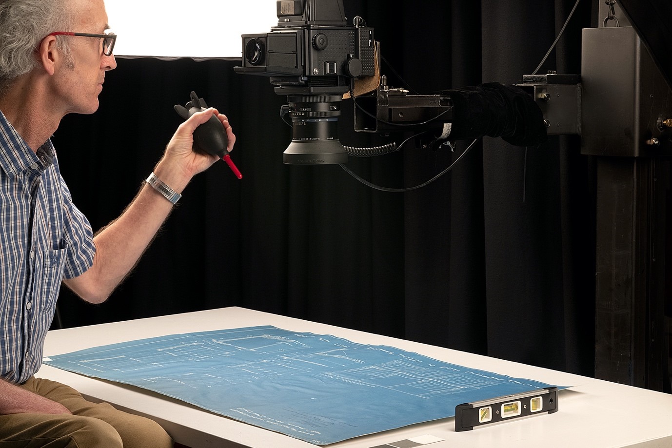
Maps and plans are digitised in the Library’s Imaging Studio and Scanning Studio by our Digital Production team. The more fragile rare maps are photographed in the Imaging Studio with a Mamiya RZ67 camera body and a P65+ digital back mounted on a copy stand with two flash heads for even lighting. Occasionally maps and plans are photographed under glass, if for example, the map has deep fold lines which prevents it laying flat.
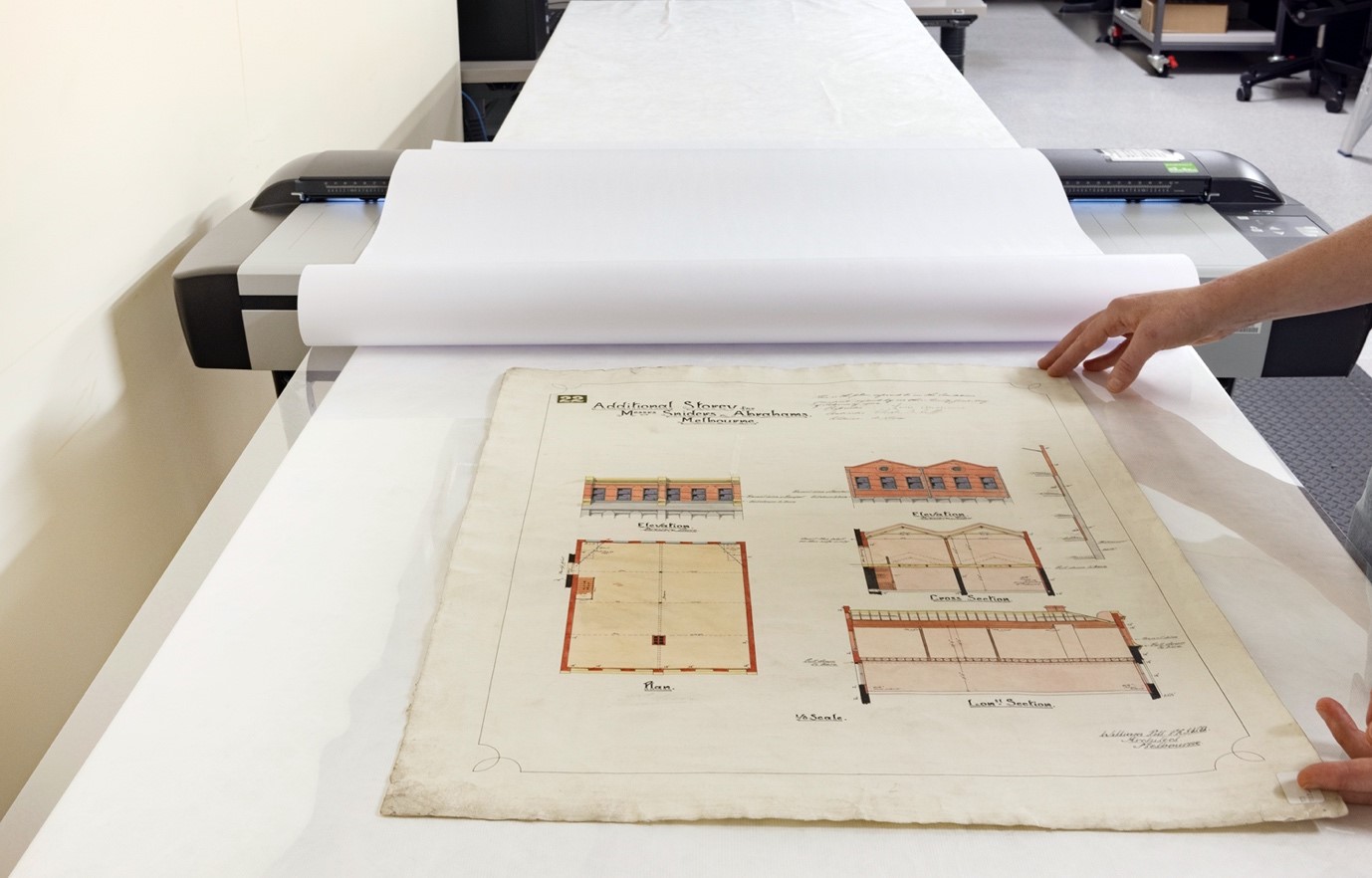
Digital Production staff also digitise maps and plans in our Scanning Studio on our Contex HD4230 large format scanner which has a maximum scan width of 1067mm and unlimited scan length with optical resolution of 600dpi. To protect the original material the map or plan is placed between mylar and paper before scanning.
Here are some highlights representing the breadth of our substantial Maps Collection.
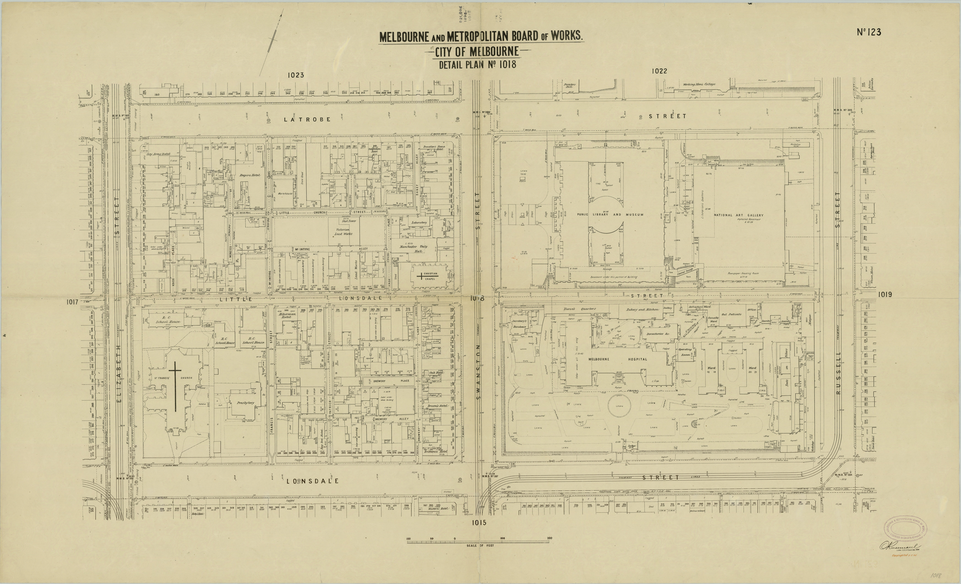
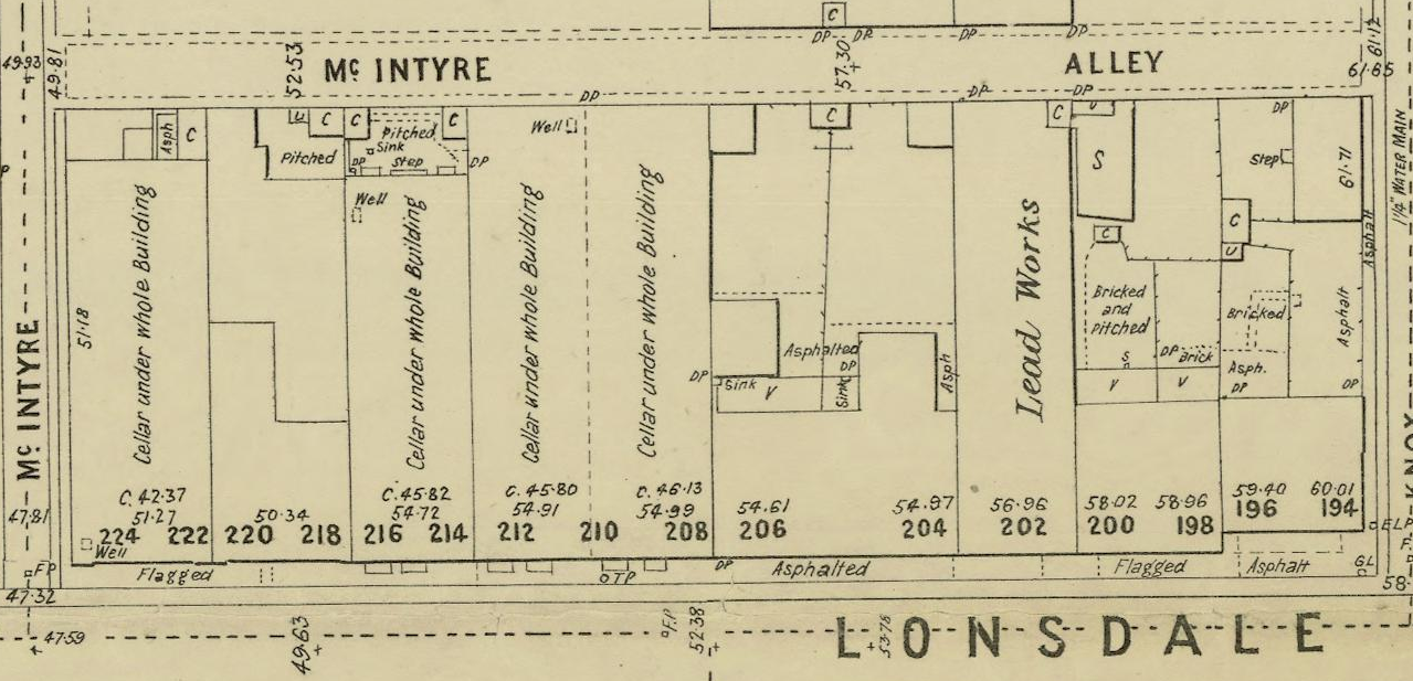
Melbourne Metropolitan Board of Works plans (MMBW)
The MMBW drainage plans were produced to enable the design and development of the sewerage system across the Melbourne CBD and suburbs. The first series produced in the 1890s at the scale of 40 feet to the inch is the most detailed.
The plans took many years to complete, with surveying and drafting work sometimes stretching over decades. Surveying usually started in the city centre and gradually worked outwards. Most plans show approximately one or two blocks and six streets.
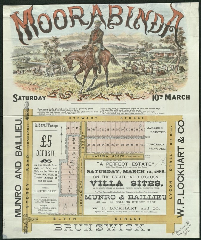
Auction Plans
The Library’s collection of auction plans was sourced from real estate agencies. They were produced to promote the sale of land subdivisions in and around Melbourne during the land boom of the 1880s through to 1930, when the Great Depression hit Australia. The plans are often highly decorative with colourful illustrations highlighting desirable amenities and scenic surrounds.
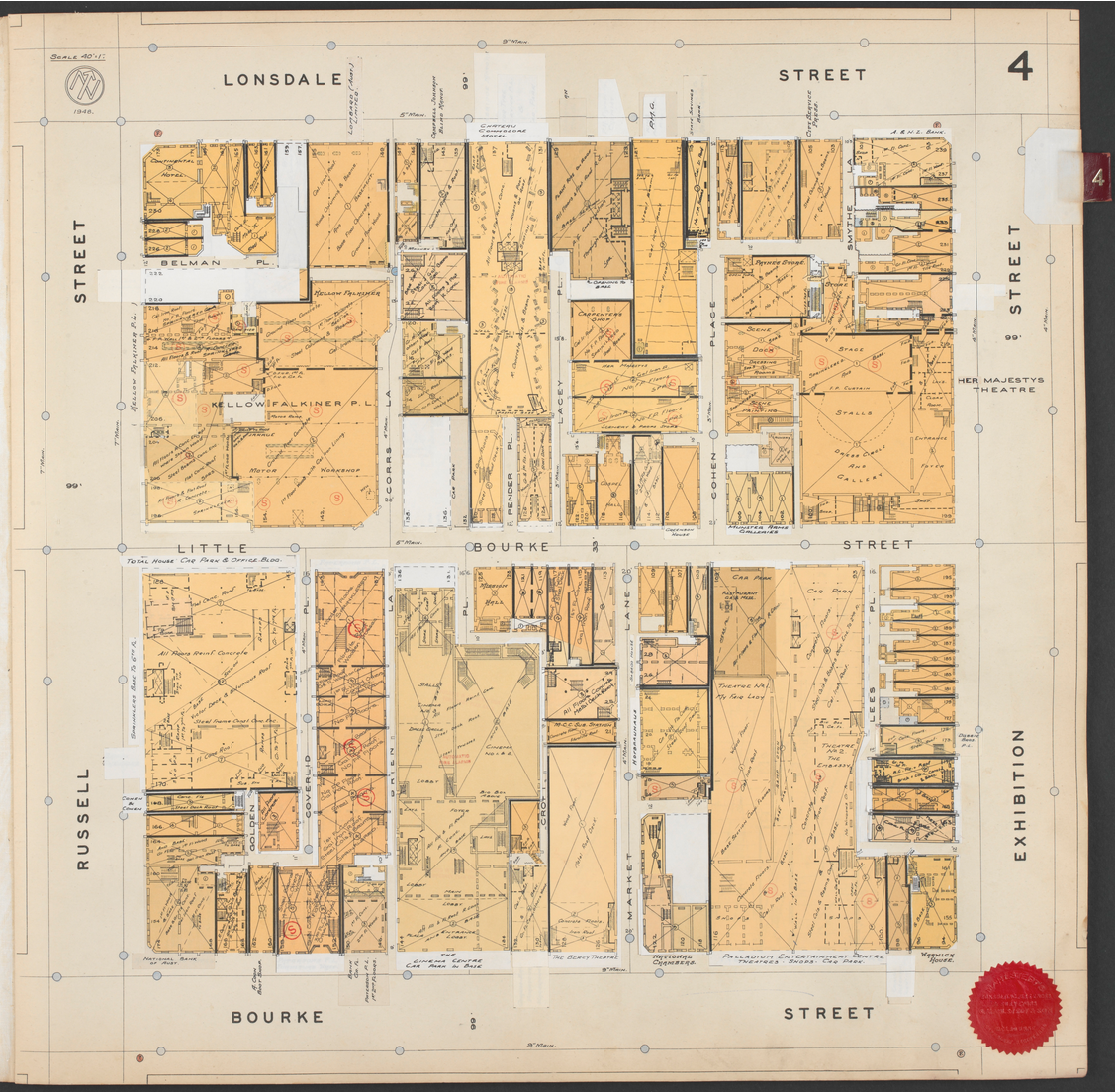
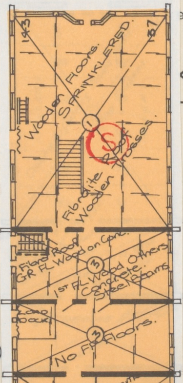
Mahlstedt Fire Insurance Plan collection
Fire insurance plans were prepared for insurance companies to record information about the form and construction of buildings in assessing risk and investigating claims. The plans comprise an estimated 24 volumes (530 leaves) published between the late 19th to mid 20th century from Ballarat, Bendigo, Geelong, Melbourne and South Melbourne. They are extremely detailed and show building materials, specifications and occupants.
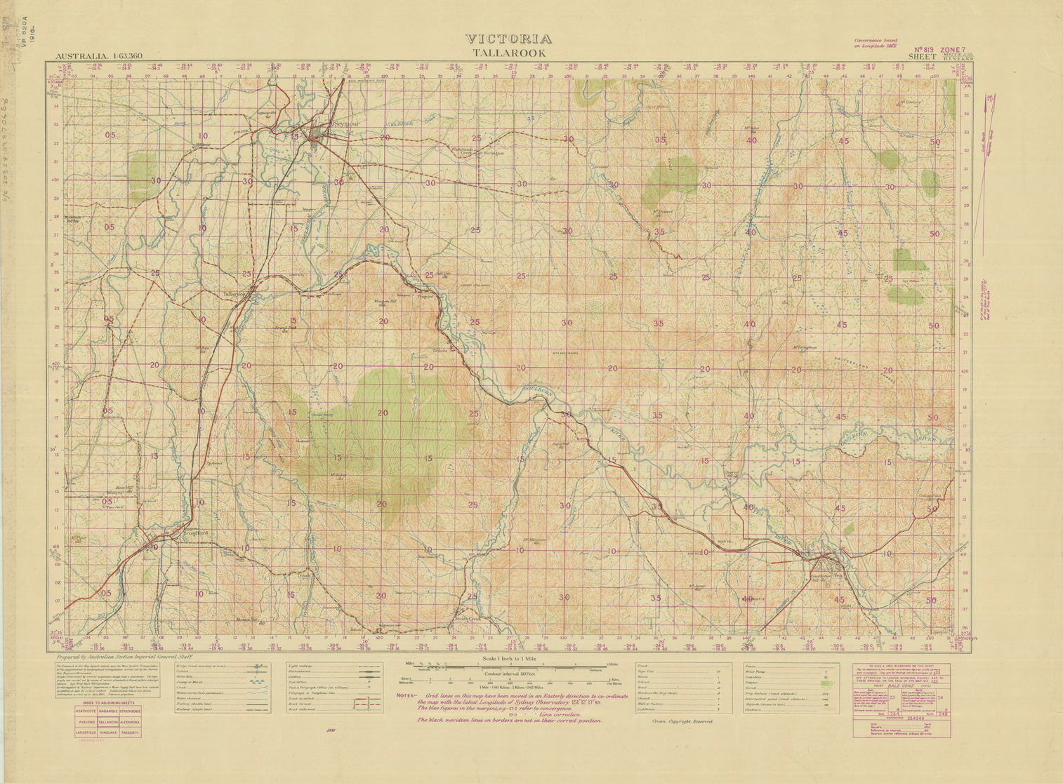
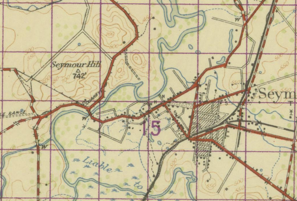
Army topographic maps
The oldest topographic series we hold is the Victorian Army Survey, which began being issued from 1913. The survey produced maps for land combat operations.
Over many years, including two World Wars, approximately 90 maps were created documenting the topography of much (but not all) of the state.
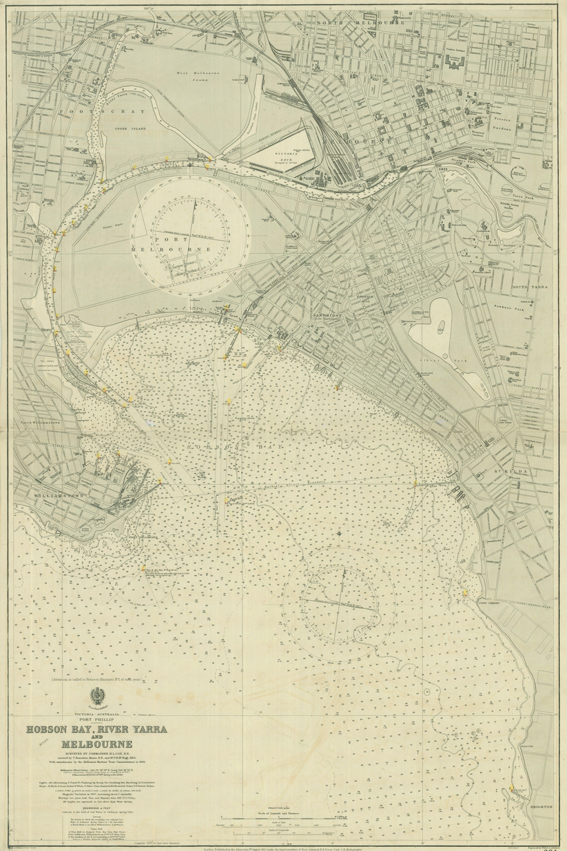
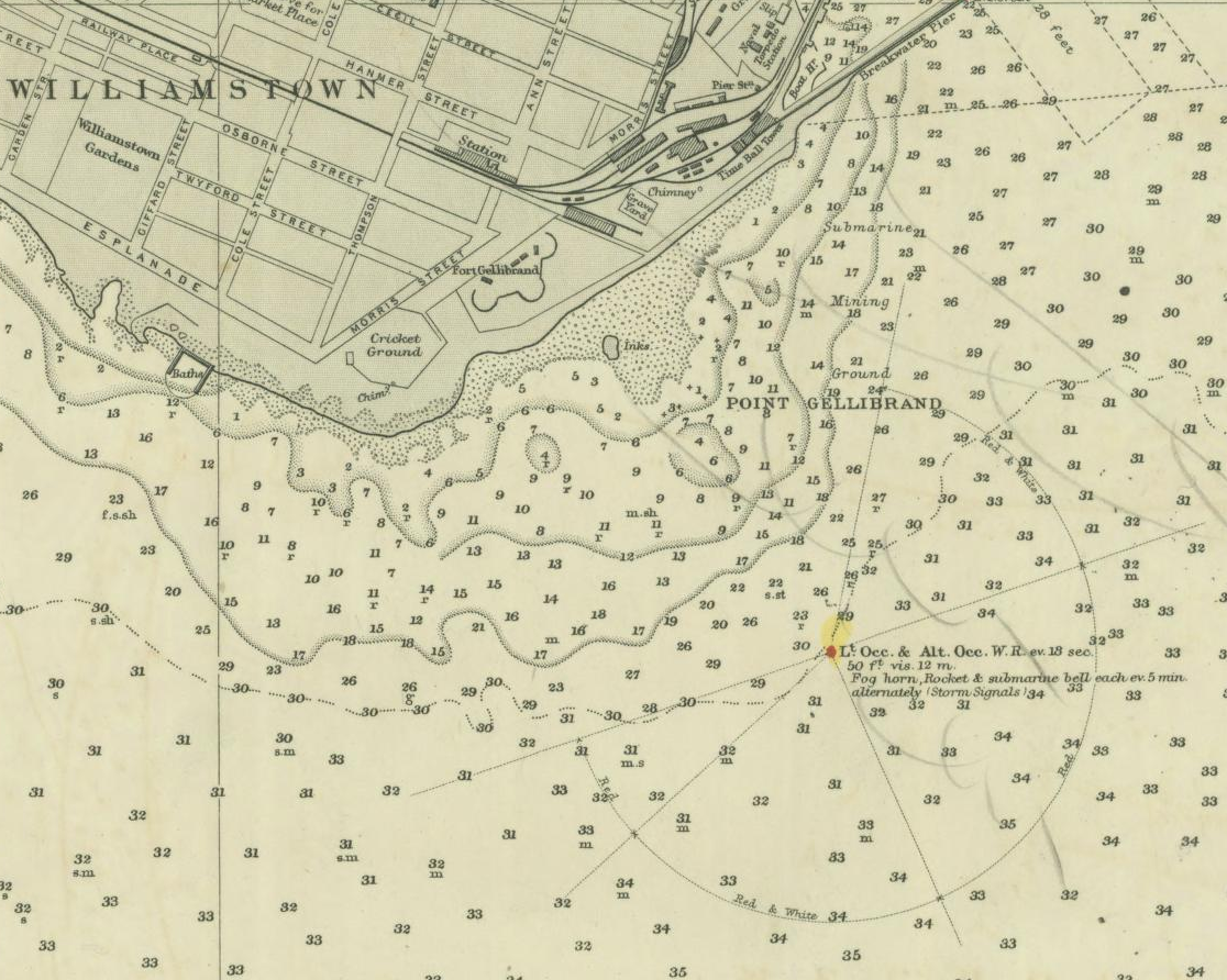
British Admiralty maps: Victoria – Australia – Port Phillip Hobson Bay, River Yarra and Melbourne
Admiralty charts, also known as nautical or hydrographic charts show maritime areas and adjacent coastal regions to aid navigation of vessels. The British Admiralty produced charts of Australia throughout the 19th century in support of the defence and commercial development of the colonies.
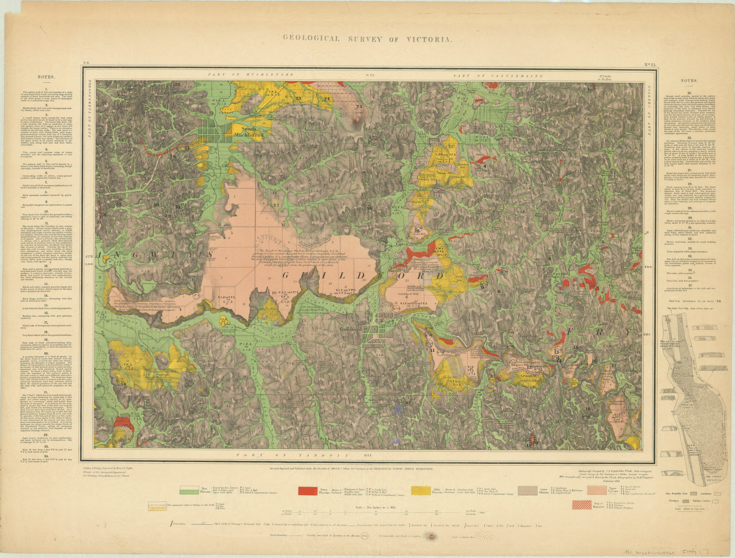
Geological quarter maps
The Geological Survey of Victoria was founded in 1852 during the gold rush era to explore geological and mineral resources. Englishman Alfred Selwyn and his team commenced a systematic program of surveying, beginning with central Victoria and the country around Melbourne, resulting in the map series known as the quarter sheets. He employed a standard colour code to indicate the age and type of the rocks depicted. The high quality maps produced under his direction ranked Victoria’s Geological Survey among the best in the world.
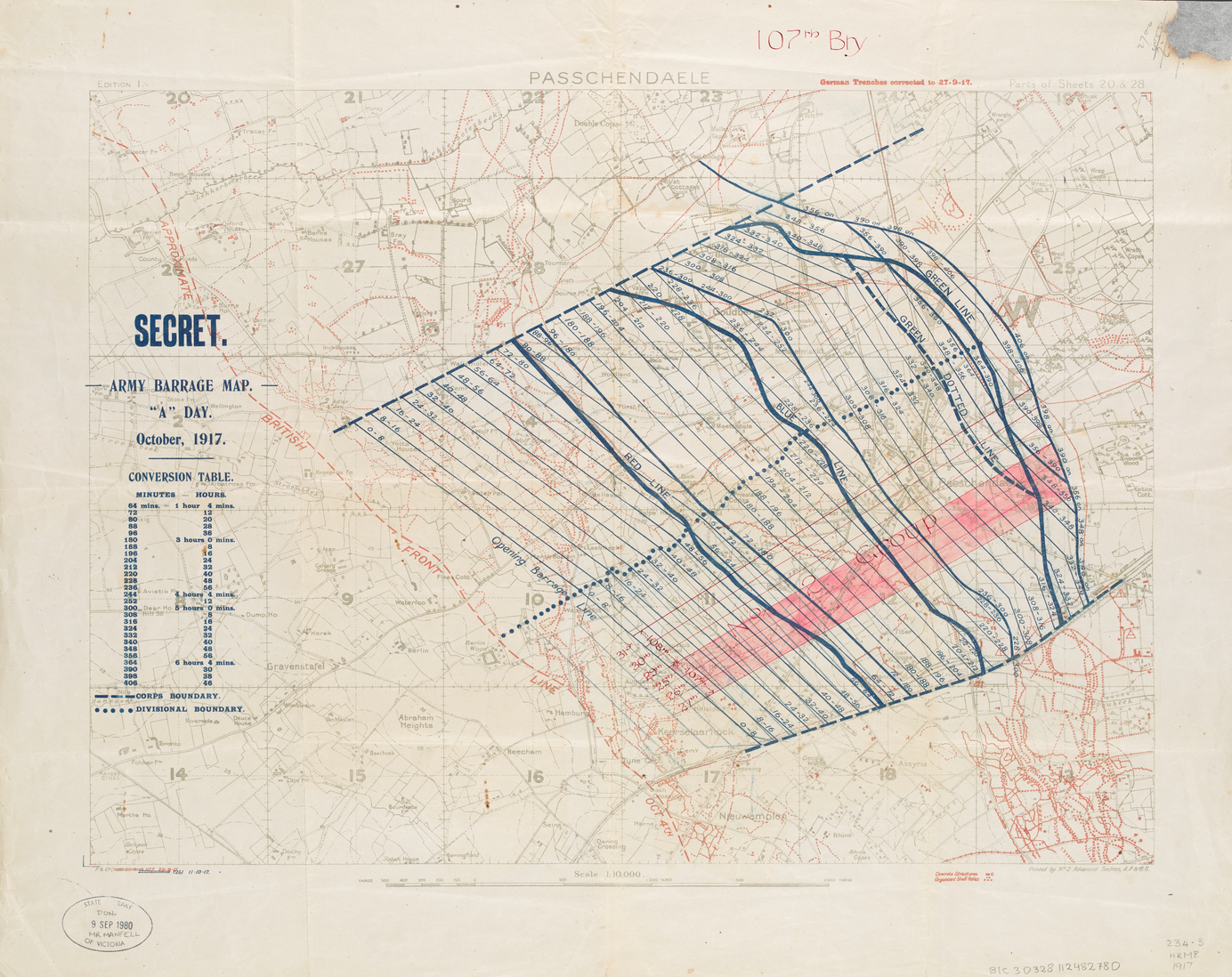
World War I maps
To commemorate the centenary of WWI, the Library digitised many collection items published between 1914-1918, including trench maps from the battlefields in France and Belgium and maps of Gallipoli from the time of the ANZAC campaign.
The map below shows secret army barrage tactics employed by British forces during the Battle of Passchendaele that lasted over 3 months. Several Australian infantry divisions fought in the battle. In one horrific week there were nearly 11,000 Australian casualties.
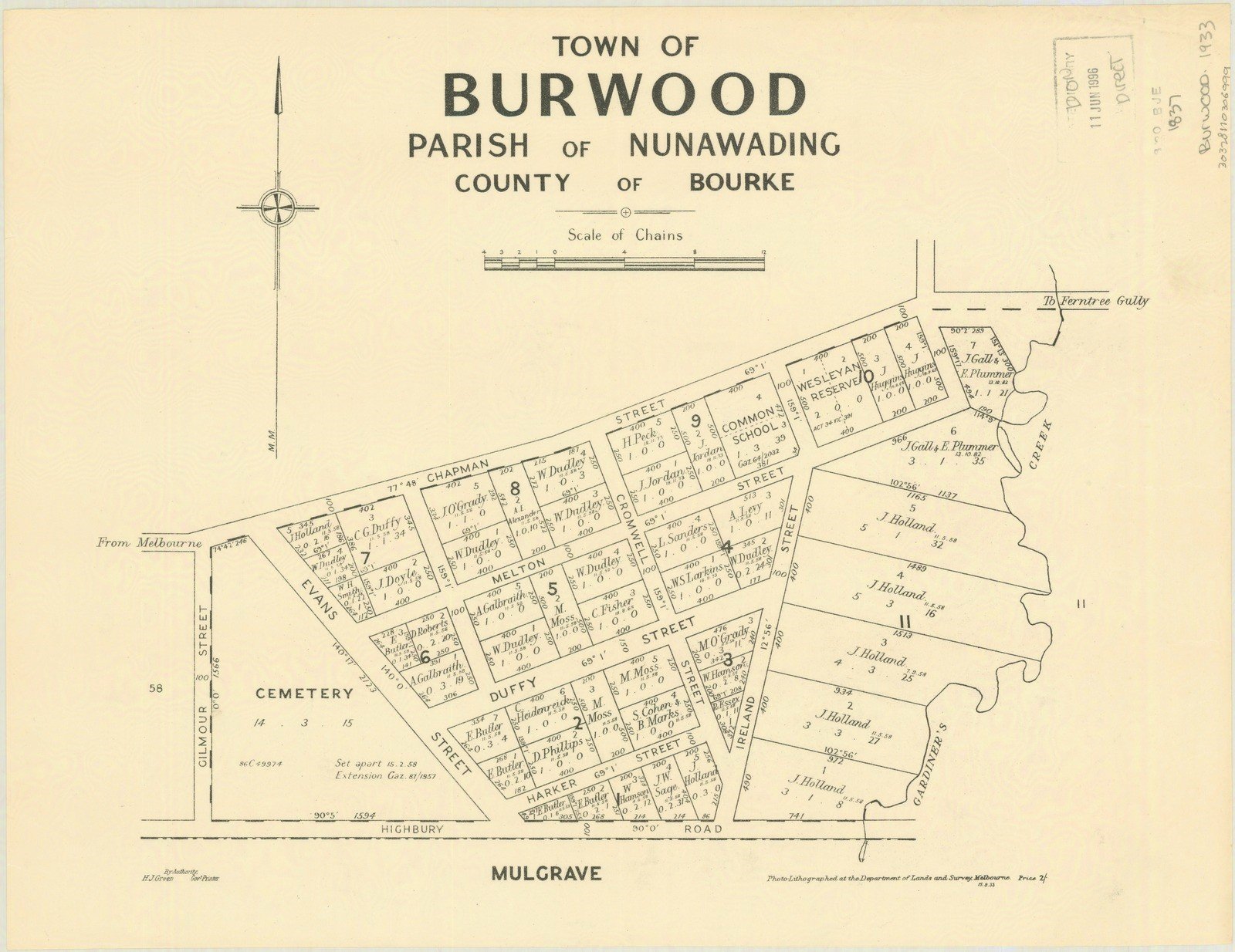
Victorian county, parish and township plans
These plans originated when the first land sales took place in the Melbourne CBD in 1837. This led to further settlement of the greater metropolitan and regional area in the decades that followed. They show the boundaries of each property in the area and mark the first owner or lease holder to take possession of allotments from the Crown. Details often include the size and shape of local settlements, the location of buildings or other structures and the location of natural features such as rivers, lakes or mountains.
Ballarat mining plans
This collection of close to 600 mining maps is thought to have been produced by the Victorian mines department. They are dated around 1870–1890 and cover the subdivisions of Gordon, Creswick and Ballarat, along with some maps of Bendigo.
They include names of individuals and show land where applications for mining permits were made. The maps also feature the names of people who occupied the surrounding areas.
The map below shows the location of a gold mining lease in the Ballarat region near Creswick Creek including existing occupants. A multicultural society was already emerging with some Chinese names and Chinese gardens marked.

Sources
Australian War Memorial (2007), Battle of Passchendaele (Third Ypres)
https://www.awm.gov.au/articles/blog/battle-of-passchendaele-third-ypres
Earth Resources, The early years Selwyn and the birth of the Geological Survey Victoria (GSV) https://earthresources.vic.gov.au/geology-exploration/geological-survey-victoria/150-years/the-early-years
I would like to see all the County of Bourke Atlas maps digitised.
These provide a unique snapshot of land ownership at the end of the 19th century.
https://catalogue.nla.gov.au/Search/Home?lookfor=author:%22Victorian%20Shire%20Map%20Co%22&iknowwhatimean=1
Hi Gary, thanks for reading the blog. Our copy of the atlas is very fragile, requiring considerable conservation work prior to digitisation. This atlas can be freely viewed and downloaded from the NLA website or Trove, and generally we preference the digitisation of unique items which are not available elsewhere. – Sarah
Hi. A friend of mine was wondering if the library has a map probably from late 19th/early 20th century of hotels in the CBD.
He saw it in a pub but it closed a few years ago.
Hi Ray
I think it could be this one –
Melbourne’s hotels 1870 in the heyday
http://search.slv.vic.gov.au/permalink/f/1cl35st/SLV_VOYAGER1134495
You can download a jpeg copy from our website for personal use, research and study.
Regards
Sarah
Hi at SLV
I have downloaded and studied with interest the late 1930s MMBW maps of my local area Mentone. However I have been unable to find a copy of map 4218 which shows the beach end of Marina Rd, Mundy St, Plummer Rd, etc. The other ends of those streets are available but not the beach ends. Could you tell me if 4218 can be made available? Thank you. Peter
Last month, a member of the Walhalla Heritage and Development League donated an exercise book of a 15-year-old student at Walhalla State School in 1885 that was good enough to have been selected for exhibition by the “Minister for Public Instruction”. Its representation in the Nov 25th post at
https://www.facebook.com/search/top?q=walhalla%20museum%20and%20corner%20store%20post%20office
… doesn’t really do it justice — it’s in a hard-bound cover, and is maybe 3cm thick. I’ll be glad to provide photos of some of its pages, if you wish, but my question is really what recommendations, if any, would you have for digitizing it?
Hi Bernard,
Thank for your enquiry- looks like an interesting local history discovery.
Sorry for the delay in responding- the Digitising team is on leave – I work with them at the Library and know some of our processes. We use in house scanners to digitise out of copyright books. Where possible we don’t disbind the book. For some projects we use the company DatacomIT
http://www.datacomit.com.au/
they also work with the public. I’d suggest you contact them. You need to think about your output- i.e; flashdrive /CDROM / internet etc. They can step you through the options and costing.
These conservation guides may assist you in preserving the exercise book
https://www.slv.vic.gov.au/search-discover/conservation-guides
Thanks
Paul
Hi there we have the original first land sale document dated 1/6/1837 by robert hoddle of melbourne verified by grim wade society
Is this something you may be interested in looking at
It is also mounted on the original jc huttons awards advertising board /poster
Hi Joanne
I’ll send you an email to discuss further.
Regards
Sarah
I have studied and downloaded many MMBW maps from the 1938-40 period. They are fascinating and very informative. However I have not been able to find map 4218 showing the beach end of several streets (Marina, Mundy, Plummer). Is this available and could it be published please?
Hi Peter
Whilst our collection of MMBW plans is comprehensive, we don’t hold every plan. If a plan can’t be located on our catalogue, it means we don’t hold it. The Public Record Office of Victoria holds a complete set. You can place an order to view or copy the microfiche plan 4218 through their website.
Regards
Sarah
Thank you Sarah, I’ll give that a try. Peter