
World Rivers Day, on 25 September, celebrates waterways and recognises the role healthy rivers play in ecosystems and peoples’ wellbeing as well as their industrial and agricultural roles.
The expansion of European settlement hugely impacted Aboriginal peoples’ connection to their land and waters.[1] Recently, developing negotiated agreements between First Nations peoples and catchment management and other authorities are working towards restoring these connections and including communities in the management of their cultural heritage. [2]
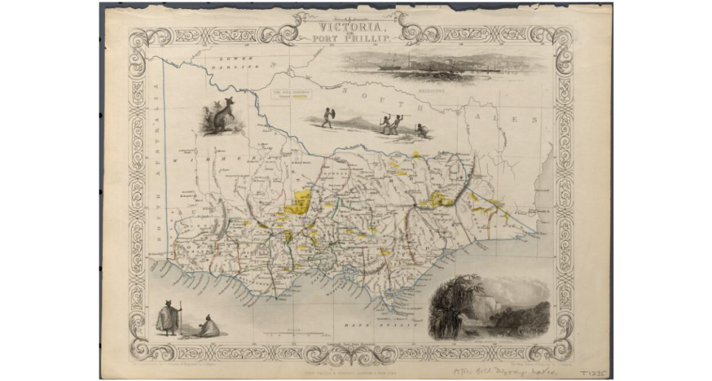
Rapkin’s map of Victoria shows how quickly rivers and watercourses were mapped after European settlement. The map was included in John Tallis’s Illustrated world atlas and modern history of the world, geographical, political, commercial and statistical, published in 1851 for the Great Exhibition.
A freshwater source cemented the decision on the site for the as yet un-named Melbourne, however by 1855, the pollution from tanners, abattoirs and other noxious industries flowing into the Yarra needed a solution.
The Age, on 25 May 1855, reported that it was ‘necessary for the health of such inhabitants that the waters of the said river, should be kept as free from pollution as possible; and whereas the carrying on of certain trades or occupations on the banks of the said river tend, much to destroy its purity, and to render the water unwholesome.’
The Yarra River Pollution Act was passed on 6 June the same year. It was not entirely successful however, and also sent noxious industries to the west and the Saltwater, or Maribyrnong River.[3]
Yan Yean Reservoir came on stream in 1857, improving Melbourne’s water supply.[4]
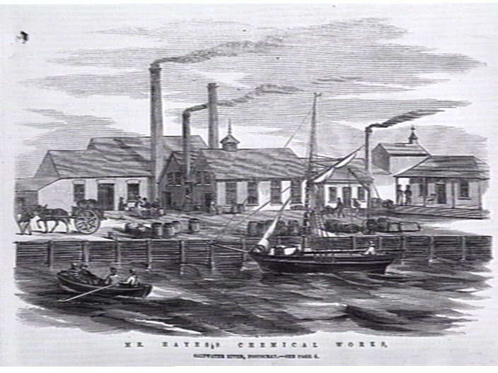
“Mr. Hayess Chemical Works, Saltwater River, Footscray.”
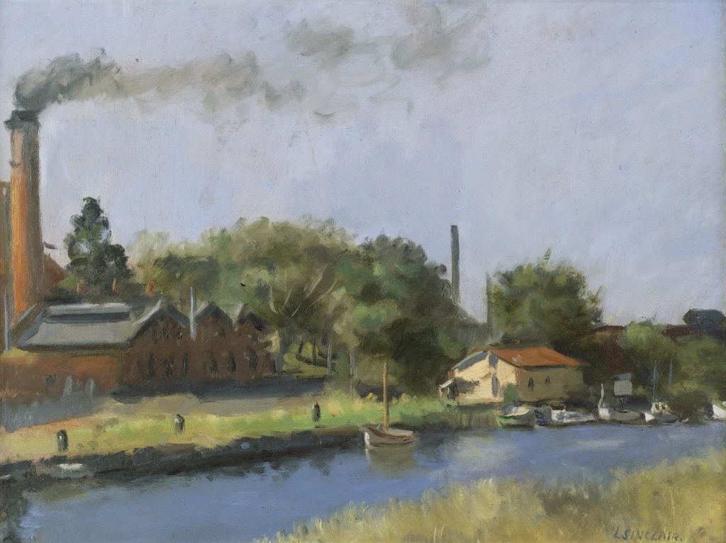
The Maribyrnong River, below, 90 years later – shows us some of what we ask of rivers – sites for industry, recreation, and somewhere beautiful to be.
This item is in copyright.
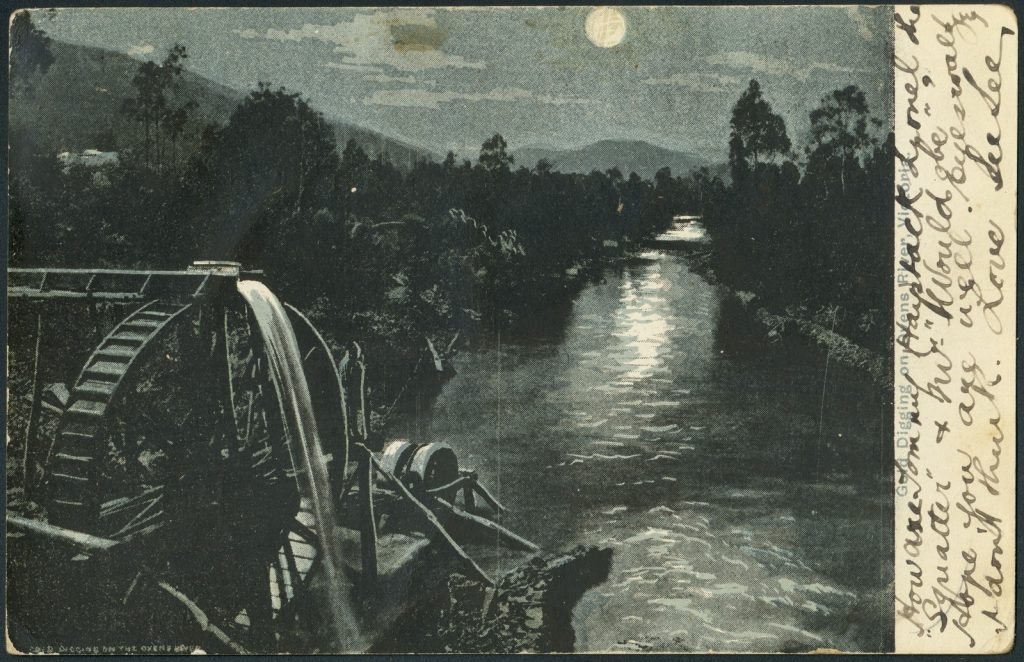
Gold!
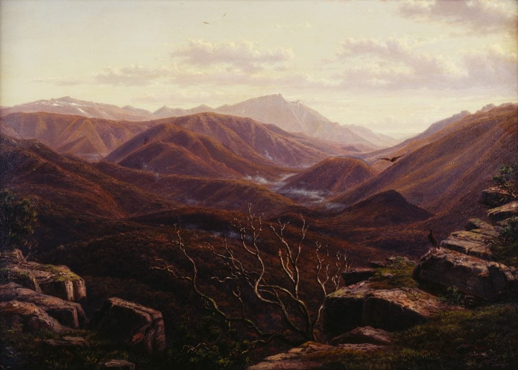
The 1850s brought thousands of hopefuls to Victoria and her river valleys – including the Ovens Valley. They were thoroughly worked over in search of gold. This, a scene of palpable calm after a clattering, hectic day.
Eugene von Guerard travelled widely in Australia after his arrival in 1852 depicting the natural world – this misty river valley, nestled in the grandeur of the Victorian Alps. His richly detailed works have helped with ecological restoration projects at sites such as Tower Hill, in western Victoria.
H30578
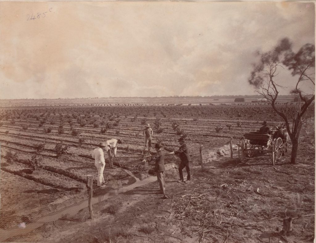
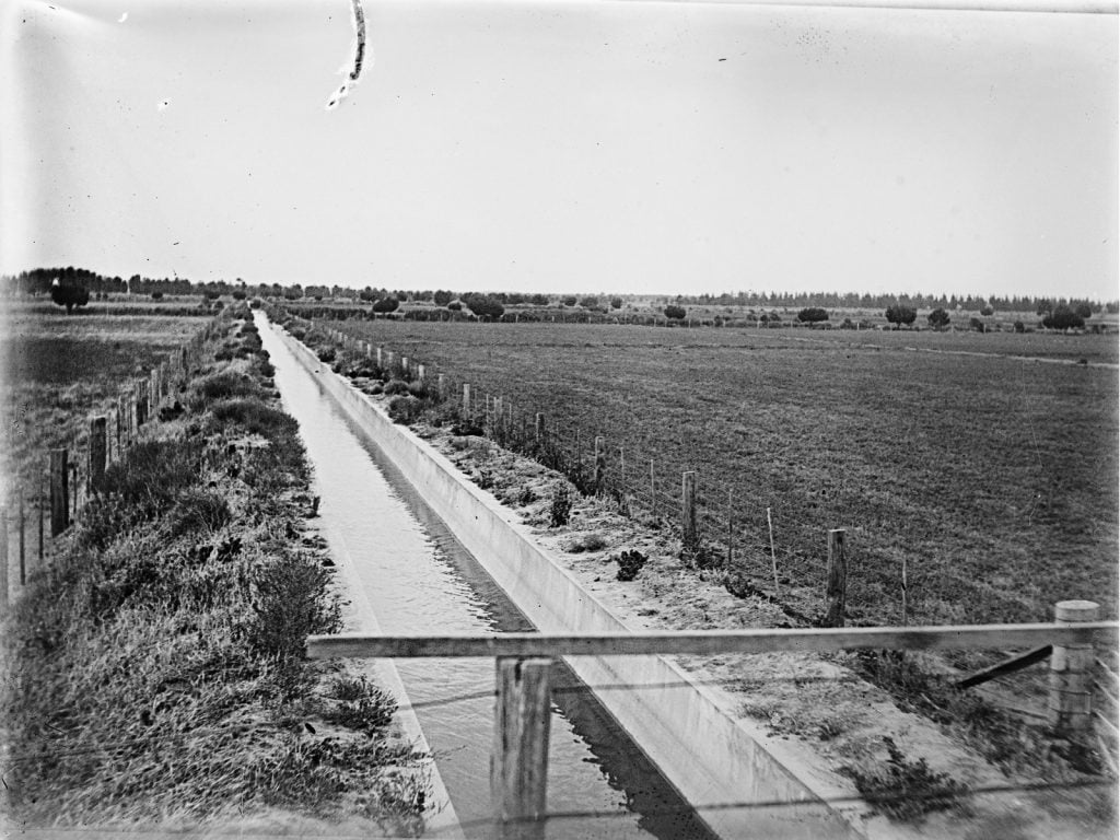
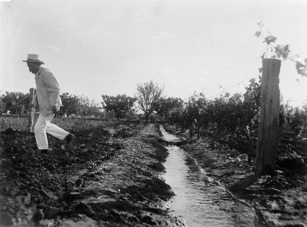
Reliable water supply and distribution was essential for the success and expansion of European settlement and agriculture, and rivers the basis of an irrigation system to drought proof the country and fuel prosperity. The Chaffey Brothers irrigation works around Mildura had a chequered story, after bankruptcy, the schemes were ultimately taken over by the Mildura Irrigation Trust.
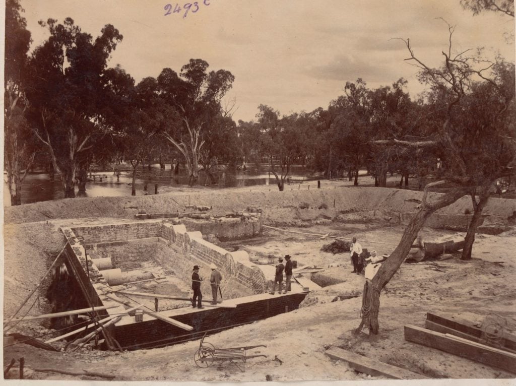
H96.160/1923, By the bend excavation, H96.160/1915
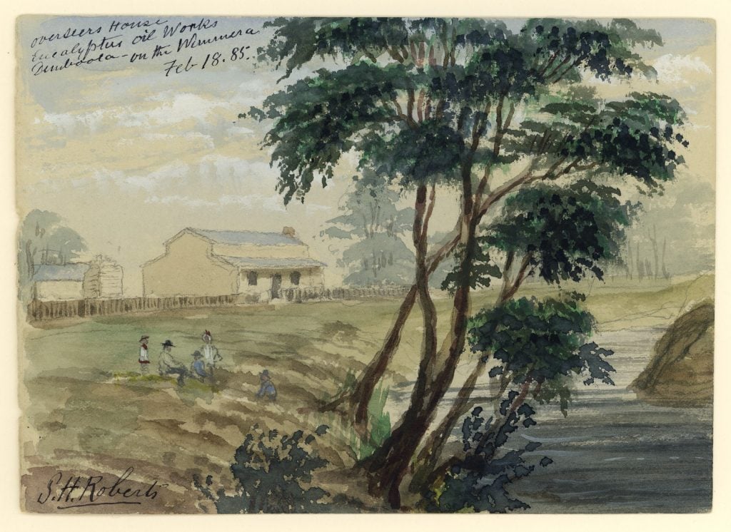
The Eucalyptus Mallee Company was in existence 1882-1885, before being bought by Bosistos. The Wimmera River is Victoria’s only landlocked river, flowing from Mt Cole, into Lake Hindmarsh.
The Murray River Waters Agreement bill was the first attempt to legislate for shared access to the river waters between South Australia, New South Wales and Victoria, and the Commonwealth.
The photographs below were taken on a parliamentary tour, guided by the newly formed State Rivers and Water Supply Commission along the Murray from Echuca to Mildura in October 1907. The Age reported that Victoria ‘desired the water to be stored and distributed in a proper way, instead of letting it run to the sea. If this were done those districts would contribute as they ought to the prosperity of the country’.
The River Murray Waters Act came into force in 1915.
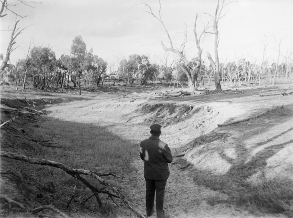
rwg/u131, rwg/u124, rwg/u123.
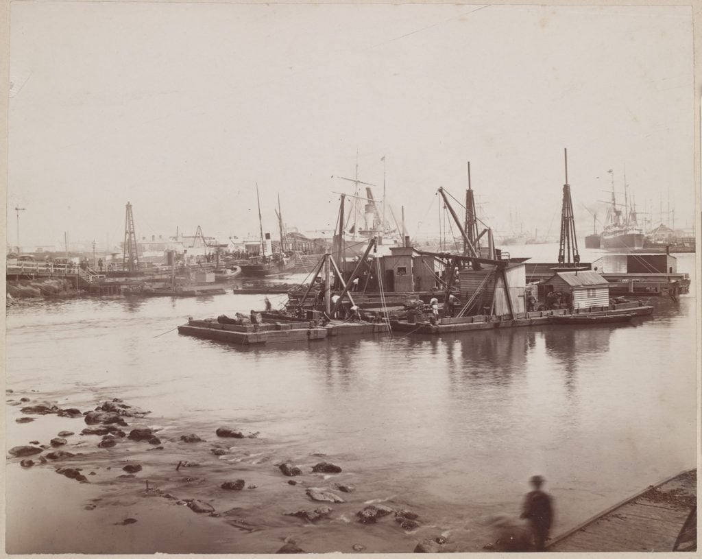
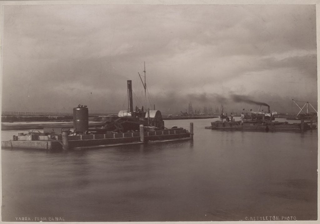
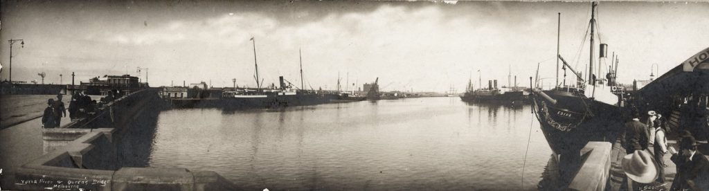
Rivers were also major thoroughfares and industry located nearby for a water supply and means of transport. These photographs by Charles Nettleton, taken in the 1880s, show Melbourne’s Yarra River at work. The dredge on the left (below) is located downstream from the Falls, just to the west of Queen Street. The Falls would allow a small boat to pass, and was a barrier to salt water going upstream. This rocky river crossing was blasted away in 1883, and Queens Bridge built soon after.
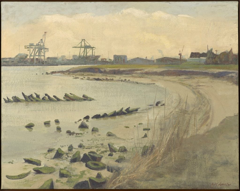
Over one hundred years later, Rick Amor’s riverscape, with an industrial backdrop – relic and rocks in the foreground, echoes the Falls of early Melbourne
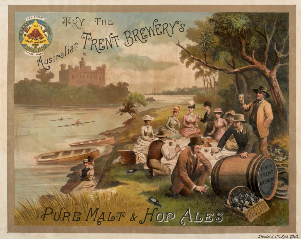
Advertising posters sold afternoons at the riverside, here, alongside the products of the Trent Brewery, as a pleasant way to pass the time. Rivers and lakes were soon to be promoted as tourist destinations – the Victorian Tourist Bureau, established in 1906, worked to ‘exploit the pleasure places of the state….as long as the wonderful attractions of our own mountains, lakes and rivers remain unexploited the magnificent opportunities for pleasure that are to be found within the boundaries of Victoria must remain neglected.’
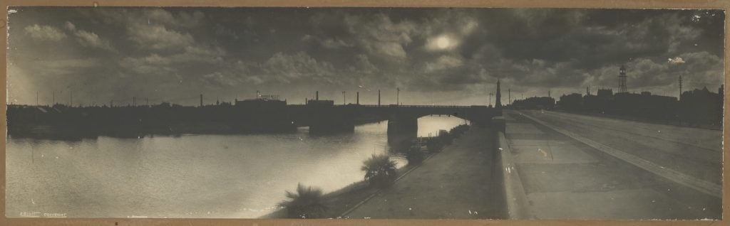
These evocative photographs of the Yarra were taken using a panorama camera – an innovation in early 20th century photography, allowing the panorama to be captured in a single frame. [5]
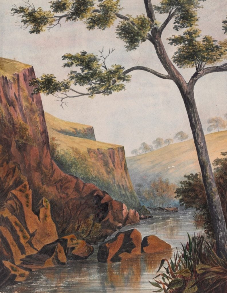
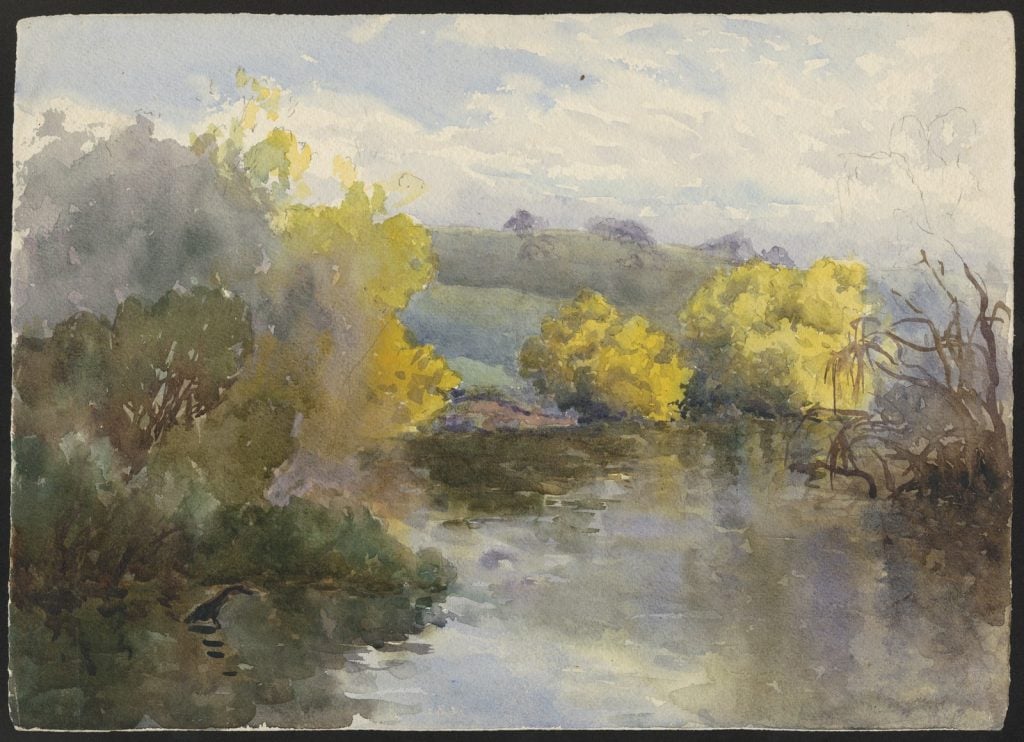
Charles Norton arrived in Victoria in 1842, his sketches and paintings record his houses and surrounding landscapes of central Victoria and around Geelong.
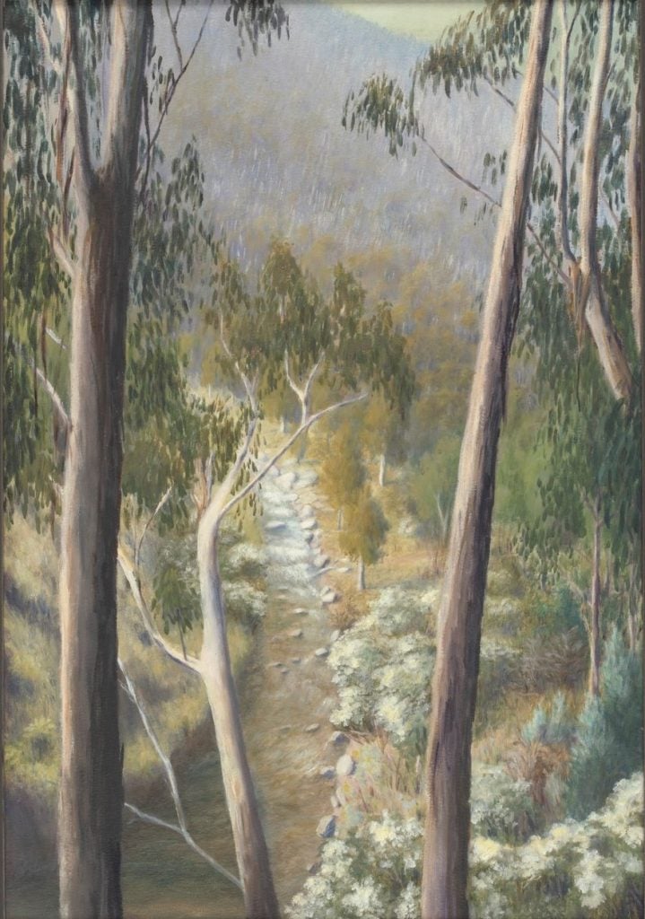
Winifred Waddell was a botanist, active in the Field Naturalists Club of Victoria and later formed the Native Plants Preservation Society of Victoria.
H91.315/32.
The Howqua [River] oil painting by Winifred Waddell, [1920-1930]; H34330/1.
This item is in copyright.
James Fawcett was an architect, artist and designer. With his partner HPC Ashworth they contributed the winning entry for the design competition for Flinders Street Station.
[between 1888 and 1910]; H2007.49/19
Concern about the fragility of our water supply continued, and in 1946, Lewis East, chairman of the SRWSC wrote in Planning for posterity,
Water Conservation is a social service of the greatest national importance. Not only does it directly provide for higher standards of living for more people but it makes possible the production of increased national wealth not obtainable in any other way; irrigation is man’s answer to the perpetual problem of drought.
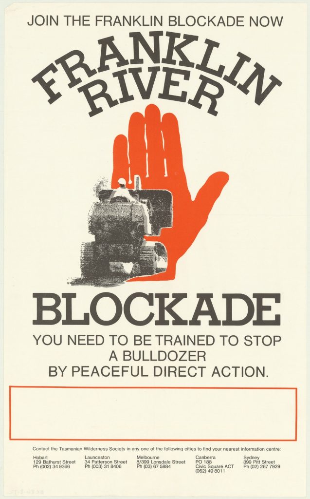
The successful campaign to save Tasmania’s Franklin River harnessed community determination and passion to protect the natural environment. The blockade came at the closing stages of the campaign – in May 1983 the Tasmanian government abandoned plans to dam the Franklin.
Community activity and activism continues to combine with an understanding of the place of rivers and all waterways in our ecosystems, and the need for their protection. For the Yarra River this, along with the importance of the connections with traditional owners was recognised by the Yarra River Protection (Wilip-gin Birrarung murron) Act of 2017. The Wurundjeri Woi-wurrung Elders delivered the Woi wurrung language preamble to the Act and Parliamentary Speech to the Lower House.
The Act aims to protect and honour Indigenous heritage and involve the community in managing the Yarra River.
References
[1] Context Pty Ltd for Heritage Victoria, 2007, Victorian Water Supply Heritage Study Volume 1: Thematic Environmental History, p.1
[2] Victorian Water Industry, 2020, Recognising and managing for Aboriginal values.
[3] Stone, Caitlin, Pollution, eMelbourne – the city past and present.
[4] Context Pty Ltd for Heritage Victoria, 2007, Victorian Water Supply Heritage Study Volume 1: Thematic Environmental History, p.14
[5] Newton, Gael. 2015, Out of sight. Vere Scott and R.P. Moore: forgotten federation-era panoramic photographers.
More to explore
World Rivers Day
The riotous Williams – floods of early Melbourne
Angliss Meatworks – built on the banks of the Maribyrnong River
Water conservation and The Murray River Waters Agreement bill, extraordinary and how everything old is new again.
Fascinating far ranging blog.
Thank you for reading Amanda – glad that you found it interesting.