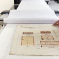
Celebrating 30,000 maps and plans digitised at the Library
In recognition of a recent significant milestone, we’re exploring some highlights of our substantial Maps Collection.

In recognition of a recent significant milestone, we’re exploring some highlights of our substantial Maps Collection.
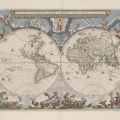
We have well over 110,000 maps in our collection— enough to carpet metropolitan Melbourne. Here are five highlights.
News:
570 Ballarat mining maps, dated between 1870–1890 (approx), are now available to search and view online using our catalogue.
Family Matters is pleased to welcome our February guest blogger, Blair Gatehouse, Digital Resources Graduate. While maps may not be the first resource that spring to mind when investigating your… Read More ›
Ask a librarian, Collection spotlights:
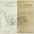
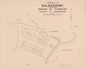
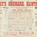
As Melbourne began to be subdividen in the late nineteenth century, real estate agents produced maps and advertisements to advertise these land sales. In this blog post we take a closer look at these digitised plans and the sort of information they can reveal.
Ask a librarian, Victorian history:
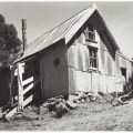
From as early as 1860, cattlemen built huts on Victoria’s high plain to protect themselves from the elements. In 1937 the Cleve Cole memorial hut was built to honour a lost Victorian skiing pioneer. Read on to discover this piece of Victoria’s alpine history.
Ask a librarian, Victorian history:
Since our opening we have looked at ways to connect with people who cannot come to our building. This includes a Travelling Library, a Country Member Postal Service and a Lending Library
Ask a librarian, Collection spotlights:
Embark on a journey through remarkable voyages with the State Library’s collection of print and electronic resources detailing first-hand accounts of historic exploration.
Ask a librarian, Collection spotlights, Research tips, Tips and tricks:
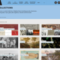
We’re expanding the Collection Discovery module to include new categories and showcase many more of the Library’s fabulous digitised collections. So what are you waiting for? Begin a virtual wander through some of our artworks, photographs, posters, maps, and much more now!
Ask a librarian, Collection spotlights, Social life & customs, Uncategorized:
What were the conditions like on the Trans-Siberian railway for women in the 1930s? Which American city was most like Melbourne in the 50s? And does anyone know what to wear to dinner when traveling first-class by ship? Learn about travel writing, but from a uniquely female perspective in the Travel Writing, Spectacle and World History database.