
We have well over 110,000 maps in our collection—enough to carpet metropolitan Melbourne. You’ll find a diverse range of maps, from antique maps showing the first outlines of the Australian coast by Matthew Flinders to drainage plans by the Melbourne and Metropolitan Board of Works to auction plans and more.
But the idea of looking through 110,000+ maps might be a bit intimidating. Let’s start with five of our favourites.
Atlas of the Australasian colonies by James McKain Meek
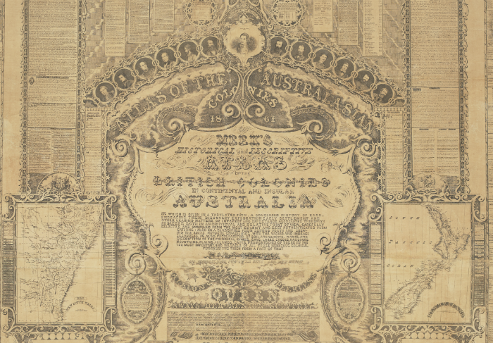
Detail of Atlas of the Australasian colonies: Meek’s historical and descriptive atlas of British colonies in continental and insular Australia by James McKain Meek, 1862
Produced by James McKain Meek in 1861, this chart, more commonly known as Meek’s Atlas, reveals a condensed history of each of the Australian colonies, including maps, statistical tables, historical text, census information and seals.
The Atlas went on to win first prize at the 1861 Victorian International Exhibition in Melbourne, before being sent on to the London International Exhibition of 1862 where a copy is still help by the Stationers’ Guild.
Between 1859 and 1863, Meek was employed by this Library (then known as the Melbourne Public Library), commissioned by Sir Redmond Barry to complete three significant pen-and-ink drawings: the Magna Charta, the Habeas Corpus Act, and the Petition and Bill of Rights. Meek would continue to produce significant graphic works, including numerous original written commissions.
Want to know more about Meek and his Atlas of the Australasian colonies? Read this blog post.
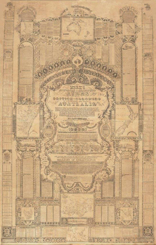
Atlas of the Australasian colonies by James McKain Meek.
Melbourne, Australia by Melinda J. Clarke, Deborah Young and Potter & Jackson
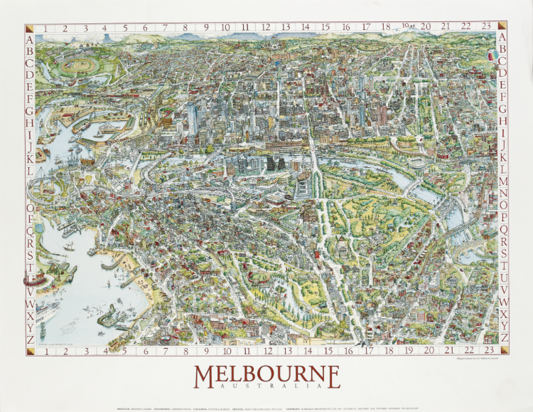
Melbourne, Australia by Melinda J. Clarke (producer), Deborah Young (line drawing), and Potter & Jackson (colouring), 1991
We didn’t always have Google Maps to provide a fun, easy way to get a bird’s eye view of Melbourne. Thankfully, we had this 1991 map of Melbourne to help.
Melinda Clarke took thousands of photographs of Melbourne, both from the ground and the air via balloon, to document the city’s landscape. Deborah Young turned the photos into a line drawing and Potter & Jackson provided the colour. The result? A bright, engaging snapshot of Melbourne. See if you can spot the Library’s dome!
A new, revised edition of the map is due to be published this year. You can preorder a copy here.
Nova et accvratissima totivs terrarvm orbis tabvla by Joan Blaeu
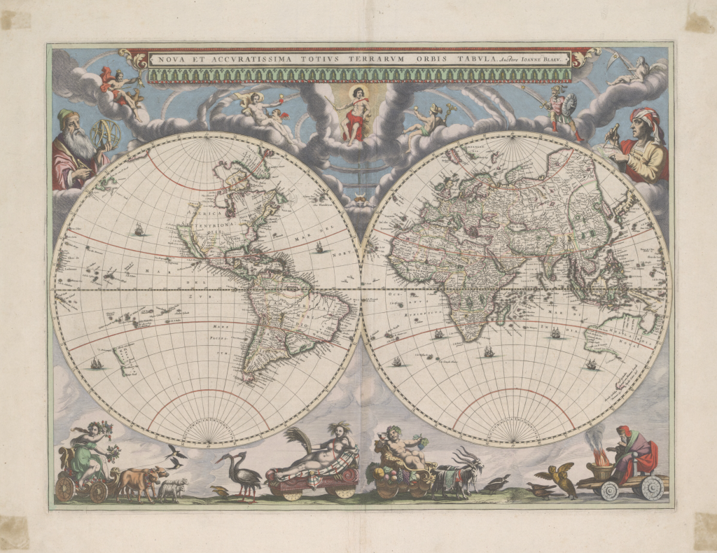
Nova et accvratissima totivs terrarvm orbis tabvla by Joan Blaeu, 1664
Nova et accvratissima totivs terrarvm orbis tabvla is a double hemispherical map of the world from 1664. It shows California as an island, and Australia, New Guinea, New Zealand are incomplete. It’s decorated with figures in carts, symbolising the four seasons, drawn by birds and beasts.
What makes this map special, however, is its incorporation the discoveries of Abel Tasman. Furthermore, it was revolutionary in its depiction of the solar system according to Copernican theory, with the earth revolving around the sun. Blaeu was the first mapmaker to incorporate this theory into a map of the world.
This map was digitised at the National Library of Australia.
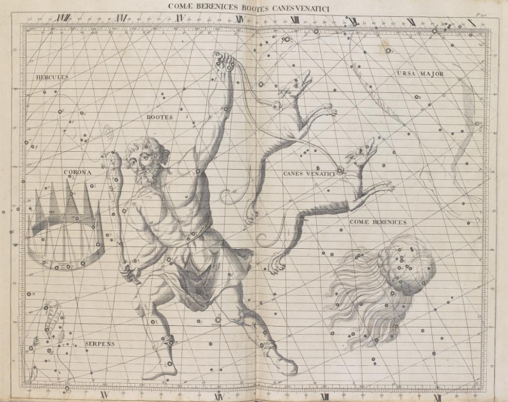
Atlas coelestis by John Flamsteed
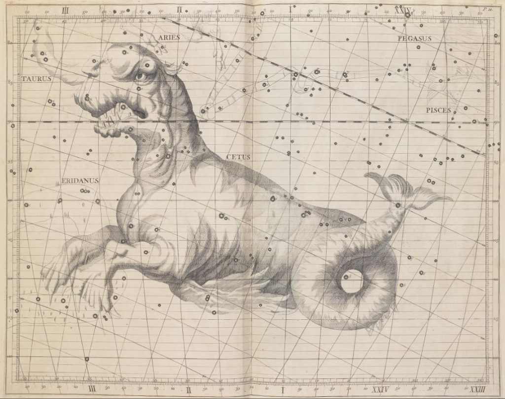
Atlas coelestis by John Flamsteed, 1729
Atlas coelestis was the first comprehensive telescopic star catalogue and companion celestial atlas. It contains 26 maps of the major constellations visible from Greenwich and was based on observations made by English astronomer John Flamsteed—he was the first Astronomer Royal and catalogued over 3000 stars. The publication enjoyed immediate success, becoming the standard reference for professional astronomers for nearly a century
The Library has two copies of Atlas coelestis, one of which is believed to have belonged to Captain James Cook.
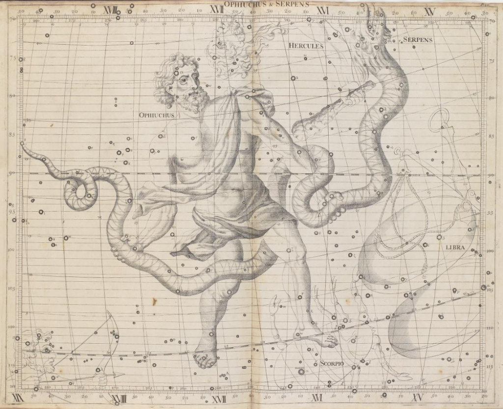
Atlas coelestis by Reverend John Flamsteed, 1729
Atlas coelestis by Reverend John Flamsteed, 1729
Miniature celestial globe
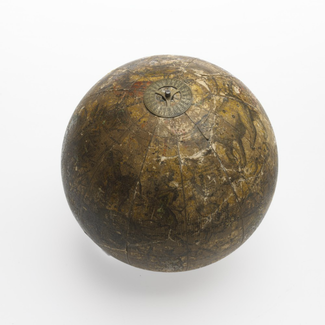
This celestial globe is believed to have belonged to Captain James Cook and used on his voyages of discovery. It would’ve been used to help determine the ship’s position at sea by astronomical observation.
It’s made from stucco with applied lacquer work and brass calibration rings.
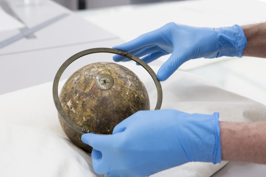
Miniature celestial globe with brass calibration ring. Photo: Teagan Glenane
Want to see more from our maps collection? Check out our blog posts on the subject or start exploring the collection yourself.
Does Australia have Cadastres or apportionment maps with landowners (or tenants) names on them?
Hi there. Thanks for reading the blog and taking the time to comment. Yes. Australia does have these maps, often referred to as county, parish and township plans. Many have been digitised and are freely available to download. We focus on Victoria and the National Library of Australia has some coverage of all states. Have a look at our research guide Maps for family history and that will give you an overview of relevant resources including parish plans.
http://guides.slv.vic.gov.au/mapsforfamilyhistory/australia
Regards
Sarah
The Public Record Office of Victoria and also the Australian Institute of Genealogical Studies in Blackburn also have copies of Parish Plans some of which can be downloaded free of charge.
Hi John
Thanks for sharing information about other institutions that provide free online access to parish plans.
Regards
Sarah