
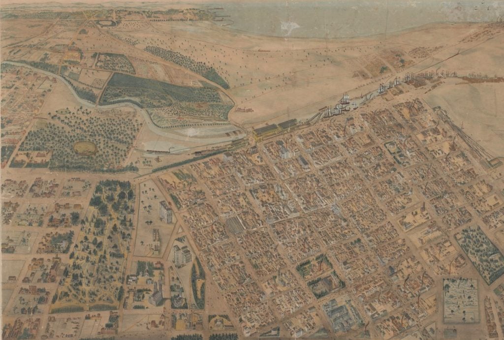
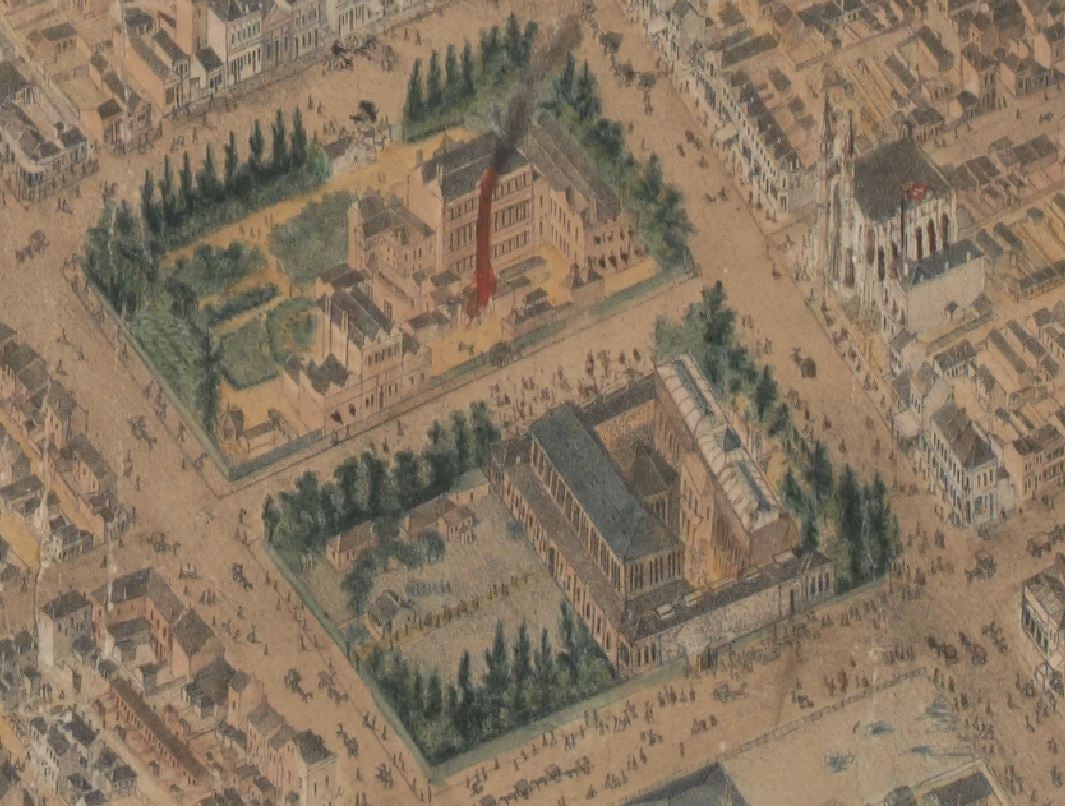
What are isometrical maps you might ask? Isometric means “relating to or having equality of measure”, and in the context of a drawing or map it means “being drawn to scale” (Macquarie Dictionary online, 2003). Sometimes called ‘bird’s eye view’ maps, these types of maps depict a view ‘from above’ and often show features (buildings, streets and landscapes) in a 3D perspective.1
The Isometrical plan of Melbourne & Suburbs is not very big. The map’s humble size – 59 cm x 93 cm – belies the amazing level of detail it offers. It shows a point-in-time – 1866 – layout of Melbourne streets, the Yarra, Port Phillip Bay in the distance, and parts of Collingwood and East Melbourne. A closer examination reveals some of the fledgling city’s most important social, economic and civic locations and buildings, as well as parks and reserves, many of which remain today. It is likely the map was sent by new settlers back to relatives overseas to give them a sense of how the city was laid out.
Below is just a sample of some locations of interest. Luckily, the Library has digitised the map as a high-resolution file which you can view or download online. A word of warning though: once you start delving into this fascinating map, you might find it difficult to stop!
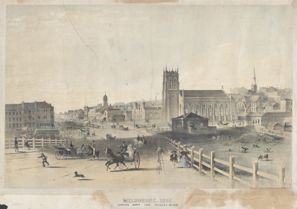
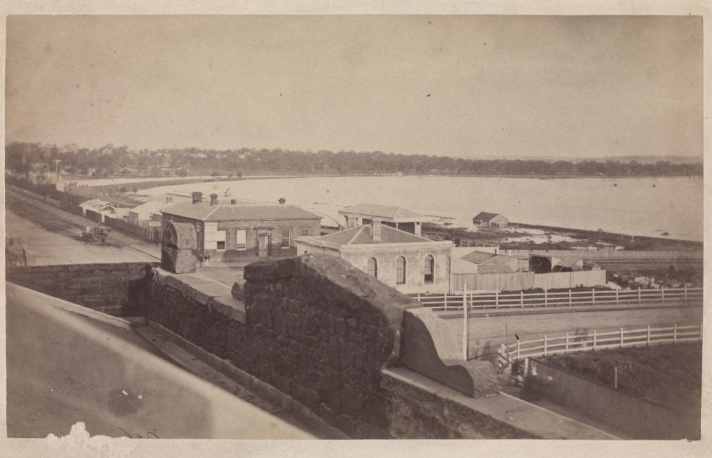
Swanston and Flinders Street intersection
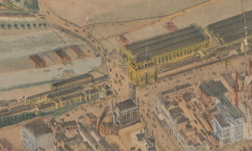
In the 1860s the intersection of Swanston and Flinders Street was, as it is now, a bustle of activity, though perhaps with a tad more odour, with the Fish Market and the City Morgue being major features of the intersection for a time. Diagonally opposite the Fish Market (where Flinders Street Station now stands) is the original St. Paul’s Church which opened in 1852.2
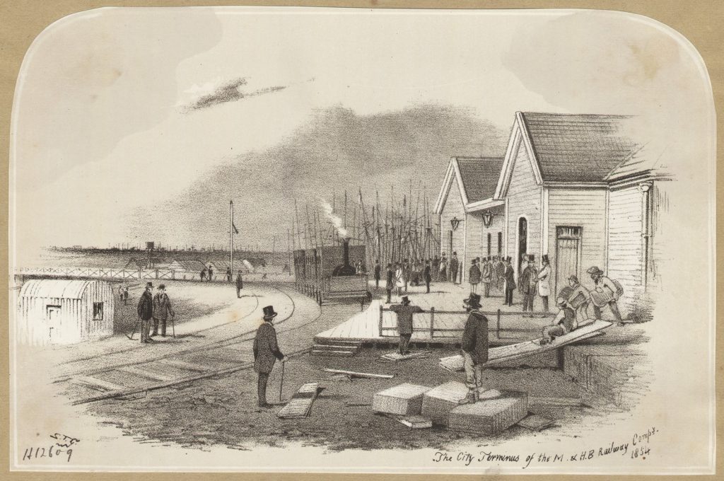
The photograph below, taken in 1875, depicts the same medley of buildings.

Fish Market
The Yarra River was a crucial source of food, and since the earliest times of the European settlement fish were traded on its banks between the Yarra Falls and Queens Wharf. The Fish Market was built in 1865 next to the Princes Bridge, replacing a more makeshift stall that had been there since the 1850s.
Victoria’s developing railway system allowed for fish to be delivered to Melbourne from Queenscliff and Western Port. For decades fishmongers plied their trade to the people of Melbourne, and its shopkeepers and restaurateurs. In 1892 the market moved to a new building near Spencer Street. The new purpose-built facility included railway access to transport the hefty cargoes of fish, and refrigeration and freezing chambers. 3
Melbourne & Hobson’s Bay United Railways’ Co. Terminus
Behind the Fish Market on the isometrical map is the roofed Melbourne & Hobson’s Bay United Railways’ Co. Terminus. The company (originally Melbourne & Hobson’s Bay Railway Co.) were responsible for Australia’s first steam railway line, which began scheduled services in September 1854 for passengers and freight on a 4-kilometre track between Flinders Street and Sandridge (now Port Melbourne).4 A line to St Kilda swiftly followed.
Princes Bridge
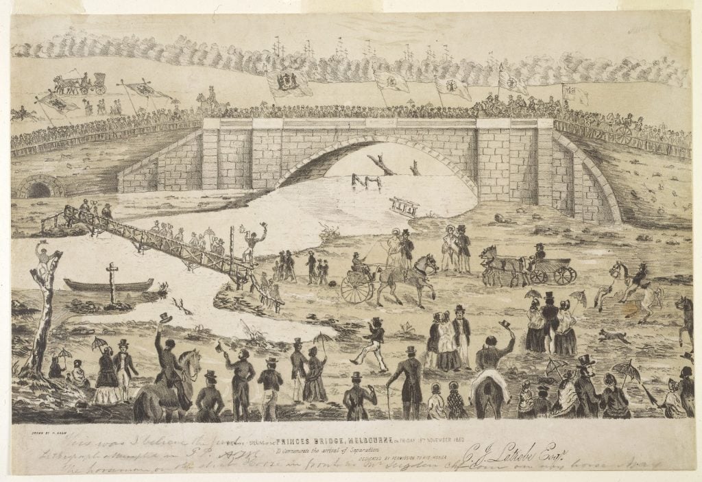
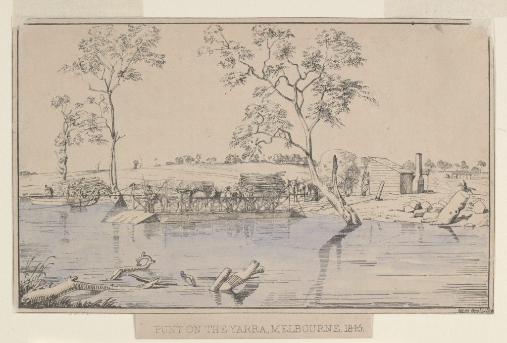
On the site of one of the oldest river crossings in the city, the original Princes Bridge can be seen, a single-arched bluestone and granite bridge, 46 metres long and 7 metres high5 – which was opened in November 1850 to much fanfare. It was named the Princes Bridge to honour Albert, the then Prince of Wales, but was also known as Lennox Bridge, after its designer. It replaced a timber toll-bridge that had been there since the early 1840s. Prior to that, river punts and ferries delivered people, animals and supplies across the river.6 The iconic bridge we know today, designed by John Grainger, was not constructed until 1888.
Morgue
The city morgue, registrars and coroners’ office were located in a small squat building which sat opposite St Paul’s on the eastern corner of Flinders Street. Every growing city needs a place to identify and store its unknown deceased, particularly a rapidly growing city like Melbourne. The discovery of gold in 1851, and the resulting influx of immigrants, caused the city’s population of 23,000 to triple in just three years.7
Before the morgue was constructed (and for some time after), inquests were held in pubs and hotels, and the bodies stored in any outbuildings that were convenient. This was an English tradition that did not work at all well with Melbourne’s sweltering summers. 8
The banks of the Yarra River, from which bodies were regularly fished, seemed as good a place as any for a much-needed dead house. Proximity with the police station on Swanston street was another plus for such a central location. The city’s residents – and their noses – did not agree. Though construction of the morgue building appears to have been completed by the mid-1850s, the morgue did not actually appear to store any dead bodies until the 1870s.9 The location of the morgue caused much controversy, and it appears to have only operated for a short time in this location. Instead, an earlier morgue in Melbourne’s wharf area was favoured, though it was increasingly reported to be in a dilapidated and sorry state.10
Old Melbourne Cemetery
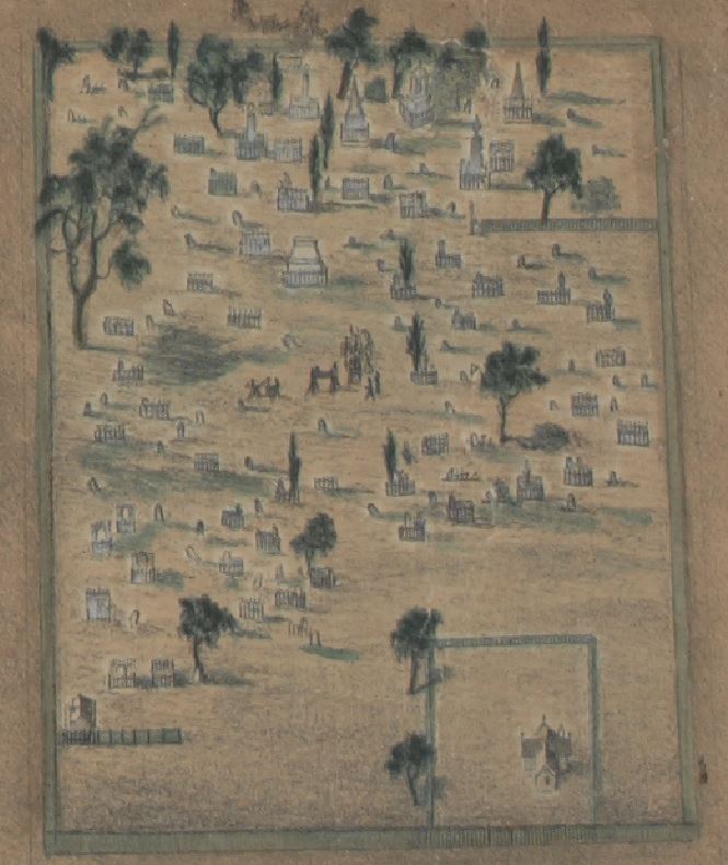
Melbourne’s first official cemetery was established in 1837, its first interment said to be a shepherd called John Smith.11 An estimated 10,000 souls were buried there from its establishment until 1878, when the site was taken over by the Queen Victoria Market, with some remains reinterred at the Melbourne General Cemetery (which opened in 1853). Reinterments to other resting places have continued up until quite recently, with 30 graves dug up by the Melbourne City Council as recently as 1991.12
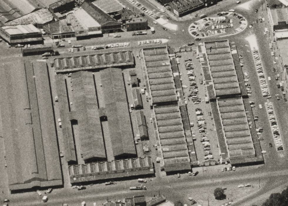
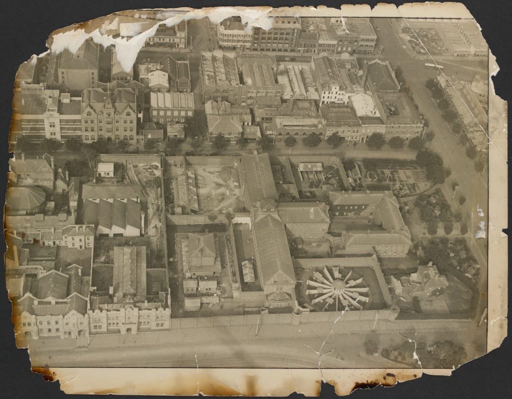
Old Melbourne Gaol
Famously the location of the execution of Ned Kelly on 11 November 1880, the Old Melbourne Gaol witnessed approximately 133 hangings between 1842 and its closure in 1929. The first cell block opened in 1845. Home to a mix of hardened and dangerous criminals, petty offenders, the homeless and the mentally ill, overcrowding and poor conditions were perennial issues. A city watch house opened in 1909 as a short-term lock up for drunks, petty crims and ‘women of ill-repute’. 13
The photo below from 1920 shows how the site had evolved since it was captured on the isometrical map in the 1860s.
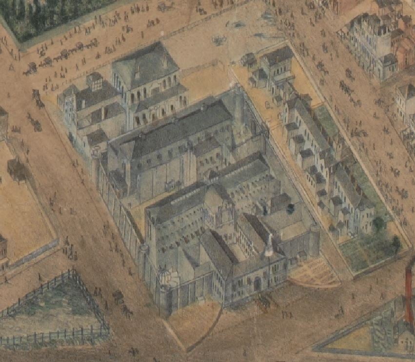
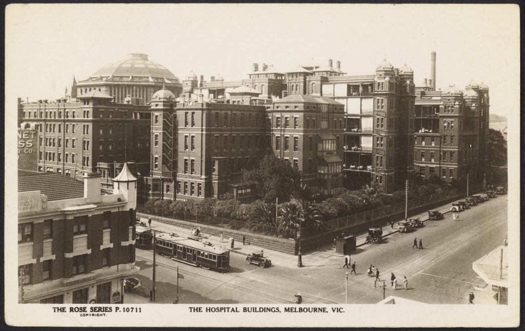
Melbourne Hospital
Once located on the corner of Lonsdale and Swanston streets, next to the Melbourne Public Library (now State Library Victoria), the Melbourne Hospital opened in 1848 as Melbourne’s first public hospital for the growing city’s sick and poor ( The Maitland Mercury and Hunter River General Advertiser, 25 Mar 1848). Initially a 10-bed cottage, the site was expanded over the years and by 1867 offered about 300 beds for patients. 14 Inadequate facilities and accommodation led to the building being condemned by a Royal Commission in 1892, and a new location in Parkville was proposed though the relocation did not occur until 1944.15
The site was refurbished as QV Melbourne, opening in 2003.16 The name QV is a tribute to the Queen Victoria Hospital for Women and Children which was originally established on the site in 1896, and at the time was only one of three hospitals in the world founded, managed and and staffed exclusively by women.17 You can still see remnants of the old hospital in the Queen Victoria Women’s Centre building.
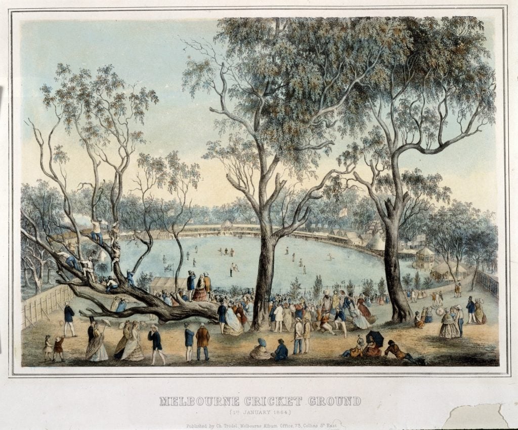
Melbourne Cricket Ground
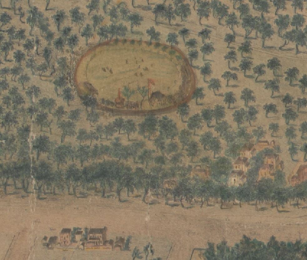
“The ‘mecca’ of Australian sport”18, the Melbourne Cricket Ground, often called the MCG or just the ‘G’ not only hosted the first test cricket match (Australia vs England, 1877), but is the spiritual birthplace of Australian Rules football, with footy of course being a major Victorian preoccupation. The Melbourne Cricket Club (established 1838) made the site its base in 1853, with the first intercolonial cricket match played by Victoria and New South Wales in 1863. The first match of Australian Football is said to have been held in 1858, with the Melbourne Football Club formed later that year.19
Eastern Market
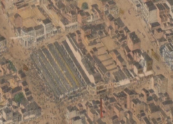
The Eastern Market started life in the 1850s as a bustling fruit and veg market. The market was expanded and improved, and played host to many functions over the years, including the Hay and Corn Market, a Paddy’s market for just about any consumable you could think of, as a ‘people’s forum’ for lectures, meetings and political demonstrations, an entertainment precinct with shooting galleries and sideshow acts, to name a few. The growth of the Queen Victoria market led to its gradual demise, and the market eventually morphed into a second-hand stall.20
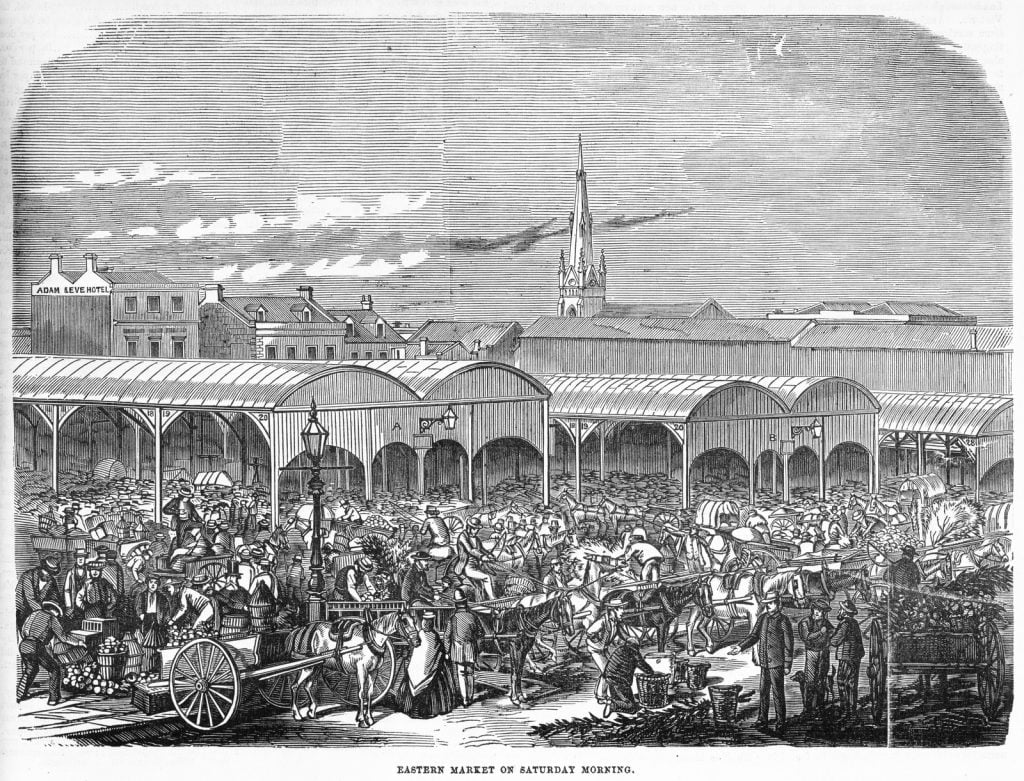
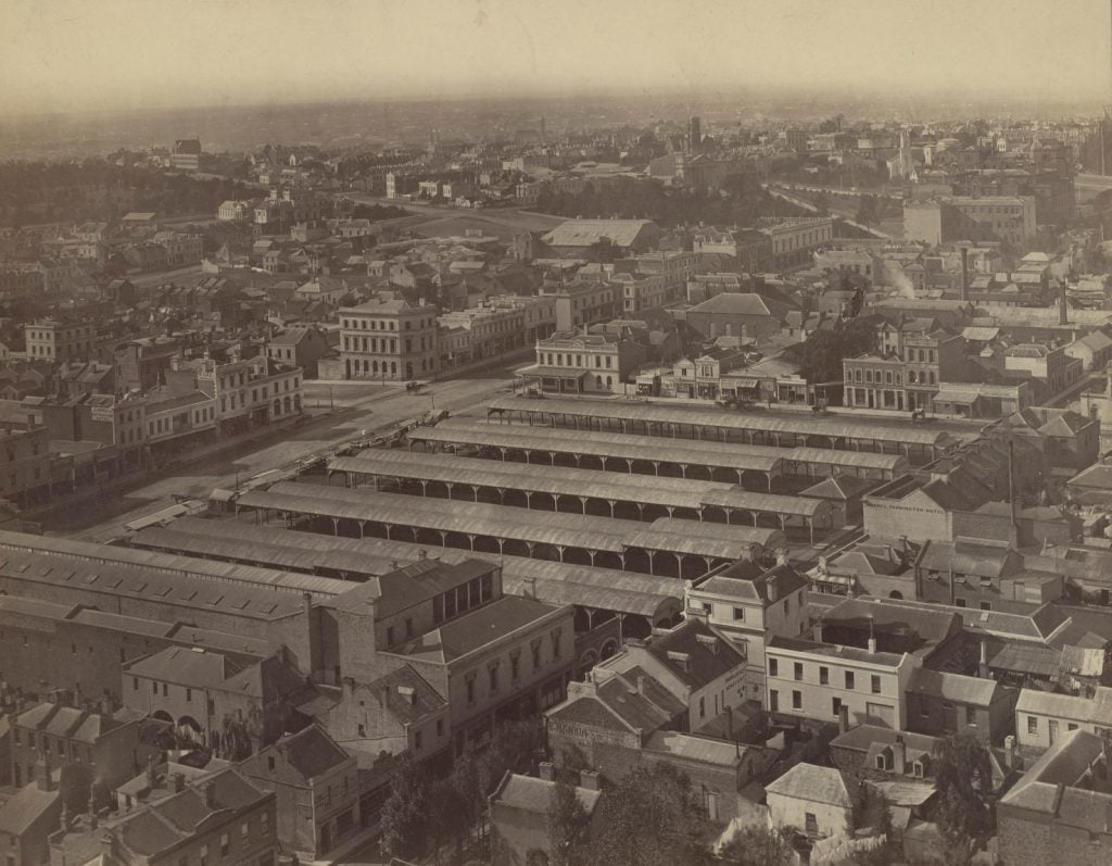
Looking East including Eastern Market and Princess Theatre, 1875. Photo by the Paterson Bros; H96.160/2712
Further reading
De Gruchy and Leigh (1866) Key to De Gruchy & Leigh’s Melbourne and suburbs, 1866 [cartographic material], De Gruchy & Leigh, Melbourne.
Bennett B (2002) The fish markets of Melbourne, The Author, Hawthorn, Vic.
Gardiner, D (2008) ‘Old Melbourne Gaol‘, eMelbourne, accessed 15 December 2022.
Pasco, R (2008) ‘Football, Australian Rules‘, eMelbourne, accessed 15 December 2022.
More to explore
References
- For some other fantastic examples of isometrical maps of Melbourne, see our blog: Bird’s eye views of Melbourne.
- It was replaced by the present St. Paul’s Cathedral, designed by William Butterfield, and opened in 1891.
- See our blog: ‘Federation Square: a brief history‘.
- Carroll, B (2008) ‘Railways‘, eMelbourne, accessed 15 December 2022.
- Wikipedia (2002) Princes Bridge, accessed 15 December 2022.
- Storey, R (2008) ‘Princes Bridge‘, eMelbourne, accessed 15 December 2022.
- Brown, A and Cooke S 2004, ‘Death, decency and the dead-house: the City Morgue in colonial Melbourne’, Provenance: The Journal of Public Record Office Victoria, issue no. 3.
- As above.
- As above.
- As above.
- Segazio, C (2008) ‘Old Melbourne Cemetery‘, eMelbourne, accessed 15 December 2022.
- As above.
- Old Melbourne Gaol (2023) History, accessed 15 December 2022.
- The Royal Melbourne Hospital (2023) History of the city campus, accessed 15 December 2022.
- With the old buildings being sold to the government for the sum of £549,000, as above.
- The Royal Melbourne Hospital (2023) History of the city campus, accessed 15 December 2022.
- Russell, E (2008) ‘Queen Victoria Medical Centre‘, eMelbourne, accessed 15 December 2022.
- Carroll, L (2008) ‘Melbourne Cricket Ground‘, eMelbourne, accessed 15 December 2022.
- As above.
- May, A (2008) ‘Eastern Market‘, eMelbourne, accessed 15 December 2022.
Thank you, Kylie. A truly fascinating and well written commentary of our city’s rich history.
The drawings and photographs are incredible.
Thanks for putting the isometrical map and related photos up. I love it. One thing confused me though – the images of St Paul’s Cathedral. In the map and images the Cathedral is shown running west to east and said to be still standing today. However, the Cathedral now runs south to north. I know historical paintings of the corner of Swanston and Flinders Street have confused me before, so I looked it up and indeed the cathedral in the images built on what had been the corn market was consecrated in 1852 but demolished in 1885. So now I will be able to look at those paintings and images and know what is going on. Thanks so much for making Melbourne history more accessible.
Hi Celia,
Thank you for pointing this out, I have amended my wording to show that the church depicted in the map is the original building, and the current St Paul’s is as you say a later building on the same site. Glad to hear you enjoyed the blog. Kind regards, Kylie
Well done Kylie. The suite of text plus maps, photographs & other images is a timely gift for those interested in the original development of Melbourne & the Hoddle Grid.
This is fantastic Kylie. I really enjoyed the read and the illustrations you have used. One small picky point; it should be interment and reinterment – no N. Internment is inprisonment not burial. Sorry to be a pedant.
Hi Julian, so glad you enjoyed the blog. Thank you for picking up my error, I have corrected the wording! Kind regards, Kylie